Near Rising Sun in Cecil County, Maryland — The American Northeast (Mid-Atlantic)
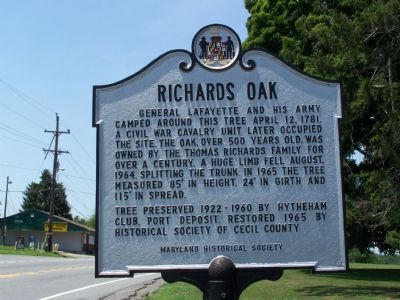
Richards Oak
Tree preserved 1922-1960 by Hytheham Club, Port Deposit. Restored 1965 by Historical Society of Cecil County.
Erected by Maryland Historical Society.
Topics and series. This historical marker is listed in these topic lists: War, US Civil • War, US Revolutionary. In addition, it is included in the Historic Trees series list. A significant historical date for this entry is April 12, 1812.
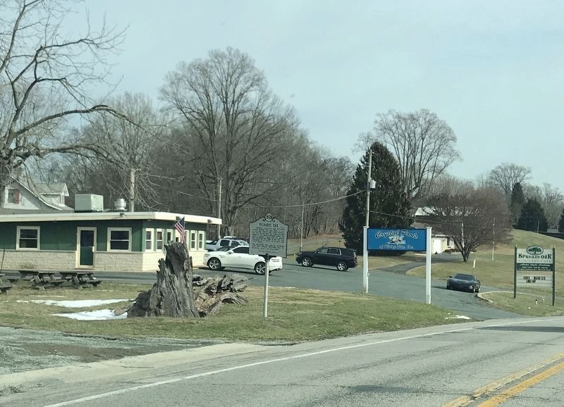
Location. 39° 41.644′ N, 76° 6.487′ W. Marker is near Rising Sun, Maryland, in Cecil County. Marker is on Conowingo Road (U.S. 1) east of Arbor Lane, on the right when traveling west. Touch for map. Marker is at or near this postal address: 1769 Conowingo Road, Rising Sun MD 21911, United States of America. Touch for directions.
Other nearby markers. At least 8 other markers are within 4 miles of this marker, measured as the crow flies. West Nottingham Academy (approx. 1˝ miles away); a different marker also named West Nottingham Academy (approx. 2.4 miles away); This Tablet is in Commemoration (approx. 2.4 miles away); a different marker also named West Nottingham Academy (approx. 2˝ miles away); A Susquehannock Indian Fort (approx. 3˝ miles away); Bald Friar Ford & Ferry (approx. 3˝ miles away); The Nottingham Lots (approx. 3.8 miles away); Parker Kidnapping & Rescue (approx. 4 miles away in Pennsylvania). Touch for a list and map of all markers in Rising Sun.
Additional commentary.
1. This marker
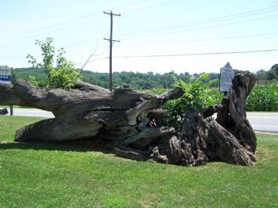
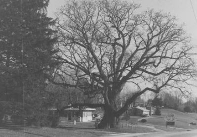
This marker was installed in 1966, to replace one destroyed by limbs falling from the tree in 1964.
— Submitted March 4, 2008, by Christopher Busta-Peck of Shaker Heights, Ohio.
2. Richards Oak Tree
I was stationed at Bainbridge, Md. in the fall of 1973 when I was driving the country side in Maryland when I came upon this historical marker and Richards Oak. I was so amazed at it's massive size, I called my parents back in Bloomington, Illinois and told them about it. They came out for a visit at thanksgiving and I took them to see the historic tree. They were also amazed. We took 3 pennies and placed them in the crack and agreed to come back in 10 years to see if they were still there, well we never made it back. I personally wrote to the mayor of Rising Sun and told her of my experience. I received a very nice written letter telling me of it's unfortunate mishap, having to be cut down. She was so kind as to send me a picture. I still have this somewhere. This was about 9 or ten years ago. This was my greatest memory of my 4 months I was in the area. I still to this day think of this very often. I would love to come back for a visit but I now live in Texas and that would be a very long drive. Well at least I got to view one of natures greatest historic tree. Jim Sherer, Lexington, Tx. Note To Editor only visible by Contributor and editor
— Submitted February 1, 2013, by Jim Sherer of Lexington, Texas.
Additional keywords. Richards Oak
Credits. This page was last revised on January 20, 2022. It was originally submitted on July 18, 2007, by Bill Pfingsten of Bel Air, Maryland. This page has been viewed 5,816 times since then and 126 times this year. Last updated on February 19, 2020, by Carl Gordon Moore Jr. of North East, Maryland. Photos: 1. submitted on July 18, 2007, by Bill Pfingsten of Bel Air, Maryland. 2. submitted on January 13, 2022, by Adam Margolis of Mission Viejo, California. 3. submitted on July 18, 2007, by Bill Pfingsten of Bel Air, Maryland. 4. submitted on March 4, 2008, by Christopher Busta-Peck of Shaker Heights, Ohio.


