Petersburg, Virginia — The American South (Mid-Atlantic)
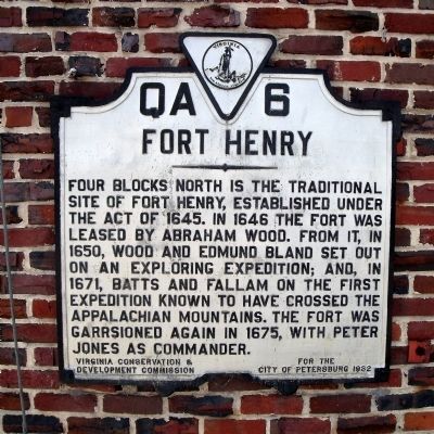
Fort Henry
Erected 1932 by Virginia Conservation & Development Commission for the City of Petersburg. (Marker Number QA-6.)
Topics and series. This historical marker is listed in these topic lists: Colonial Era • Forts and Castles • Settlements & Settlers. In addition, it is included in the Virginia Department of Historic Resources (DHR) series list. A significant historical year for this entry is 1645.
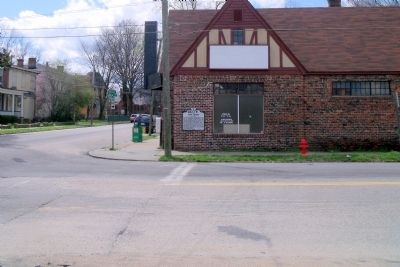
Location. 37° 13.52′ N, 77° 24.95′ W. Marker is in Petersburg, Virginia. Marker is at the intersection of North South Street and West Washington Street (U.S. 1), on the right when traveling south on North South Street. Touch for map. Marker is in this post office area: Petersburg VA 23803, United States of America. Touch for directions.
Other nearby markers. At least 8 other markers are within walking distance of this marker. Headquarters of Gen. R. E. Lee (approx. ¼ mile away); Joseph Cotten (approx. ¼ mile away); General Lee's Headquarters (approx. 0.3 miles away); Grace Episcopal Church (approx. 0.3 miles away); Folly Castle (approx. 0.4 miles away); The First Methodist Meeting House (approx. 0.4 miles away); Bishop Payne Divinity School (approx. 0.4 miles away); North Carolina Confederate Hospital (approx. 0.4 miles away). Touch for a list and map of all markers in Petersburg.
Credits. This page was last revised on February 2, 2023. It was originally submitted on April 4, 2009, by Bernard Fisher of Richmond, Virginia. This page has been viewed 1,595 times since then and 67 times this year. Photos: 1, 2. submitted on April 4, 2009, by Bernard Fisher of Richmond, Virginia.

