Near Dinwiddie in Dinwiddie County, Virginia — The American South (Mid-Atlantic)
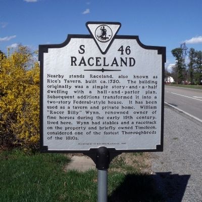
Raceland
Erected 2000 by Department of Historic Resources. (Marker Number S-46.)
Topics and series. This historical marker is listed in these topic lists: Animals • Architecture • Industry & Commerce • Settlements & Settlers. In addition, it is included in the Virginia Department of Historic Resources (DHR) series list. A significant historical year for this entry is 1750.
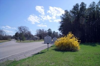
Location. 37° 8.242′ N, 77° 31.601′ W. Marker is near Dinwiddie, Virginia, in Dinwiddie County. Marker is at the intersection of Boydton Plank Road (U.S. 1) and Quaker Road, on the right when traveling south on Boydton Plank Road. Touch for map. Marker is in this post office area: Dinwiddie VA 23841, United States of America. Touch for directions.
Other nearby markers. At least 8 other markers are within 2 miles of this marker, measured as the crow flies. Gravelly Run Quaker Meeting House (here, next to this marker); Quaker Road Engagement (approx. 0.8 miles away); White Oak Road (approx. 0.9 miles away); Cattle (Beefsteak) Raid (approx. 0.9 miles away); Burgess Mill (approx. 1.2 miles away); Hatcher's Run (approx. 1.2 miles away); The Battle of White Oak Road (approx. 1.4 miles away); a different marker also named The Battle of White Oak Road (approx. 1.4 miles away). Touch for a list and map of all markers in Dinwiddie.
Credits. This page was last revised on February 3, 2020. It was originally submitted on April 5, 2009, by Bernard Fisher of Richmond, Virginia. This page has been viewed 1,730 times since then and 25 times this year. Photos: 1, 2. submitted on April 5, 2009, by Bernard Fisher of Richmond, Virginia.

