Cumberland in Allegany County, Maryland — The American Northeast (Mid-Atlantic)
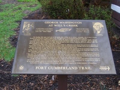
George Washington at Willís Creek
Fort Cumberland Trail
Young George was a skilled surveyor by the age of sixteen. He assisted in laying out the town of Alexandria, Virginia, and came to our area in 1748 to survey and layout the Fairfax manors in the South Branch Valley. He slept in a "straw bed" with lice and fleas and on one occasion his bed caught fire as he slept. During this time, he visited Thomas Cresap near Old Town (Oldtown, Md.) and gained valuable knowledge of frontier living and of the Indians.
George left from Will's Creek on November 13, 1753, to deliver an ultimatum to the French from Lt. Governor Dinwiddie of Virginia to leave the Ohio Valley. During this perilous journey in winter over hundreds of miles, Washington fell into the icy Allegheny River and could have drowned. He was also fired upon by an Indian and missed from fifty feet away.
From Will's Creek, in April, 1754, 22 year old Lt. Colonel Washington and his command of 150 men marched to meet the French. In May, he and his Indian allies defeated a party of Frenchmen. This spark ignited hostilities leading to the French and Indian War. In July, Washington was defeated in his first major battle, at Fort Necessity (near Uniontown, Pa.).
George studied military customs and tactics from this cabin while General Braddock's army encamped at Fort Cumberland in May-June 1755. As aide-de-camp to Braddock, he marched with the ill-fated expedition against the French. His advice to Braddock concerning backwoods warfare was ignored by the arrogant general. Washington led the retreat of those left from the field. He had four bullets through his clothing and two horses shot under him, but once again escaped unharmed.
George was made commander of all Virginia forces in August in 1755 and in the next three years spent much time in this area with his forces. He wrote ardent love letters to his future bride from this cabin at Fort Cumberland. He was with General Forbes in the successful campaign against Fort Duquesne (Pittsburgh, Pa.) in November of 1758.
As President, in 1794, Washington reviewed troops gathered here to suppress the Whiskey Rebellion in Pennsylvania.
Topics and series. This historical marker is listed in these topic lists: Colonial Era • Forts and Castles • War, French and Indian. In addition, it is included in the Former U.S. Presidents: #01 George Washington, the George Washington Slept Here, and the Whiskey Rebellion series lists. A significant historical month for this entry is April 1754.
Location. 39° 38.975′ N, 78° 45.885′ W. Marker is in Cumberland, Maryland, in Allegany County. Marker is at the intersection of Greene Street and Bridge Street on Greene Street. Touch for map. Marker is in this post office area: Cumberland MD 21502, United States of America. Touch for directions.
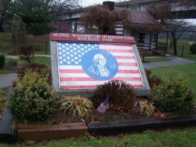
Other nearby markers. At least 8 other markers are within walking distance of this marker. Headquarters of George Washington (here, next to this marker); Col. Joshua Fry (a few steps from this marker); Riverside Park (a few steps from this marker); Fort Cumberland Trail (a few steps from this marker); Where the Road Began (a few steps from this marker); National Road Monument (within shouting distance of this marker); Beginning Of National Pike (within shouting distance of this marker); The Old National Pike (within shouting distance of this marker). Touch for a list and map of all markers in Cumberland.
Credits. This page was last revised on February 17, 2021. It was originally submitted on April 6, 2009, by Bill Pfingsten of Bel Air, Maryland. This page has been viewed 3,023 times since then and 48 times this year. Last updated on February 17, 2021, by Carl Gordon Moore Jr. of North East, Maryland. Photos: 1, 2. submitted on April 6, 2009, by Bill Pfingsten of Bel Air, Maryland.

