Berryville in Clarke County, Virginia — The American South (Mid-Atlantic)
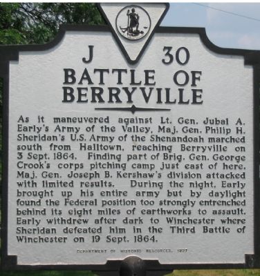
Battle of Berryville
Erected 1999 by Department of Historic Resources. (Marker Number J-30.)
Topics and series. This historical marker is listed in this topic list: War, US Civil. In addition, it is included in the Virginia Department of Historic Resources (DHR) series list. A significant historical date for this entry is September 3, 1864.
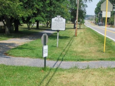
Location. 39° 9.711′ N, 77° 59.867′ W. Marker is in Berryville, Virginia, in Clarke County. Marker is at the intersection of Westwood Road and West Main Street (Business U.S. 7), on the right when traveling south on Westwood Road. On the grounds of the Clarke County High School. Touch for map. Marker is at or near this postal address: 240 Westwood Road, Berryville VA 22611, United States of America. Touch for directions.
Other nearby markers. At least 8 other markers are within 2 miles of this marker, measured as the crow flies. A different marker also named Battle of Berryville (about 400 feet away, measured in a direct line); Harry F. Byrd Sr. (approx. 0.3 miles away); Berryville (approx. 0.7 miles away); James Ireland (approx. one mile away); Clarke County Courthouse (approx. 1.2 miles away); Clarke County Civil War Monument (approx. 1.2 miles away); Bank of Clarke County (approx. 1.2 miles away); Traveler Was Tethered on This Spot (approx. 1.2 miles away). Touch for a list and map of all markers in Berryville.
More about this marker. This marker replaces a previous J-30, titled “Anderson and Crook,” which read, “Near here R. H. Anderson, on his march to join Lee, then hard pressed at Petersburg, met Crook’s Army of West Virginia. Anderson attacked, driving Crook back on Sheridan”s main army, September 4, 1864.” The current J-30 has a more historically accurate narrative.
Also see . . . Berryville Battle Summary. (Submitted on July 19, 2007, by Craig Swain of Leesburg, Virginia.)
Additional commentary.
1. Newspaper Report of the Cavalry fight on Sunday Sept 4, 1864
GEN. SHERIDAN'S ARMY.; The Cavalry Fight on Sunday A Spirited Engagement.
Published: September 10, 1864
From our Special Correspondent.
HARPER's FERRY, Monday, Sept 5, 1864.
The two armies now confront each other. In the vicinity of Berryville -- the enemy occupying the dirt works in the latter place, which have been strengthened and extended. Our men have not been idle, and the spade has been freely used.
The enemy undertook, Sunday, to cut off the cavalry from the infantry. They had boasted before that they would surround and destroy the cavalry. At this time Maj. BEARDSLEY, with the Sixth New-York Cavalry, then at White Post, on the Winchester and Millwood pike, was directed by Gen. TORBERT to communicate with our infantry, supposed to be at or near Berryville. The command had arrived within one mile of the latter place, when his advance guard discovered a picket of two men in the road. A little further on a party of eight men exposed themselves on the right, within pistol range, and bid the Major "good morning." Lieut. BELL was directed to deploy a line of skirmishers. Having done so, asked if he should open fire, and the Major told him to blaze away. As the firing commenced, squadron after squadron came boiling up from a ravine on the left flank of the main command, now forming for attack. At the same time another force of the enemy came upon his rear. Thus situated, Major BEARDSLEY decided
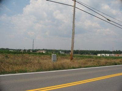
Photographed By Craig Swain, July 15, 2007
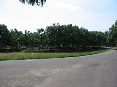
3. Site of Kershaw's Attack
Kershaw's Division advanced across the grounds of the present day high school (right side, background) across Westwood Road, against Crook's Federals. The Federal lines ran roughly southwest to northeast along the high ground in the cornfield in the background. The granite marker in the foreground is a separate battlefield marker.
Among the killed are Orderly Sergt. DUER, Company A; Sergt. COLES, Company G; Corp. PRATT, Company I; ADAM SEE, of Company H.
One of the prisoners captured is said to be a deserter from the Fifth New-York Zouaves.
The attacking party was commanded by MOSBY, and numbered between 300 and 400 men. Major BEARDSLEY had only 76 men when the fight commenced.
On
the same day an ambulance train was captured between Halltown and Charlestown, but most of the train was subsequently recaptured.
This morning a small party was stopped just outside of Halltown by a party of bushwhackers. To-day, five of MOSBY's men were brought in -- two of them dressed in citizen's clothing. E.A. PAUL. Note To Editor only visible by Contributor and editor
— Submitted August 11, 2013, by John Allen of Usa.
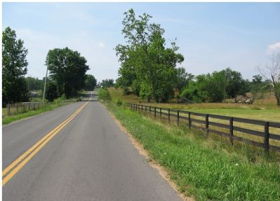
Photographed By Craig Swain, July 15, 2007
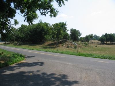
6. North Flank of Federal Lines
Looking from the far north flank of the defensive line, down Route 611. The Federal XIX Corps anchored their lines with an artillery position on the high ground south of Long Marsh Run (center, where the guard rails stand beside the road).
Credits. This page was last revised on June 16, 2016. It was originally submitted on July 19, 2007, by Craig Swain of Leesburg, Virginia. This page has been viewed 4,086 times since then and 61 times this year. Photos: 1, 2, 3, 4, 5, 6. submitted on July 19, 2007, by Craig Swain of Leesburg, Virginia. • J. J. Prats was the editor who published this page.
