Lincoln in Middlesex County, Massachusetts — The American Northeast (New England)
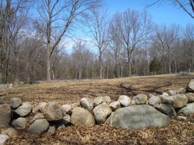
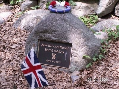
Bloody Angle
Minute Man National Hist Park, Mass.
— National Park Service —
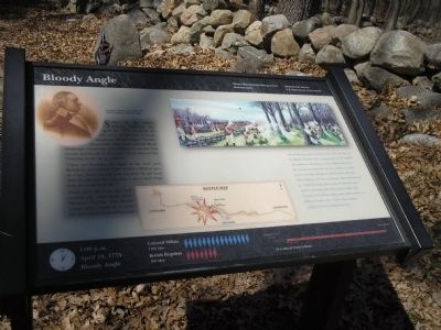
“Upon our ascending the height to the road” said British Lt. Sutherland, “[the Woburn Militia] gave us a very heavy fire, but some shot from the left hand drew my attention that way when I saw a much larger body drawn up to my left . . .”
These were the men who had crossed the farm fields from Meriam’s Corner. The British troops were caught in a cross-fire from both sides of the road.
“We arrived just in time to meet the enemy. These were then on the opposite side of the road, a young growth of wood well filled with Americans. The enemy was now completely between two fires, renewed and briskly kept up. They ordered out a flank guard on the left to dislodge the Americans from their posts behind larger trees, but they only became a better mark to be shot at. A short but sharp contest ensued, at which the enemy received more deadly injury than at any one place from Concord to Charlestown. Eight or more of their number were killed on the spot, and no doubt, many wounded.”
- Edmund Foster, Reading Minute Man
1:00 p.m. April 19, 1775 Bloody Angle
Colonial Militia 1500 Men
British Regulars 700 Men
14¼ miles & 6 hours to Boston
Erected by Minute Man National Historical Park.
Topics. This historical marker is listed in these topic lists: Notable Events • War, US Revolutionary. A significant historical date for this entry is April 19, 1775.
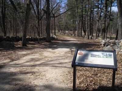
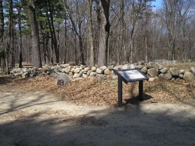
Location. 42° 27.207′ N, 71° 17.582′ W. Marker is in Lincoln, Massachusetts, in Middlesex County. Marker is at the intersection of Bedford Lane and Battle Road, on the left when traveling north on Bedford Lane. Marker is located along the Battle Road in Minute Man National Historical Park. Touch for map. Marker is in this post office area: Lincoln MA 01773, United States of America. Touch for directions.
Other nearby markers. At least 8 other markers are within walking distance of this marker. Hartwell Tavern Historical Area (about 600 feet away, measured in a direct line); Trades along the Battle Road (approx. 0.6 miles away); Weapon of the Day (approx. 0.7 miles away); End of Paul Revere’s Midnight Ride (approx. ¾ mile away); The Capture of Paul Revere (approx. ¾ mile away); The Midnight Riders (approx. ¾ mile away); Paul Revere Capture Site (approx. 0.8 miles away); Brooks Historical Area (approx. 0.8 miles away). Touch for a list and map of all markers in Lincoln.
More about this marker. The top left of the marker contains a portrait of “Loammi Baldwin [who] commanded the Woburn Militia at Bloody Angle.” The top right features a picture of lines of British soldiers exchanging fire with Colonial troops behind trees. The bottom of the marker includes a map of the route from Concord to Lexington, with the site of the Bloody Angle indicated.
Also see . . .
1. Minute Man National Historical Park. National Park Service website. (Submitted on April 19, 2009, by Bill Coughlin of Woodland Park, New Jersey.)
2. The Battle of Concord. The American Revolutionary War website. (Submitted on May 7, 2009, by Bill Coughlin of Woodland Park, New Jersey.)
Credits. This page was last revised on February 14, 2022. It was originally submitted on April 18, 2009, by Bill Coughlin of Woodland Park, New Jersey. This page has been viewed 4,207 times since then and 46 times this year. Last updated on February 11, 2022, by Carl Gordon Moore Jr. of North East, Maryland. Photos: 1, 2, 3. submitted on April 18, 2009, by Bill Coughlin of Woodland Park, New Jersey. 4, 5. submitted on April 19, 2009, by Bill Coughlin of Woodland Park, New Jersey. 6. submitted on May 31, 2009, by Gary Flemming of Billerica, Massachusetts. • J. Makali Bruton was the editor who published this page.
