Franklin, Virginia — The American South (Mid-Atlantic)
War Comes to the Blackwater
(sidebar)
“Those were days full of sorrow and anxiety from morning till night, and through the night the heavy roaring of cannon like thunder and the whole earth full of smoke, and everything in an unsettled condition. One did not feel like work, and where we were located we could not raise a crop, as we were in the border line…. Longstreet’s Brigade was camped on my father’s farm, and the lame, sick, halt, and maimed, and all those who did not want to go to the front were there, and they were not very desirable neighbors; no hungry people are. Pig after pig disappeared until there were none left and the same with chickens, turkeys, calves, and lambs, and last of all the beehives.”
Jenny Camp Norfleet
Time Line
1862 U.S. gunboats shell Franklin and the Confederates fortify the Blackwater.
1863 The Confederates besiege Union-held Suffolk. Units from Franklin participate in the Gettysburg campaign.
1864 The Siege of Petersburg isolates Franklin.
1865 Franklin begins to recover as the railroad is rebuilt and the river trade is reorganized.
1867 Blacks vote for the first time.
1869 Franklin’s first municipal government is organized.
1873 Franklin’s first newspapers are printed.
1876 Franklin incorporates.
1877 P.D. camp and Company is organized.
1878 The Farmers and Merchants Steam Transportation Company leases the Clyde Line’s facilities.
Topics. This historical marker is listed in this topic list: War, US Civil. A significant historical month for this entry is April 1865.
Location. 36° 40.468′ N, 76° 55.174′ W. Marker is in Franklin, Virginia. Marker is at the intersection of South Main Street and South Main Street, on the right when traveling north on South Main Street. Touch for map. Marker is in this post office area: Franklin VA 23851, United States of America. Touch for directions.
Other nearby markers. At least 8 other markers are within walking distance of this marker. "Can't Is Not in the Camp's Vocabulary" (here, next to this marker); The Age of Steam (here, next to this marker); The Age of Gasoline (here, next to this marker); Recovery and Progress (here, next to this marker); The Barretts: A Franklin Pioneer Family (here, next to this marker); Confederate Commissary Center (a few steps from this marker); Battle of Franklin (a few steps from this marker); The Blackwater Line (a few steps from this marker). Touch for a list and map of all markers in Franklin.
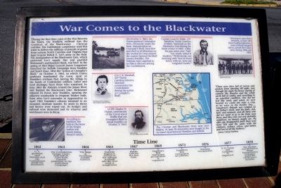
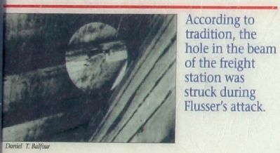
More about this marker. On the lower left is a photo of a damaged beam with the caption, “According to tradition, the hole in the beam of the freight station was struck during Flusser’s attack.” Daniel T. Balfour
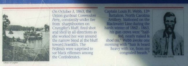
On the upper left center is a photo of a gunboat with the caption, “On October 3, 1863, the Union gunboat Commodore
Perry, constantly under fire from sharpshooters on Crumpler’s Bluff, fired shot and shell in all directions as she worked her way around the narrow bend at the bluff toward Franklin. The Federals were surprised to see black riflemen among the Confederates.” Library of Congress
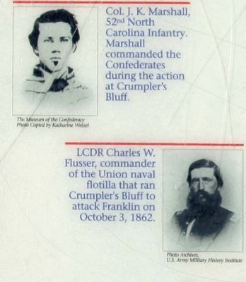
On the middle left center is a photo of “Col. J.K. Marshall, 52nd North Carolina Infantry. Marshall commanded the Confederates during the action at Crumpler’s Bluff.” The Museum of the Confederacy. Photos copied by Katherine Wetzel
On the lower left center is a photo of “LCDR Charles W. Flusser, commander of the Union naval flotilla that ran Crumpler’s Bluff to attack Franklin on October 3, 1862.” Photo Archives, U.S. Army Military History Institute
On the upper right center is a photo of “Captain Louis H. Webb, 13th Battalion, North Carolina Artillery. Stationed on the Blackwater Line during the harsh winter of 1862-1863, his gun crews were “half-fed, nearly naked & shoeless.” Webb awoke one morning with “hair & beard heavy with ice, from my congealed breath.” The Webb Family Archives
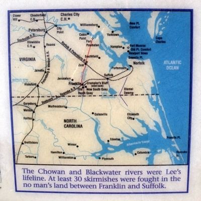
On the lower right center is an area map carrying the caption, “The Chowan and Blackwater rivers were Lee’s lifeline. At least 30 skirmishes were fought in the no man’s land between Franklin and Suffolk.”
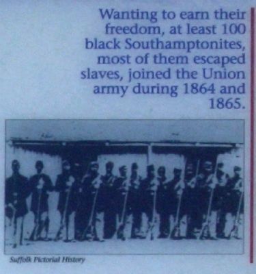
On the upper right is a photo of USCT Troops carrying the caption, “Wanting to earn their freedom, at least 100 black Southamptonites, most of them escaped slaves, joined the Union army during 1864 and 1865.” Suffolk Pictorial History
Credits. This page was last revised on November 1, 2021. It was originally submitted on April 21, 2009, by Bernard Fisher of Richmond, Virginia. This page has been viewed 2,088 times since then and 51 times this year. Photos: 1, 2. submitted on April 21, 2009, by Bernard Fisher of Richmond, Virginia. 3, 4, 5, 6. submitted on November 14, 2011, by Mike Stroud of Bluffton, South Carolina. 7. submitted on April 21, 2009, by Bernard Fisher of Richmond, Virginia. 8. submitted on January 31, 2021, by Devry Becker Jones of Washington, District of Columbia.
