Lincoln in Middlesex County, Massachusetts — The American Northeast (New England)
Brooks Historical Area
Minute Man National Historical Park
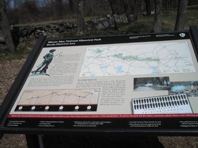
The park preserves sites where Colonial militia men and British soldiers clashed on April 19, 1775. A force of 700 British soldiers left Boston to seize military supplies stockpiled in Concord. Alarm riders alerted the countryside. In area towns, militia companies assembled, ready to defend their communities and their liberties if necessary.
After brief battles at Lexington Green (5:00 a.m.) and Concord’s North Bridge (9:30 a.m.) fighting escalated along the “Battle Road.” As the British troops marched back towards Boston, militia companies poured in. By afternoon, nearly 4,000 Colonists unleashed “an incessant fire” upon the British soldiers. At the end of the day, the Colonists surrounded and laid siege to Boston. The Revolutionary War had begun.
The Battle Road Trail - - - - - - - - - -
This five mile trail from Meriam’s Corner to Fiske Hill provides pedestrian, bicycle and wheelchair access to many cultural and natural sites within the park. The trail visits battle sites, agricultural fields, colonial homes and taverns, forests, fragile wetlands, and historic landmarks. Portions of the trail are on the Battle Road where the British column marched; other sections follow stone walls and farm lanes traversed by the Colonists.
Many visitors begin their tour by viewing the exhibits and orientation program at the Minute Man Visitor Center.
Erected by Minute Man National Historical Park.
Topics. This historical marker is listed in these topic lists: Notable Events • War, US Revolutionary. A significant historical month for this entry is April 1826.
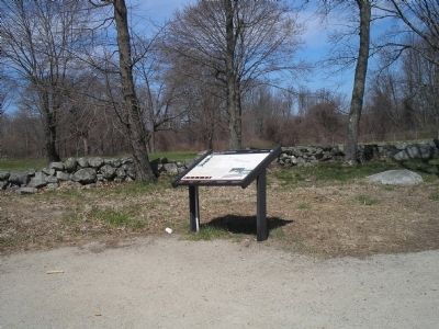
Location. 42° 27.202′ N, 71° 18.498′ W. Marker is in Lincoln, Massachusetts, in Middlesex County. Marker is at the intersection of N Great Road (Massachusetts Route 2A) and Concord Turnpike, on the right when traveling west on N Great Road. Touch for map. Marker is in this post office area: Lincoln MA 01773, United States of America. Touch for directions.
Other nearby markers. At least 8 other markers are within one mile of this marker, measured as the crow flies. Landscape Changes (a few steps from this marker); Trades along the Battle Road (approx. 0.2 miles away); Bloody Angle (approx. 0.8 miles away); Meriam’s Corner (approx. 0.8 miles away); Hartwell Tavern Historical Area (approx. 0.8 miles away); a different marker also named Meriam’s Corner (approx. 0.9 miles away); a different marker also named Meriam’s Corner (approx. 0.9 miles away); Bedford Minutemen (approx. one mile away). Touch for a list and map of all markers in Lincoln.
More about this marker. The top of the marker features a map of Minute Man National Historical Park. The bottom left of the marker contains a map of the Battle Road on April 19, 1775, with the progress of the British retreat indicated: Meriam’s Corner, Concord - 12:30 p.m.; Lincoln – 1:00 p.m; Lexington – 2:30 p.m.; Menotomy – 4:30 p.m.; Cambridge – 5:30 p.m.; Charlestown – 7:00 p.m.
Two photographs from a reenactment of the fighting on the Battle Road appear at the bottom right of the marker. Also present are a picture of the Minute Man statue from North Bridge and a reprint of an image of Salem Gazette broadside telling of the “Bloody Butchery by the British Troops or the Runaway Fight of the Regulars.”
Also see . . .
1. Minute Man National Historical Park. National Park Service website. (Submitted on April 27, 2009, by Bill Coughlin of Woodland Park, New Jersey.)
2. The Battle of Concord. The American Revolutionary War website. (Submitted on May 7, 2009, by Bill Coughlin of Woodland Park, New Jersey.)
Credits. This page was last revised on February 14, 2022. It was originally submitted on April 27, 2009, by Bill Coughlin of Woodland Park, New Jersey. This page has been viewed 1,418 times since then and 17 times this year. Last updated on February 10, 2022, by Carl Gordon Moore Jr. of North East, Maryland. Photos: 1, 2, 3. submitted on April 27, 2009, by Bill Coughlin of Woodland Park, New Jersey. • J. Makali Bruton was the editor who published this page.


