Near Frederick in Frederick County, Maryland — The American Northeast (Mid-Atlantic)
The Lost Order
Shrouded in a Cloak of Mystery
— Antietam Campaign 1862 —
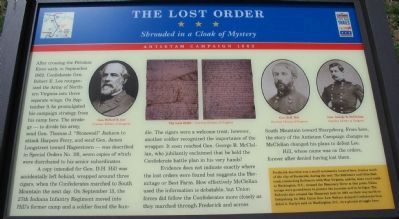
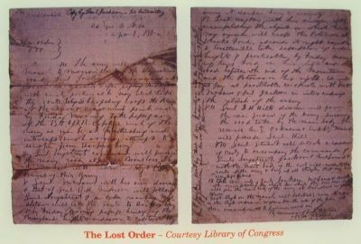
A copy intended for Gen. D.H. Hill was accidentally left behind, wrapped around three cigars, when the Confederates marched to South Mountain the next day. On September 13, the 27th Indiana Infantry Regiment moved into Hill's former camp and a soldier found the bundle. The cigars were a welcome treat; however, another soldier recognized the importance of the wrapper. It soon reached Gen. George B. McClellan, who jubilantly exclaimed that he held the Confederate battle plan in his very hands!
Evidence does not indicate exactly where the lost orders were found but suggests the Hermitage or Best Farm. How effectively McClellan used the information is debatable, but Union forces did follow the Confederates more closely as they marched through Frederick and across South Mountain toward Sharpsburg. From here, the story of the Antietam Campaign changes as McClellan changed his plans to defeat Lee.
Hill, whose name was on the orders, forever after denied having lost them.
(Sidebar):
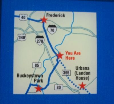
Frederick Junction was a small community located here, 3 miles south of the city of Frederick, during the war. The Baltimore and Ohio Railroad, connecting Baltimore with West Virginia, and the main road south to Washington, D.C., crossed the Monocacy River at this point. Union troops were posted here to protect the junction and its bridges. The Federals also crossed the Monocacy here in 1863 on their way north to Gettysburg. In 1864, Union Gen. Lew Wallace delayed Confederate Gen. Jubal A. Early's raid on Washington, D.C., in a pivotal struggle here.
Erected 2009 by Maryland Civil War Trails.
Topics and series. This historical marker is listed in this topic list: War, US Civil. In addition, it is included in the Maryland Civil War Trails series list. A significant historical month for this entry is September 1862.
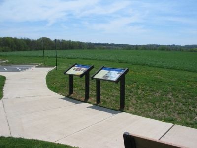
Location. 39° 22.625′ N, 77° 23.737′ W. Marker is near Frederick, Maryland, in Frederick County. Marker can be reached from Urbana Pike (State Highway 355), on the right when traveling north. Located at the Monocacy National Battlefield visitor center. Touch for map. Marker is in this post office area: Frederick MD 21704, United States of America. Touch for directions.
Other nearby markers. At least 8 other markers are within walking distance of this marker. 1862 Antietam Campaign (here, next to this marker); Monocacy Battlefield (here, next to this marker); Battle Begins (a few steps from this marker); A Bold Plan (within shouting distance of this marker); This Boulder Overlooks the Monocacy Battlefield (about 500 feet away, measured in a direct line); Battle of Monocacy (about 500 feet away); Headquarters of Generals Robert E. Lee, "Stonewall" Jackson and Longstreet Sept. 6-9, 1862. (about 500 feet away); Nick of Time (approx. 0.4 miles away). Touch for a list and map of all markers in Frederick.
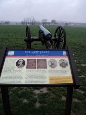
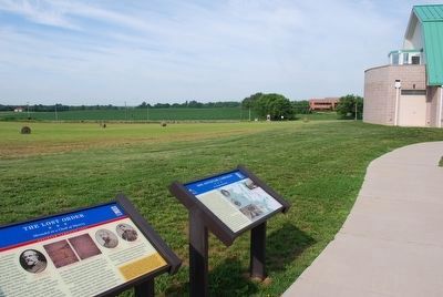
More about this marker. The marker displays portraits of Gens. Lee, D.H. Hill, and McClellan. In the center is a copy of the lost orders.
Related markers. Click here for a list of markers that are related to this marker. Lost Special Orders 191 markers
Also see . . . Lees Lost Order. Part of the New York Times' Disunion series, Phil Leigh's article (September 13, 2012) examines how the Lost Order came to be and its effects on both the battle and the war. (Submitted on September 13, 2012.)
Credits. This page was last revised on June 16, 2016. It was originally submitted on April 27, 2009, by Craig Swain of Leesburg, Virginia. This page has been viewed 1,719 times since then and 23 times this year. Photos: 1. submitted on April 27, 2009, by Craig Swain of Leesburg, Virginia. 2. submitted on April 12, 2011, by Bill Coughlin of Woodland Park, New Jersey. 3, 4, 5. submitted on April 27, 2009, by Craig Swain of Leesburg, Virginia. 6. submitted on August 9, 2015, by Brandon Fletcher of Chattanooga, Tennessee.
