Kenton in Hardin County, Ohio — The American Midwest (Great Lakes)
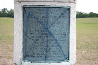
This Tablet Marks Hullís Trail; 1812
Erected 1912 by Fort McArthur Chapter Daughters of the American Revolution.
Topics and series. This historical marker is listed in these topic lists: Forts and Castles • Military • War of 1812. In addition, it is included in the Daughters of the American Revolution series list. A significant historical year for this entry is 1812.
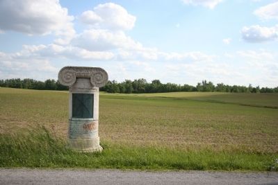
Location. 40° 39.829′ N, 83° 39.877′ W. Marker is in Kenton, Ohio, in Hardin County. Marker is on County Road 106 (County Route 106). This historical marker is located just 1/2 mile north of the actual site of Fort McArthur, and about 3 miles to the west of the Hardin County Courthouse, which is located in downtown Kenton, Ohio. Touch for map. Marker is in this post office area: Kenton OH 43326, United States of America. Touch for directions.
Other nearby markers. At least 8 other markers are within 4 miles of this marker, measured as the crow flies. Fort McArthur Cemetery (approx. half a mile away); Welcome To Kenton (approx. 3 miles away); Mad River Railroad (approx. 3 miles away); Frank Bondi (approx. 3.1 miles away); Gene Autry (approx. 3.1 miles away); The Hardin County Courthouse (approx. 3.1 miles away); Fort McArthur (approx. 3.1 miles away); Veterans Memorial (approx. 3.1 miles away). Touch for a list and map of all markers in Kenton.
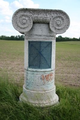
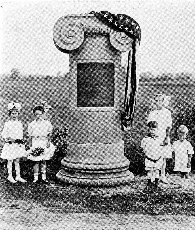
More about this marker. With the 100 year anniversary of the War of 1812 approaching, Hardin County found itself making plans to tear down their old courthouse. The county leaders decided to keep the front stone columns from the old courthouse so that they could use them as markers for "Hull's Trail," erecting them as trail markers in 1912, as they celebrated their county's role in the 100 year anniversary of the War of 1812.
This marker is part of one of the old county courthouse columns and helps to mark not only the site of the War of 1812 era Fort McArthur, but it also helps (along with several other column pieces in several other locations throughout Hardin County) to mark the path of Hull's Trail from Urbana, Ohio to Detroit, Michigan.
Regarding This Tablet Marks Hullís Trail; 1812. Shortly before the start
of the War of 1812 the American General William Hull, the commander of the American fortification on Michigan's border with Canada, Fort Detroit, knew that unless his position was reinforced with additional troops, that his command would be in serious trouble once the war finally got under way. So he took it upon himself to travel down to southern Ohio in order to raise those additional troops.
As soon as General Hull had raised himself an army of soldiers, he began to march northward from Urbana, Ohio. Since much of the territory between Urbana and Detroit was a hostile wilderness through both territory controlled by pro-British Native Americans and an inhospitable region know as the Black Swamp, General Hull built a string of military fortifications, along his route, in order to protect his lines of supply and communication. One of those fortifications, built to protect the crossing of the Scioto River, was Fort McArthur.
Related markers. Click here for a list of markers that are related to this marker. To better understand the relationship, study each marker in the order shown.
Credits. This page was last revised on May 23, 2022. It was originally submitted on April 28, 2009, by Dale K. Benington of Toledo, Ohio. This page has been viewed 2,014 times since then and 23 times this year. Photos: 1, 2, 3. submitted on April 28, 2009, by Dale K. Benington of Toledo, Ohio. 4. submitted on July 23, 2019, by Allen C. Browne of Silver Spring, Maryland. • Kevin W. was the editor who published this page.


