San Martin in Santa Clara County, California — The American West (Pacific Coastal)
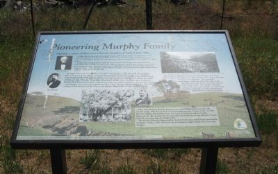
Pioneering Murphy Family
Charting a course of their own to become founders of Santa Clara Valley
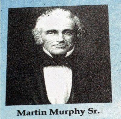
In 1844, Martin Murphy Sr. brought his large, Irish family across the continent in the Stephens-Murphy-Townsend overland part. Their determination, optimism and close family bonds helped them cross rugged terrain and become founders of early Santa Clara Valley.
In 1846, Martin Murphy, Sr. made his way to Santa Clara Valley and established his homestead. For $1500 he purchased the 9000-acre Rancho Ojo del Agua de la Coche, named for its many springs. Murphy’s ranch and hospitality created a welcome resting place for many travelers. Later the town of San Martin would grow up around the ranch and be named in honor of Murphy’s patron saint.
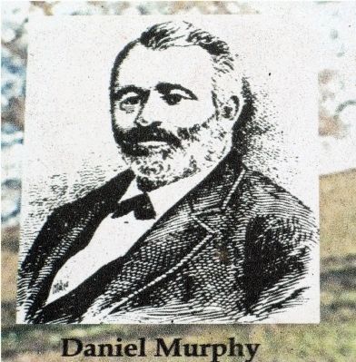
Murphy’s sons, John and Daniel, struck gold in the Sierras in 1849, but made their fortunes selling dry goods to the miners. The town they established bears the family name – Murphys. John became a prominent San Jose citizen, as treasurer, coroner, and sheriff for the newly formed County of Santa Clara. In 1854, Daniel took over the operation of Murphy Sr.’s ranch. He began purchasing cattle and land. At the time of his death in 1881, Dan’s landholdings in California, Nevada, New Mexico and Arizona made him perhaps the largest landowner on the Pacific Coast. The Murphy clan’s pioneering spirit continued as they helped establish Santa Clara University, College of Notre Dame and the cities of San Martin, Morgan Hill, San Jose and Sunnyvale.
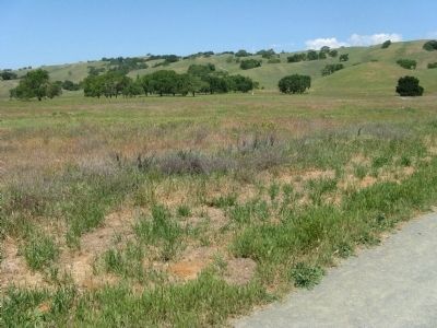
After Dan Murphy died his property was subdivided and changed hands several times. The Harvey Bear family bought property to graze cattle. In 1997, the Bear family sold 4,445-acres to the Santa Clara Parks and Recreation Department. The former Ojo del Agua Rancho lands have been added to Coyote Lake-Harvey Bear Ranch County Park.
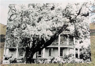
The historic Murphy homestead, pictured at left, once stood on the Bear Ranch property. Today, cattle still graze the parklands to fight weeds and reduce fire danger.
Erected by Santa Clara County Parks Department.
Topics. This historical marker is listed in these topic lists: Agriculture • Industry & Commerce • Settlements & Settlers. A significant historical year for this entry is 1844.
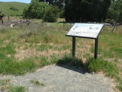
Location. 37° 5.968′ N, 121° 34.524′ W. Marker is in San Martin, California, in Santa Clara County. Marker can be reached from the intersection of East San Martin Avenue and New Avenue, on the left when traveling east. Marker is located at the Trailhead at the Coyote Lake-Harvey Bear Ranch County Park. Touch for map. Marker is at or near this postal address: 2080 East San Martin Avenue, San Martin CA 95046, United States of America. Touch for directions.
Other nearby markers. At least 8 other markers are within 5 miles of this marker, measured as the crow flies. Coyote Lake – Harvey Bear Ranch County Park (here, next to this marker); Community of San Martin (approx. 2.2 miles away); Rucker School Historical Site 1894 (approx. 3.2 miles away); Franklin Family Ranch (approx. 3.4 miles away); Site of 21-Mile House (approx. 3.8 miles away); de Anza Expedition (approx. 4 miles away); John Page House (approx. 4.6 miles away); Waiting For The Train (approx. 4.6 miles away). Touch for a list and map of all markers in San Martin.
Regarding Pioneering Murphy Family. Also see: “Community of San Martin” and “Coyote Lake-Harvey Bear Ranch County Park” markers for additional information regarding the Murphy family.
Also see . . .
1. The Stevens-Murphy-Townsend Party. The Martin Murphy party crossed the plains in 1844 to California. They were the first party to cross the Sierras in a covered wagon, the first to bring oxen across the plains and the first to use the route now used by Union and Pacific Railroads. The Donner party used the route two years later and Martin Murphy, Jr. was a member of the party who rescued them. (Submitted on May 2, 2009, by Syd Whittle of Mesa, Arizona.)
2. Opening of the California Trail. The party arrived successfully in California, and in bringing wagons over the Sierra, they had opened the California Trail. (Submitted on May 2, 2009, by Syd Whittle of Mesa, Arizona.)
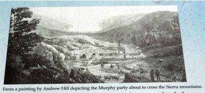
5. Close-Up of Artwork on Marker
From a painting by Andrew Hill depicting the Murphy party about to cross the Sierra mountains.
[Description under photo on marker:]
The Stephens-Murphy-Townsend overland party consisted of many wagons, cattle, oxen, and "about 40 men and a large proportion of women and children." They crossed a challenging landscape with little water in the deserts, heavy snow in the mountains and the births of two girls. The Stephens-Murphy-Townsend party pioneered the overland route that many emigrants traveled, including the ill-fated Donner party, a year later.
Credits. This page was last revised on August 13, 2023. It was originally submitted on May 2, 2009, by Syd Whittle of Mesa, Arizona. This page has been viewed 2,498 times since then and 103 times this year. Photos: 1, 2, 3, 4, 5, 6, 7, 8. submitted on May 2, 2009, by Syd Whittle of Mesa, Arizona.
