Pocahontas in Tazewell County, Virginia — The American South (Mid-Atlantic)
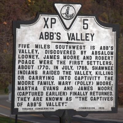
Abb’s Valley
Erected 1939 by Virginia Conservation Commission. (Marker Number XP-5.)
Topics and series. This historical marker is listed in these topic lists: Colonial Era • Settlements & Settlers. In addition, it is included in the Virginia Department of Historic Resources (DHR) series list. A significant historical month for this entry is July 1786.
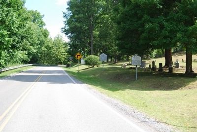
Location. 37° 18.592′ N, 81° 20.087′ W. Marker is in Pocahontas, Virginia, in Tazewell County. Marker is on County Route 644 just west of Virginia Route 102, on the right when traveling west. Touch for map. Marker is in this post office area: Pocahontas VA 24635, United States of America. Touch for directions.
Other nearby markers. At least 8 other markers are within 2 miles of this marker, measured as the crow flies. Pocahontas (a few steps from this marker); Pocahontas Cemetery (a few steps from this marker); Jordan Nelson’s Coal Bank (approx. ¼ mile away in West Virginia); Town of Pocahontas Commercial District (approx. half a mile away); Pocahontas Mine No. 1 (approx. 0.6 miles away); Bramwell (approx. one mile away in West Virginia); Mill Creek Coal & Coke Co. (approx. one mile away in West Virginia); The Coal Barons (approx. 1.6 miles away in West Virginia). Touch for a list and map of all markers in Pocahontas.
More about this marker. Until recent times, Virginia historical markers were only erected on primary roads. When this marker was erected, this roadway was Virginia Route 85, today’s Route 102, that extended down this roadway into Pocahontas. (Route 102 now ends at the intersection a few hundred feet from this marker.) That is why this marker was placed here and not on the county road “five miles southwest” in the valley itself.
Related markers. Click here for a list of markers that are related to this marker. They are about the Captives of Abb’s Valley.
Credits. This page was last revised on July 3, 2017. It was originally submitted on July 23, 2007, by Dawn Bowen of Fredericksburg, Virginia. This page has been viewed 2,834 times since then and 143 times this year. Photos: 1. submitted on November 14, 2015, by J. J. Prats of Powell, Ohio. 2. submitted on July 23, 2007, by Dawn Bowen of Fredericksburg, Virginia. • J. J. Prats was the editor who published this page.

