Maumee in Lucas County, Ohio — The American Midwest (Great Lakes)
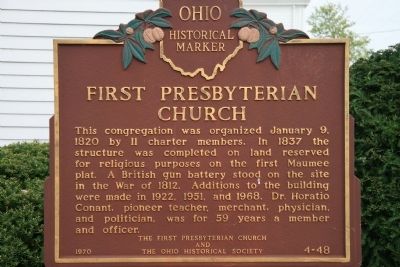
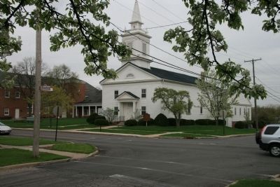
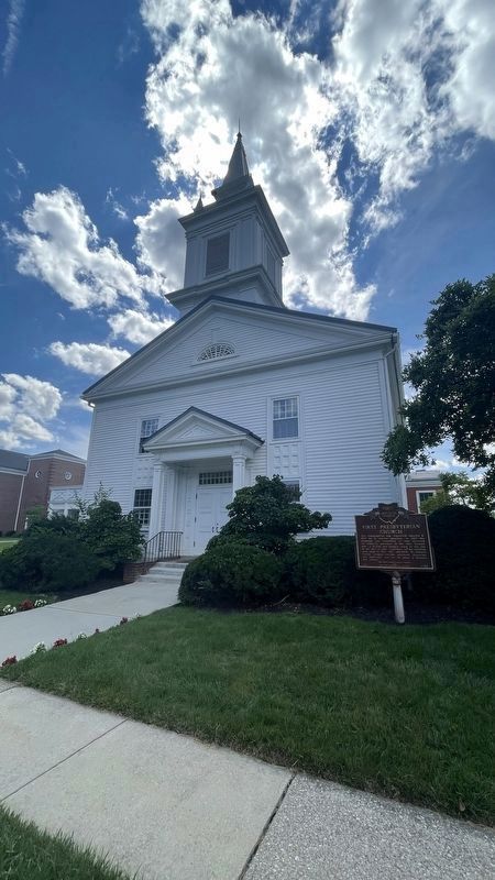
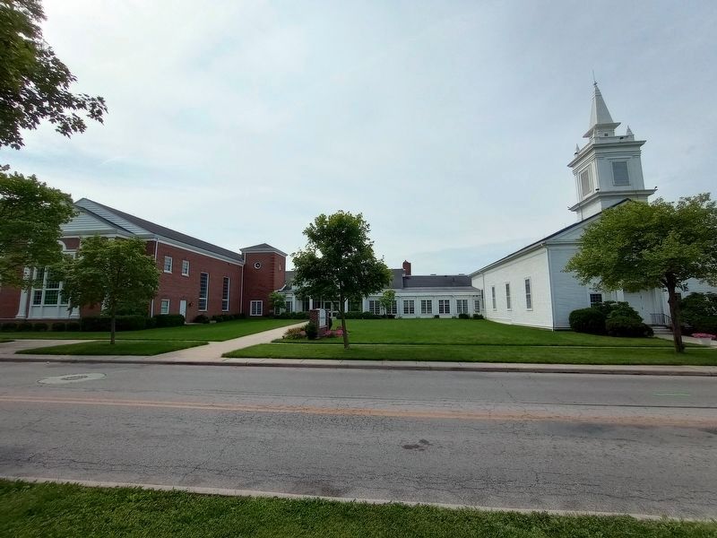
First Presbyterian Church
Ohio Historical Marker
Erected 1970 by The First Presbyterian Church and The Ohio Historical Society. (Marker Number 4-48.)
Topics and series. This historical marker is listed in these topic lists: Churches & Religion • Military • Settlements & Settlers • War of 1812. In addition, it is included in the Ohio Historical Society / The Ohio History Connection series list. A significant historical date for this entry is January 9, 1870.
Location. 41° 33.695′ N, 83° 39.053′ W. Marker is in Maumee, Ohio, in Lucas County. Marker is at the intersection of East Broadway Street and Gibbs Street., on the left when traveling west on East Broadway Street. This historical marker is located in the front northwest corner of the church property, as you drive by on East Broadway Street. Touch for map. Marker is in this post office area: Maumee OH 43537, United States of America. Touch for directions.
Other nearby markers. At least 8 other markers are within walking distance of this marker . G.A.R. Civil War Monument (about 500 feet away, measured in a direct line); Maumee Honor Roll (about 500 feet away); Pecan (about 600 feet away); House of Four Pillars (about 700 feet away); Cottonwood (about 700 feet away); Historic Buildings in the City of Maumee (about 700 feet away); Northern Light Lodge No. 40 Free and Accepted Masons (approx. 0.2 miles away); Ohio Buckeye (approx. 0.2 miles away). Touch for a list and map of all markers in Maumee.
More about this marker. The First Presbyterian Church is located one block away from the Maumee River flood plain, and if not for the existance of modern day buildings and structures, within view of the War of 1812 era fortification, Fort Meigs.
Regarding First Presbyterian Church. Since my interest in this marker is in the events that are related to the War of 1812, that is what I will focus upon. Regarding the British gun battery located at the First Presbyterian Church (on the other side of the Maumee River from the American fortifications at Fort Meigs), Charles E. Slocum writes in his book, "History of the Maumee River Basin" (copyright 1905), the following: "There had been continuous rain, and the efforts of the British to move their heavy cannon (with two hundred men and
several oxen to each twenty-four-pounder) and construct batteries, were very laborious and attended with delays. The work was carried forward first only at night and later uninterruptedly day and night with strong relays, not withstanding the rain and shots from Fort Meigs which killed some of their men and wounded others."
"By the early morning of the 30th April they had completed two batteries nearly opposite Fort Meigs, on the sites of the present Methodist and Presbyterian Churches in Maumee Village, the first mounting two twenty-four-pounder cannon (the heaviest at Fort Meigs being two eighteen-pounders) and the other mounting three howitzers, one eight inches and the other two five and a half inches caliber. During the mounting of these cannon several more were killed by the good aim of the American artillerymen at the Fort."
Credits. This page was last revised on July 10, 2023. It was originally submitted on May 9, 2009, by Dale K. Benington of Toledo, Ohio. This page has been viewed 1,144 times since then and 28 times this year. Photos: 1, 2. submitted on May 9, 2009, by Dale K. Benington of Toledo, Ohio. 3. submitted on July 10, 2023, by Craig Doda of Napoleon, Ohio. 4. submitted on August 15, 2021, by Chad McKinney of Mount Gilead, Ohio. 5, 6. submitted on July 10, 2023, by Craig Doda of Napoleon, Ohio. • Bill Pfingsten was the editor who published this page.
