Harpers Ferry in Jefferson County, West Virginia — The American South (Appalachia)
St. John's Episcopal Church
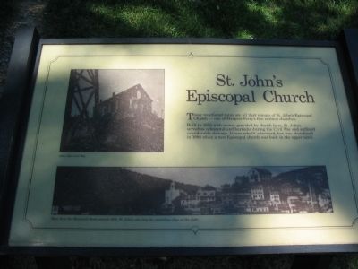
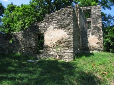
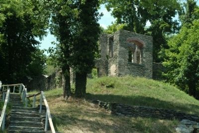
Built in 1852 with money provided by church fairs, St. John's served as a hospital and barracks during the Civil War and suffered considerable damage. It was rebuilt afterward, but was abandoned in 1895 when a new Episcopal church was built in the upper town.
Topics. This historical marker is listed in these topic lists: Churches & Religion • War, US Civil. A significant historical year for this entry is 1852.
Location. 39° 19.375′ N, 77° 43.92′ W. Marker is in Harpers Ferry, West Virginia, in Jefferson County. Marker can be reached from Church Street, on the right when traveling south. Located on the trail to Jefferson Rock in lower town of Harpers Ferry National Historic Site. Touch for map. Marker is in this post office area: Harpers Ferry WV 25425, United States of America. Touch for directions.
Other nearby markers. At least 8 other markers are within walking distance of this marker. The John Brown Raiders (within shouting distance of this marker); St. Peter's Roman Catholic Church (about 300 feet away, measured in a direct line); Welcome to St. Peter’s Roman Catholic Church (about 300 feet away); Springhouses and Root Cellars (about 300 feet away); Harper House Tavern (about 300 feet away); Harper House: The Mansion on the Hill (about 300 feet away); Shenandoah Street about 1880 (about 400 feet away); Sweets for Harpers Ferry (about 400 feet away). Touch for a list and map of all markers in Harpers Ferry.
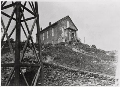
More about this marker. The marker displays photos of the church after the Civil War and seen from the Maryland shore around 1888, St. John's sits atop the ascending ridge over the right.

May 29, 1886
4. St. John's Episcopal Church
Photo found in the upper left of the marker. Image courtesy of the Library of Congress. The Library's complete title for the image is:Photocopy of photograph (in 1960, original was owned by a Mrs. Dudrow of Bolivar, West Virginia Pittsburgh Photographer's Society 29 May 1886 EAST AND SOUTH FACADES (BELL TOWER OF CATHOLIC CHURCH IN FOREGROUND) - St. John's Episcopal Church (Ruins), Church & Cliff Streets, Harpers Ferry, Jefferson County, WV
Credits. This page was last revised on March 24, 2020. It was originally submitted on May 10, 2009, by Craig Swain of Leesburg, Virginia. This page has been viewed 1,264 times since then and 43 times this year. Photos: 1, 2. submitted on May 10, 2009, by Craig Swain of Leesburg, Virginia. 3. submitted on August 22, 2010, by Paul Jordan of Burlington, N. C., U. S. A.. 4. submitted on December 20, 2014.


