Near Powhatan in Powhatan County, Virginia — The American South (Mid-Atlantic)
Ewell Crosses the Appomattox
Racing West
— Lee’s Retreat —
After Union Gen. Ulysses S. Grant broke through Confederate Gen. Robert E. Lee’s lines at Petersburg on April 2, 1865, Lee ordered the evacuation of Petersburg and Richmond. The Army of Northern Virginia retreated west on several roads, with Grant in pursuit. Lee planned to turn south and join Gen. Joseph E. Johnston in North Carolina, but Grant kept part of his force between Lee and his objective. On April 9, surrounded at Appomattox Court House, Lee surrendered.
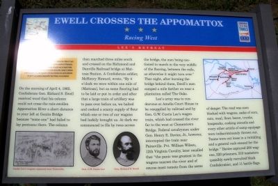
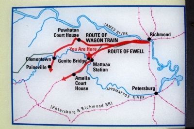
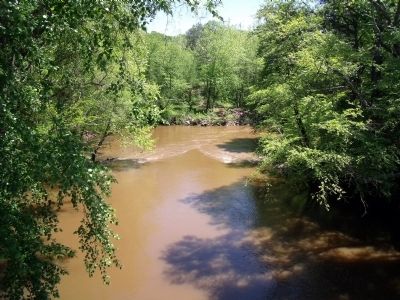
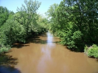
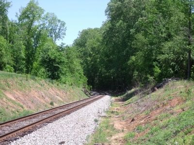
On the morning of April 4,1865, Confederate Gen. Richard S. Ewell received word that his column could not Cross the rain-swollen Appomattox River a short distance to your left at Genito Bridge because “some one” had failed to lay pontoons there. The column then marched three miles south and crossed on the Richmond and Danville Railroad bridge at Mattoax Station. A Confederate soldier, McHenrv Howard, wrote, “By 4 o’clock we were within one mile of [Mattoax], but as some flooring had to be laid or put in order and after that a large train of artillery was to pass over before us, we halted and cooked a scanty supply of flour which one or two of our wagons had luckily brought us. At dark we commenced to file by twos across the bridge, the men being cautioned to march in the very middle of the flooring, between the rails, as otherwise it might turn over.” That night, after burning the bridge behind them, Ewell’s men camped a mile farther on near a plantation called The Oaks.
Lee’s army was to rendezvous at Amelia Court House to be resupplied by railroad and by Gen. G.W. Custis Lee’s wagon train, which had crossed the river far to the west at Clementown Bridge. Federal cavalrymen under Gen. Henry E. Davies, Jr., however, intercepted the train near Paineville. Pvt. William Wilson, 12th Virginia Cava1ry later recalled that “the panic was greatest in the wagons nearest the river and of course most remote from the scene of danger. The road was soon blocked with wagons, sacks of corn, oats, meal, flour, bacon, trunks, knapsacks, cooking utensils and every other article of camp equipage were indiscriminately thrown out. Teams were cut loose in a twinkling and a general rush ensued for the bridge.” Davies captured 200 wagons, 320 prisoners, 310 teamsters (possibly newly recruited black Confederates), and 11 battle flags.
Erected by Virginia Civil War Trails.
Topics and series. This historical marker is listed in this topic list: War, US Civil. In addition, it is included in the Virginia Civil War Trails series list. A significant historical month for this entry is April 1898.
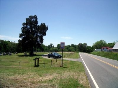
Location. 37° 27.661′ N, 77° 51.634′ W. Marker is near Powhatan, Virginia, in Powhatan County. Marker is on Genito Road, 0.1 miles west of Rocky Ford Road, on the left when traveling west. Touch for map. Marker is at or near this postal address: 3090 Genito Rd, Powhatan VA 23139, United States of America. Touch for directions.
Other nearby markers. At least 8 other markers are within 7 miles of this marker, measured as the crow flies. Skinquarter Baptist Church (approx. 5.2 miles away); John Banister Tabb (approx. 5.6 miles away); Powhatan Court House (approx. 6.4 miles away); The Court House (approx. 6.4 miles away); Powhatan Courthouse (approx. 6.4 miles away); Memorial to Powhatan Servicemen (approx. 6.4 miles away); The Powhatan Troop (approx. 6.4 miles away); The Courthouse Tavern / Atkinson's Hotel / The Village (approx. 6.4 miles away). Touch for a list and map of all markers in Powhatan.
More about this marker. On the lower left is a sketch entitled "Custis Lee's wagons captured near Paineville." On the lower center are photos of "Gen. G.W. Custis Lee" and "Gen. Richard S. Ewell". On the upper right is an map of Ewell's route.
Credits. This page was last revised on November 11, 2021. It was originally submitted on May 11, 2009, by Bernard Fisher of Richmond, Virginia. This page has been viewed 1,749 times since then and 52 times this year. Photos: 1, 2, 3, 4, 5, 6, 7. submitted on May 11, 2009, by Bernard Fisher of Richmond, Virginia.
