Carson in Prince George County, Virginia — The American South (Mid-Atlantic)
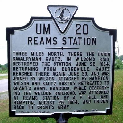
Reams Station
Erected 1948 by Virginia Conservation Commission. (Marker Number UM-20.)
Topics and series. This historical marker is listed in this topic list: War, US Civil. In addition, it is included in the Virginia Department of Historic Resources (DHR) series list. A significant historical date for this entry is June 22, 1864.
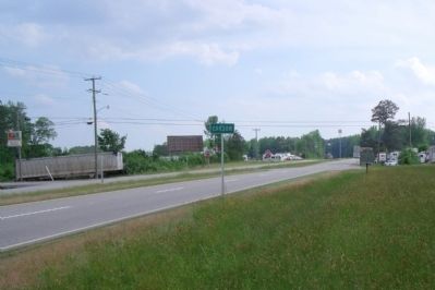
Location. 37° 2.458′ N, 77° 23.365′ W. Marker is in Carson, Virginia, in Prince George County. Marker is at the intersection of South Crater Road (U.S. 301) and Woodys Road, on the right when traveling south on South Crater Road. Touch for map. Marker is in this post office area: Carson VA 23830, United States of America. Touch for directions.
Other nearby markers. At least 8 other markers are within 5 miles of this marker, measured as the crow flies. Prince George County / Sussex County (approx. 3.1 miles away); Second Battle Of Reams Station (approx. 4.1 miles away); North Carolina (approx. 4.1 miles away); Fighting At Reams Station (approx. 4.1 miles away); a different marker also named Second Battle Of Reams Station (approx. 4.1 miles away); a different marker also named Ream's Station (approx. 4.2 miles away); a different marker also named Second Battle Of Reams Station (approx. 4.2 miles away); Second Battle of Reams Station (approx. 4.2 miles away).
Also see . . . Reams Station. American Battlefield Trust (Submitted on November 11, 2021.)
Credits. This page was last revised on November 11, 2021. It was originally submitted on May 11, 2009, by Bernard Fisher of Richmond, Virginia. This page has been viewed 1,730 times since then and 37 times this year. Last updated on January 8, 2021, by Bradley Owen of Morgantown, West Virginia. Photos: 1, 2. submitted on May 11, 2009, by Bernard Fisher of Richmond, Virginia.

