College Park in Clayton County, Georgia — The American South (South Atlantic)
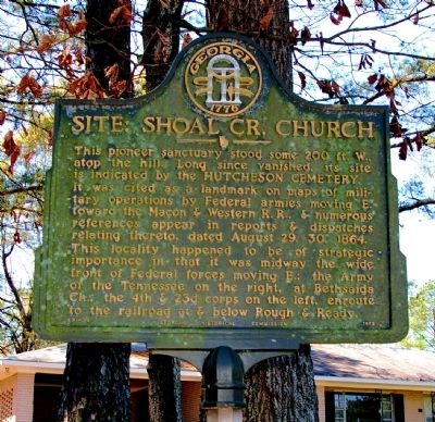
Site: Shoal Cr. Church
It was cited as a landmark on maps of military operations by Federal armies moving E. toward the Macon & Western R. R., & numerous references appear in reports & dispatches relating thereto, dated August 29, 30, 1864.
This locality happened to be of strategic importance in that it was midway the wide front of Federal forces moving E.: the Army of the Tennessee on the right, at Bethsaida Ch., the 4th & 23d corps on the left, enroute to the railroad at & below Rough & Ready.
Erected 1958 by Georgia Historical Commission. (Marker Number 031-34.)
Topics and series. This historical marker is listed in these topic lists: Cemeteries & Burial Sites • Churches & Religion • War, US Civil. In addition, it is included in the Georgia Historical Society series list. A significant historical year for this entry is 1864.
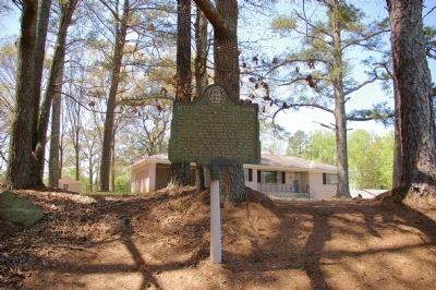
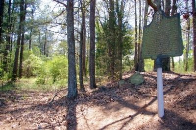
Location. 33° 35.441′ N, 84° 26.848′ W. Marker is in College Park, Georgia, in Clayton County. Marker is at the intersection of West Fayetteville Road (Georgia Route 314) and East Fayetteville Road, on the right when traveling south on West Fayetteville Road. Marker is southwest of the intersection, off West Fayetteville Road on the old abandoned roadbed of a portion of Flat Shoals Road. Touch for map. Marker is in this post office area: Atlanta GA 30349, United States of America. Touch for directions.
Other nearby markers. At least 8 other markers are within 3 miles of this marker, measured as the crow flies. 14th A.C. at Shoal Creek Church (within shouting distance of this marker); Site: Marcus Long House (approx. 1.3 miles away); Baird’s Div., 14th A.C. (approx. 1.3 miles away); Site: The Mann House (approx. 1.3 miles away); Site of Couch House (approx. 2 miles away); Hart Cemetery (approx. 2.2 miles away); Howard's March to Jonesboro (approx. 2.2 miles away); Bethsaida Baptist Church and Cemetery (approx. 2.2 miles away). Touch for a list and map of all markers in College Park.
Credits. This page was last revised on June 16, 2016. It was originally submitted on May 12, 2009, by David Seibert of Sandy Springs, Georgia. This page has been viewed 1,230 times since then and 15 times this year. Photos: 1, 2, 3. submitted on May 12, 2009, by David Seibert of Sandy Springs, Georgia. • Craig Swain was the editor who published this page.


