East Lexington in Middlesex County, Massachusetts — The American Northeast (New England)
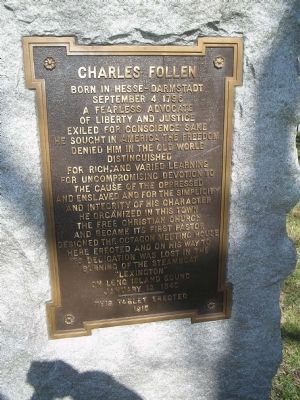
Charles Follen
September 4, 1796
A fearless advocate
of Liberty and Justice.
Exiled for conscience sake,
he sought in America the freedom
denied him in the Old World.
Distinguished
for rich and varied learning,
for uncompromising devotion to
the cause of the oppressed
and enslaved, and for the simplicity
and integrity of his character.
He organized in this town
the Free Christian Church
and became its first pastor.
Designed the octagon meeting house
here erected and on his way to
its dedication was lost in the
burning of the steamboat
“Lexington”
on Long Island Sound
January 13, 1840.
----------
This lablet erected
1915
Erected 1915.
Topics. This historical marker is listed in these topic lists: Churches & Religion • Settlements & Settlers • Waterways & Vessels. A significant historical month for this entry is January 1784.
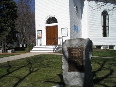
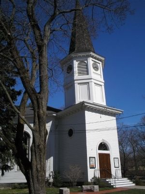
Location. 42° 25.783′ N, 71° 12.43′ W. Marker is in East Lexington, Massachusetts, in Middlesex County. Marker is at the intersection of Massachusetts Ave. (Massachusetts Route 4) and Barnes Place, on the right when traveling north on Massachusetts Ave.. Marker is located infront of the Follen Community Church. Touch for map . Marker is at or near this postal address: 755 Massachusetts Avenue, Lexington MA 02420, United States of America. Touch for directions.
Other nearby markers. At least 8 other markers are within 2 miles of this marker, measured as the crow flies. Robbins Cemetery (approx. 0.3 miles away); Munroe Tavern (approx. 0.9 miles away); The Foot of the Rocks (approx. 1˝ miles away); a different marker also named The Foot of the Rocks (approx. 1˝ miles away); Arlington Reservoir (approx. 1.7 miles away); Old Belfry (approx. 1.8 miles away); Lexington Ship Memorial (approx. 1.8 miles away); Lexington Minuteman (approx. 1.8 miles away).
Credits. This page was last revised on November 22, 2019. It was originally submitted on May 19, 2009, by Bill Coughlin of Woodland Park, New Jersey. This page has been viewed 920 times since then and 7 times this year. Photos: 1, 2, 3. submitted on May 19, 2009, by Bill Coughlin of Woodland Park, New Jersey.


