Annapolis in Anne Arundel County, Maryland — The American Northeast (Mid-Atlantic)
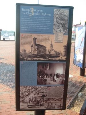
Transportation on the Chesapeake Highway
Annapolis, at mid-18th century, the largest town on the western shore of the Chesapeake Bay, served as the main port for travelers crossing to the Eastern Shore and points north to Philadelphia and beyond. Those arriving at the harbor by sail could travel south by land from Annapolis to Upper Marlboro and across the Potomac River into Virginia. Sail-powered ferries carried passengers on the 15 mile voyage across the Bay from Annapolis to Rock Hall or to other locations on the Eastern Shore.
The new congress of the United States met in Annapolis from November 1783 until Jun 1784, drawing men to town from the thirteen new states that formed the nation's government. Two days before Christmas in 1783, George Washington resigned his commission in the State House Senate Chamber. Those delegates from Princeton, the previous meeting place, most likely arrived by taking a ferry across the Bay. Maryland's own delegates to earlier meetings of the Continental Congress in Philadelphia - like the state's four signer's of the Declaration of Independence (Charles Carrol of Carrollton, Samuel Chase, William Paca, and Thomas Stone) - had traveled the same route on the journeys back and forth. With ratification of the Treaty of Paris in January 1784, Annapolis became the country's first peacetime capital.
Sail and steam vessels continued to carry people and goods to and from Annapolis throughout the 19th century. This commerce became regional, rather than national once Baltimore emerged as Maryland's major metropolis. Annapolis became a market center for local farmers and fisheries, linked by steamboats to a network of towns and landings throughout the Bay.
Topics. This historical marker is listed in these topic lists: Colonial Era • Industry & Commerce • War, US Revolutionary • Waterways & Vessels. A significant historical month for this entry is January 1784.
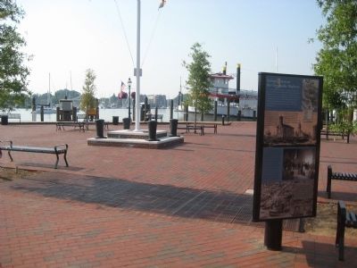
Location. 38° 58.598′ N, 76° 29.083′ W. Marker is in Annapolis, Maryland, in Anne Arundel County. Marker can be reached from Dock Street, 0.1 miles Market Space. Marker is on the plaza beyond the parking lot. Touch for map. Marker is in this post office area: Annapolis MD 21401, United States of America. Touch for directions.
Other nearby markers. At least 8 other markers are within walking distance of this marker. Steamboats Give Way to the New Bay Bridge (here, next to this marker); Annapolis: Capital of Commerce (a few steps from this marker); Maritime Annapolis: An Enduring Legacy (a few steps from this marker); Gateway to Discovery (a few steps from this marker); Watermen and Working Harbor (a few steps from this marker); Commodore John Barry (within shouting distance of this marker); Annapolis Depicted (about 300 feet away, measured in a direct line); Sy Mohr's City Dock Harbormaster Collage (about 400 feet away). Touch for a list and map of all markers in Annapolis.
Credits. This page was last revised on June 16, 2016. It was originally submitted on May 24, 2009, by F. Robby of Baltimore, Maryland. This page has been viewed 846 times since then and 9 times this year. Photos: 1, 2. submitted on May 24, 2009, by F. Robby of Baltimore, Maryland.

