Latrobe in El Dorado County, California — The American West (Pacific Coastal)
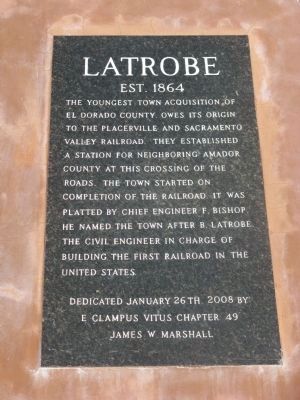
Latrobe
Est. 1864
Erected 2008 by E Clampus Vitus, James W. Marshall Chapter No.49.
Topics and series. This historical marker is listed in these topic lists: Notable Places • Railroads & Streetcars. In addition, it is included in the E Clampus Vitus series list. A significant historical date for this entry is January 26, 1862.
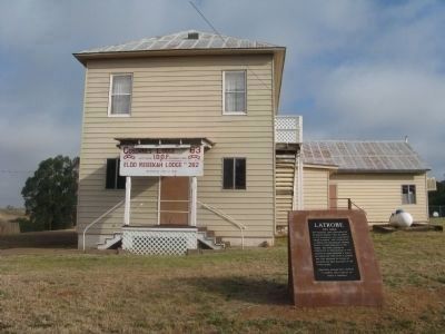
Location. 38° 33.518′ N, 120° 58.884′ W. Marker is in Latrobe, California, in El Dorado County. Marker is on South Shingle Road near Elvira Street, on the left when traveling east. Marker is located at the I.O.O.F. Hall. Touch for map. Marker is at or near this postal address: 7672 South Shingle Road, Shingle Springs CA 95682, United States of America. Touch for directions.
Other nearby markers. At least 8 other markers are within 9 miles of this marker, measured as the crow flies. Latrobe Elementary School (about 400 feet away, measured in a direct line); Gold Mining and Michigan Bar (approx. 6.3 miles away); Forest Home (approx. 6˝ miles away); Du Roc House (approx. 6.6 miles away); Camp Site of Boston-Newton Party (approx. 7.9 miles away); Mormon Tavern (approx. 8 miles away); Chinese Store (approx. 8.8 miles away); Memorial Entrance (approx. 8.9 miles away).
Also see . . .
1. Sacramento Valley Railroad (1852 – 1877). On April 19 1877 the Sacramento Valley Railroad was consolidated with the Folsom and Placerville Railroad to form the Sacramento and Placerville Railroad. (Submitted on May 24, 2009.)
2. Sacramento History Online. Click “View Large Image” link to view an expense bill for the Sacramento and Placerville Railroad from 1889. (Submitted on May 24, 2009, by Syd Whittle of Mesa, Arizona.)
Credits. This page was last revised on July 31, 2018. It was originally submitted on May 24, 2009, by Syd Whittle of Mesa, Arizona. This page has been viewed 1,820 times since then and 25 times this year. Photos: 1, 2, 3, 4. submitted on May 24, 2009, by Syd Whittle of Mesa, Arizona.


