Orwell in Addison County, Vermont — The American Northeast (New England)
American Blockhouse – 1777
Mount Independence State Historic Site
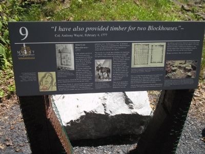
“I have also provided timber for two Blockhouses.”
- Col. Anthony Wayne, February 4, 1777
In the summer and fall of 1776 American forces concentrated on fortifying the northern point of the rocky Mount Independence peninsula, in anticipation of a British advance from Canada. Along the southeast and southern land-locked perimeters soldiers only had the time to construct log and stone breastworks as a first line of defense against the enemy, should the British attempt to encircle the Mount and assault it from the rear (south).
Col. Anthony Wayne, in command of the under-strength garrison at Mount Independence and Fort Ticonderoga in the grim winter of 1776-1777, was determined to “Render this post tenable and leave it in a much securer and better state.” On February 4, 1777, he informed Northern Department commander Gen. Philip Schuyler, “I have also provided timber for two Blockhouses – which will be erected in a few day[s].”
That month, as a second line of defense, the Americans built Wayne’s two substantial blockhouses about 600 feet apart on high ground overlooking the southern breastworks. They were 30 by 30 feet square, and two stories tall atop stone foundations. American maps from 1777 show each structure held a force of 100 men and two cannon. Soldiers on the second floor would have had an unlimited view of any enemy advancing by land to attack Mount Independence.
There are no period drawings of these blockhouses. Based on plans of other blockhouses from the time, it is likely that the second story was cantilevered over the first floor. Defending soldiers could fire through holes in the floor of the overhang on any approaching enemy. Each wall would have loopholes for muskets and portholes for cannon.
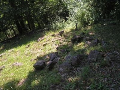
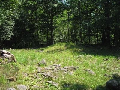
After the British gained control of Mount Independence on July 6, 1777, they used these blockhouses as part of the defense against their American enemy to the south. When the British evacuated on November 8, 1777, they burned everything, including this blockhouse, only leaving behind stones from the foundation, lumps of charcoal, some nails, and the ruined fireplace.
Respect our history. Take only photographs.
Erected by Mount Independence State Historic Site.
Topics. This historical marker is listed in this topic list: War, US Revolutionary. A significant historical date for this entry is February 4, 1864.
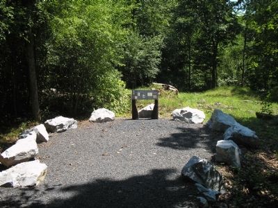
Location. 43° 49.453′ N, 73° 22.671′ W. Marker is in Orwell, Vermont, in Addison County. Marker can be reached from Mount Independence Road, on the right when traveling south. Marker is along the walking trail in Mount Independence
State Historic Site. Touch for map. Marker is in this post office area: Orwell VT 05760, United States of America. Touch for directions.
Other nearby markers. At least 8 other markers are within walking distance of this marker. Storehouse - 1776 (about 500 feet away, measured in a direct line); Heritage Travelers over the Years (about 500 feet away); Foundation -1776 or 1777 (about 500 feet away); Third Brigade Encampment – 1776 (about 600 feet away); Southern Battery – 1777 (about 700 feet away); British Blockhouse - 1777 (about 700 feet away); The American Southern Defenses – 1776-1777 (approx. 0.2 miles away); General Hospital – 1777 (approx. 0.2 miles away). Touch for a list and map of all markers in Orwell.
More about this marker. The left side of the marker contains a “1777 map showing location of American blockhouses, From Proceedings of a General Court Martial, Held at White Plains . . . . For the Trial of Major General St. Clair, 1778.” Next to this is a drawing of “A blockhouse from the Capt. John Calfe powder horn. Collection of the New Hampshire Historical Society.” Next is a painting of “Col. Anthony Wayne of Pennsylvania, commander of Mount Independence and Fort Ticonderoga during the winter of 1776-1777.” The upper right of the marker features a drawing of the “Floor plan of a typical Revolutionary
War blockhouse, which could be either square or rectangular. From Thomas Anburey’s Travels Through the Interior Parts of America, 1776-1781.” Finally, the marker’s lower right contains a photograph of archaeological work being done at this site. It has the caption, “Under the mound of earth you see in the center of the blockhouse foundation are the remains of a two-sided, double-hearth fireplace measuring about 6 feet by 512 feet. Archaeologists made that discovery in 1989. Collection of the Vermont Division for Historic Preservation.”
Related markers. Click here for a list of markers that are related to this marker. This series of markers are found on the walking trails in Mount Independence State Historic Site.
Credits. This page was last revised on November 3, 2020. It was originally submitted on May 24, 2009, by Bill Coughlin of Woodland Park, New Jersey. This page has been viewed 1,936 times since then and 32 times this year. Photos: 1, 2, 3, 4. submitted on May 24, 2009, by Bill Coughlin of Woodland Park, New Jersey.


