Orwell in Addison County, Vermont — The American Northeast (New England)
British Blockhouse - 1777
Mount Independence State Historic Site
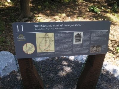
“Blockhouses, none of them finished.” -
Lt. John Starke, Royal Navy, September 1777
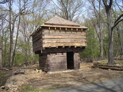
After the British captured Mount Independence on July 6, 1777, their military engineers decided to build six new blockhouses to augment American-built defenses on the southeast and southern land exposures in anticipation of potential American attacks. Three were nearly completed. The new British blockhouses supported the log and stone breastworks from 1776, the two blockhouses built in February 1777, and the three stone artillery batteries built in late June.
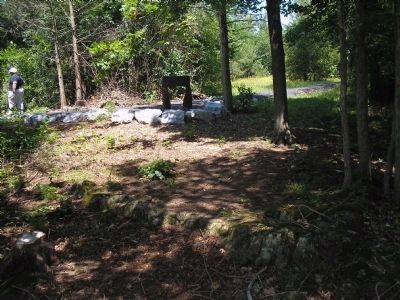
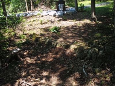
This is the 20 by 24 foot stone foundation of one of the three British blockhouses. They were smaller in size than the American blockhouses, but also were two stories tall and constructed of squared timbers on a dry-laid stone foundation. The central fireplace probably had a double hearth with a large brick chimney. According to a 1777 map, the British blockhouses had two cannon with a guard of 56 British and German soldiers. One German stated the “3 newly constructed blockhouses were all provided with cannon.”
On September 18, 1777, when two American militia parties of 500 men each attacked Mount Independence and Fort Ticonderoga, the British garrison made use of their unfinished blockhouses and successfully repelled the American overland advance from the south. After this incursion members of the German Prinz Friedrich Regiment encamped in the vicinity to be closer to the lines if the Americans attacked again. The regiment supplied the necessary troops to man the blockhouse and the breastworks just below this location.
Though the Americans had insufficient numbers to regain their old defenses, the raid had its effect. British reinforcements from Canada destined for Lt. Gen. John Burgoyne to the south halted at Mount Independence to become part of the garrison there. When British Gen. Guy Carleton asked for artillerymen to be returned to Canada, Brig. Gen. Henry Watson Powell, commander at the Mount, responded on October 5, 1777 “It would be impossible to send any of the Artillery stationed here to Canada, there are so many Batteries and Block Houses, that they are not by any means capable to the duty expected of them.”
By late October construction of the new blockhouses was incomplete, although the buildings apparently were habitable. As the British evacuated on November 8, 1777, soldiers torched the structures. This stone foundation is a silent witness of their presence.
Respect our history. Take only photographs.
Erected by Mount Independence State Historic Site.
Topics. This historical marker is listed in this
topic list: War, US Revolutionary. A significant historical month for this entry is February 1777.
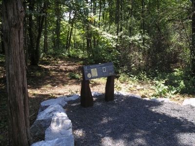
Location. 43° 49.369′ N, 73° 22.794′ W. Marker is in Orwell, Vermont, in Addison County. Marker can be reached from Mount Independence Road, on the right when traveling south. Marker is along the walking trail in Mount Independence State Historic Site. Touch for map. Marker is in this post office area: Orwell VT 05760, United States of America. Touch for directions.
Other nearby markers. At least 8 other markers are within walking distance of this marker. The American Southern Defenses – 1776-1777 (within shouting distance of this marker); Southern Battery – 1777 (within shouting distance of this marker); Foundation -1776 or 1777 (within shouting distance of this marker); German Hut – 1777 (within shouting distance of this marker); Storehouse - 1776 (about 400 feet away, measured in a direct line); Lake Champlain and the American Revolution (about 500 feet away); Third Brigade Encampment – 1776 (about 500 feet away); Heritage Travelers over the Years (about 600 feet away). Touch for a list and map of all markers in Orwell.
More about this marker. A map of Mount Independence appears at the top left of the marker. It has the caption, “Excerpt of an October 1777 map drawn by Captain de Chesnoy, a French volunteer with the American army, that indicates the placement
of Mount Independence fortifications, including this blockhouse. ‘K’s in detail show blockhouses. Collection of Library of Congress.” A “Period drawing of a blockhouse used in the American Revolution, from Thomas Asburrey’s Travels through the Interior Forts of America, (1789, reprinted 1969)” is found on the center of the marker. The bottom right of the marker contains a modern photograph of the site with the caption “Still to be seen here are faint foundations of the double-sided fireplaces, as well as traces of bricks and mortar.”
Related markers. Click here for a list of markers that are related to this marker. This series of markers are found on the walking trails in Mount Independence State Historic Site.
Credits. This page was last revised on November 3, 2020. It was originally submitted on May 25, 2009, by Bill Coughlin of Woodland Park, New Jersey. This page has been viewed 1,733 times since then and 27 times this year. Photos: 1, 2, 3, 4, 5. submitted on May 25, 2009, by Bill Coughlin of Woodland Park, New Jersey.
