Orwell in Addison County, Vermont — The American Northeast (New England)
Storehouse - 1776
Mount Independence State Historic Site
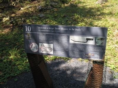
“ordered a large Stoer House to be built.” -
Col. Jeduthan Baldwin, August 17, 1776
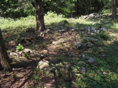
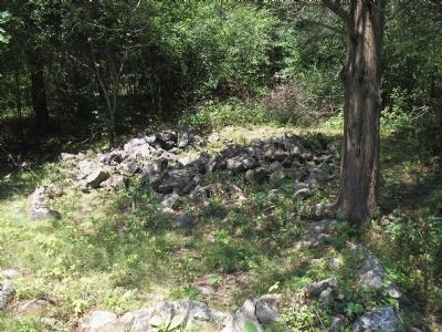
At least one of the storehouses constructed on Mount Independence during the Revolution stood in this area. Portions of the remaining stone foundations are discernable to the left, although the many outcroppings of bedrock and ledges make it difficult to distinguish between natural and man-made formations.
The success of large defensive outposts such as Mount Independence, located miles from any settlement, depended on the secure storage and re-supply of materials needed for a garrison: tools of all kinds, building supplies, armaments, ammunition, powder, tents, food, clothing, and medicine. The Commissary and Quartermaster departments of the Continental Army managed the ordering, inventory, and distribution of supplies to each regiment throughout the country.
In August 1776 Chief Engineer Jeduthan Baldwin ordered a party of carpenters, who came from many regiments and were under the leadership of Lt. Benjamin Beal of the 25th Continental Regiment (Massachusetts), to start constructing two storehouses. Supplies to be stored in this building had been shipped in from Albany, New York, and then probably were hauled here over a road from the wharf at the southern end of the Mount, a distance of over a quarter mile. This was an advantageous location, between the encampments of the Second and Third Brigades.
Beal recorded in his journal on August 15, “raised the store for the army 96 feet in length & had orders to build one 60 feet by 30.” Both structures were timber-framed, with no windows, and had wooden floors. There was probably a room for the commissary for food or the quartermaster for all other supplies. Not enough of this foundation remains to determine if it was the larger or smaller storehouse.
These large buildings were used for other purposes if there was a need. When the 18th Continental Regiment (Massachusetts) arrived on Mount Independence in late August 1776, it possessed no tents. Until the men could build proper housing, they were ordered to quarter in this newly completed and still empty storehouse. Food-related remains such as butchered animal bones and bottle fragments, discovered outside the walls in a 1992 archeological study, are evidence of the time this building served as housing. Other items outside the walls included buttons, gunflints, nails, and spikes, and may relate to either the use of this building for housing or for storage.
Respect our history. Take only photographs.
Erected by Mount Independence State Historic Site.
Topics. This historical marker is listed in this topic list: War, US Revolutionary. A significant historical year for this entry is 1776.
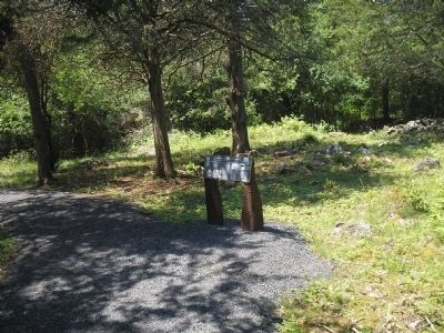
Location. 43° 49.43′ N, 73° 22.771′ W. Marker is in Orwell, Vermont, in Addison County. Marker can be reached from Mount Independence Road, on the right when traveling south. Marker is along the walking trail in Mount Independence State Historic Site. Touch for map. Marker is in this post office area: Orwell VT 05760, United States of America. Touch for directions.
Other nearby markers. At least 8 other markers are within walking distance of this marker. Third Brigade Encampment – 1776 (within shouting distance of this marker); Heritage Travelers over the Years (within shouting distance of this marker); Foundation -1776 or 1777 (about 300 feet away, measured in a direct line); British Blockhouse - 1777 (about 400 feet away); American Blockhouse – 1777 (about 500 feet away); Southern Battery – 1777 (about 500 feet away); The American Southern Defenses – 1776-1777 (about 500 feet away); General Hospital – 1777 (about 500 feet away). Touch for a list and map of all markers in Orwell.
More about this marker. The lower left of the marker contains a Map, “Ticonderoga & its Dependencies, August 1776,” by American Lt. Col. John Trumbull, showing the brigades encamped on Mount Independence in 1776 and the storehouse constructed that summer, from The Autobiography,
Reminiscences and Letters of Colonel John Trumbull, 1841.” The right side of the marker features photographs of a bayonet and flints discovered in the 1992 investigation of this site. Photos from the Collection of the Mount Independence State Historic Site.
Related markers. Click here for a list of markers that are related to this marker. This series of markers are found on the walking trails in Mount Independence State Historic Site.
Credits. This page was last revised on November 3, 2020. It was originally submitted on May 25, 2009, by Bill Coughlin of Woodland Park, New Jersey. This page has been viewed 1,128 times since then and 11 times this year. Photos: 1, 2, 3, 4. submitted on May 25, 2009, by Bill Coughlin of Woodland Park, New Jersey.


