Orwell in Addison County, Vermont — The American Northeast (New England)
Foundation -1776 or 1777
Mount Independence State Historic Site
— What do you think? - —
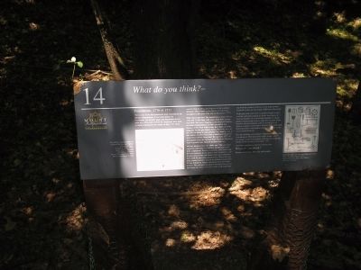
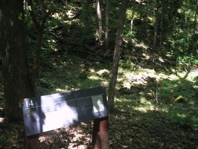
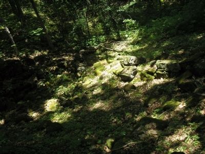
This is one of the best-preserved stone foundations on Mount Independence. It was built during the Revolution, but historic maps and documents do not refer to it. Who built it? Did the Americans have time to build it during the two weeks in June 1777 when constructing the three gun batteries of the southern defenses? Was it built by the British and Germans encamped in this area from July to November 1777?
What was it used for? The foundation is about 19 feet wide and 31 feet long, with stone walls three to four feet thick. Surveyors mapping archaeological features on Mount Independence in 1966 speculated that because of the thick walls it may have been a powder magazine for the gun battery below, but is the base of this hill too damp to store powder? It is usually cool in this hollow. Could it have been a storehouse for provisions? Did soldiers sleep here? By late July 1777 off duty guards from the German Prinz Friedrich Regiment slept in guardrooms adjacent to these batteries.
Military treatises from the 1600s and 1700s provided engineers with plans for building fortifications and their components. Powder magazines, to be built with the least exposure to the enemy, were designed to safely store gunpowder and loaded shells and sometimes were used for provisions and housing. Those that supplied cannon batteries were to be located at least 20 to 30 feet behind the battery and about three feet underground. This sheltered location is invisible from potential enemy fire below and also is next to the path leading from the southern defenses to the main powder magazine in the star fort about 3,000 feet to the north.
Walls and roofs were to be secured by boards to prevent the earth from falling in. Roofs were layers of fascines (bundles of sticks bound together) or strong planks covered with seven to eight feet of earth. Some treatises advised building walls of several rows of gabions (similar to bottomless baskets) filled with earth and board floors with shallow cellars on rope so any water would drain out.
Was this building ever finished? Historians examining the foundation in 1966 found little debris inside – only a few lumps of charcoal, perhaps from the fire set by the British before leaving in November 1777.
Historians continue to look for answers, but
Respect our history. Take only photographs.
Erected by Mount Independence State Historic Site.
Topics. This historical marker is listed in this topic list: War, US Revolutionary. A significant historical month for this entry is June 1777.
Location. 43° 49.388′ N, 73° 22.753′ W. Marker is in Orwell, Vermont
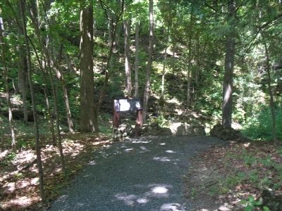
, in Addison County. Marker can be reached from Mount Independence Road, on the right when traveling south. Marker is along the walking trail in Mount Independence State Historic Site. Touch for map. Marker is in this post office area: Orwell VT 05760, United States of America. Touch for directions.
Other nearby markers. At least 8 other markers are within walking distance of this marker. British Blockhouse - 1777 (within shouting distance of this marker); Southern Battery – 1777 (within shouting distance of this marker); Storehouse - 1776 (about 300 feet away, measured in a direct line); The American Southern Defenses – 1776-1777 (about 300 feet away); Third Brigade Encampment – 1776 (about 500 feet away); German Hut – 1777 (about 500 feet away); Heritage Travelers over the Years (about 500 feet away); American Blockhouse – 1777 (about 500 feet away). Touch for a list and map of all markers in Orwell.
More about this marker. The bottom left of the marker contains a picture from “John Muller’s military treatise for engineers, The Attack and Defense of Fortified Places show[ing] a powder magazine behind the gun battery. Special Collections, Bailey-Howe Library, University of Vermont.” The right of the marker features another picture from Muller’s treatise showing various tools used for building fortifications.
Related markers. Click here for a list of markers that are related to this marker. This series of markers
are found on the walking trails in Mount Independence State Historic Site.
Credits. This page was last revised on November 3, 2020. It was originally submitted on May 28, 2009, by Bill Coughlin of Woodland Park, New Jersey. This page has been viewed 1,297 times since then and 15 times this year. Photos: 1, 2, 3, 4. submitted on May 28, 2009, by Bill Coughlin of Woodland Park, New Jersey.


