Near Prairie du Sac in Sauk County, Wisconsin — The American Midwest (Great Lakes)
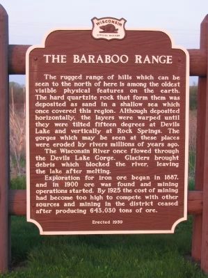
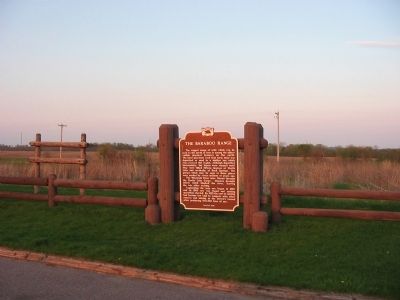
The Baraboo Range
The Wisconsin River once flowed through the Devils Lake Gorge. Glaciers brought debris which blocked the river, leaving the lake after melting.
Exploration for iron ore began in 1887, and in 1900 ore was found and mining operations started. By 1925 the cost of mining had become too high to compete with other sources and mining in the district ceased after producing 643,030 tons of ore.
Erected 1959 by the Wisconsin Historical Society. (Marker Number 89.)
Topics and series. This historical marker is listed in these topic lists: Industry & Commerce • Natural Features • Waterways & Vessels. In addition, it is included in the Wisconsin Historical Society series list. A significant historical year for this entry is 1887.
Location. 43° 19.947′ N, 89° 45.519′ W. Marker is near Prairie du Sac, Wisconsin, in Sauk County. Marker is on U.S. 12, 1.2 miles north of Prairie Road (County Highway Z), on the right when traveling north. Marker is at a highway pull-off. Touch for map. Marker is in this post office area: Prairie du Sac WI 53578, United States of America. Touch for directions.
Other nearby markers. At least 8 other markers are within 6 miles of this marker, measured as the crow flies. Wollersheim Winery (approx. 3.9 miles away); August W. Derleth (approx. 4.2 miles away); Free Congregation of Sauk County (approx. 4.4 miles away); Culver's (approx. 4˝ miles away); Sauk City (approx. 4˝ miles away); The Salem Church (approx. 4.8 miles away); Early History of Devil's Lake (approx. 5˝ miles away); North Shore Hotel Era (approx. 5˝ miles away).
Also see . . . Baraboo Range. Wikipedia entry. "The rocks are as much as 1.6 billion years old, among the oldest exposed rocks in North America consisting mainly of pink Baraboo quartzite and red rhyolite." (Submitted on May 31, 2009.)
Credits. This page was last revised on June 16, 2016. It was originally submitted on May 31, 2009, by Keith L of Wisconsin Rapids, Wisconsin. This page has been viewed 2,646 times since then and 144 times this year. Photos: 1, 2. submitted on May 31, 2009, by Keith L of Wisconsin Rapids, Wisconsin. 3. submitted on July 24, 2010, by William J. Toman of Green Lake, Wisconsin. 4. submitted on May 31, 2009, by Keith L of Wisconsin Rapids, Wisconsin. • Craig Swain was the editor who published this page.


