Orwell in Addison County, Vermont — The American Northeast (New England)
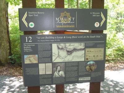
The American Southern Defenses – 1776-1777
Inscription.
“we are Building a Large & Long Breast work on the South Side.” -
Pvt. Thomas Killam, August 19, 1776
When the American Northern Army arrived at Ticonderoga in mid-July 1776, the 300-acre peninsula opposite on the Vermont shore was a rugged land mass ideal for adaptation as a major fortification. What would soon be named Mount Independence faced north, toward the enemy, with water surrounding it on three sides and rugged cliffs and steep rock-strewn slopes on the land-locked south side.
In early August 1776, after fortifying the northern point, American fatigue parties began construction of a one and one half mile long breastworks of logs and stone along the upper edge of the rocky southern slope. Chief Engineer Jeduthan Baldwin ordered most of the fortifications here to be constructed of soil and fascines (long bundles of branches) and then sodded with grass to restrict erosion.
The works probably stood nearly four feet high; enough to protect soldiers standing behind it. Because the American army expected a British attack to come from the north rather than the south, they did not place cannons here at this time. As a further defense, the men placed a barrier of abatis, bunches of tree branches with sharpened ends, in front of the breastworks. When completed this line should have looked quite formidable to an enemy trying to scale the slopes in the face of musket fire.
During the grim winter of 1776-1777, the American soldiers remaining here worked hard to build the huts and fortifications, and due to the cold they used much of the timber for firewood. Col. Anthony Wayne, commander of the fortifications at Mount Independence and Ticonderoga, assessed the situation and ordered the soldiers to “make this place as formidable as possible.” Breastworks alone were not sufficient to repel the enemy, so in February 1777 he ordered construction of two thirty-foot square blockhouses behind and above these lines. The two thirty-foot structures, armed with cannon, provided another level of defense for a land approach to Mount Independence.
As summer drew near, the British under John Burgoyne were pushing south on Lake Champlain. American defenses had to be ready. Morale was high. Massachusetts Colonel Samuel Brewer wrote: “Our numbers are few but in high spirit, and seem determined to conquer or die.”
Brewer recorded on June 14, 1777 . . . Polish engineer Thaddeus Kosciuszko, who had been appointed by Congress as a lieutenant colonel in the Continental Army, was Baldwin’s new assistant. Kosciuszko, a talented artillery specialist classically trained in France, had arrived at Mount Independence and Ticonderoga
in May.
On June 30, 1777 Baldwin recorded: “began the process of a fortifying Mt. Independence.” Kosciuszko led 500 to 600 men in building the batteries, locating them on intermittent slopes with no dead ground in front. These fortifications protected the breastworks on each side. Baldwin increased the batteries thirty inches high so the barrels of the cannon could just peek over the top. Work proceeded quickly. By June 27 Baldwin recorded that they were “leying platforms” for the cannons, and placed a fresh line of abatis in front of the breastworks.
When the Americans abandoned Mount Independence on the night of July 5 and 6, 1777, the British army utilized the newly completed Southern Batteries.
Second Marker:
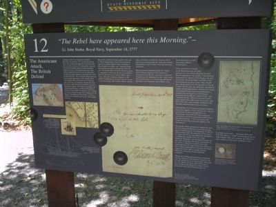
The Americans Attack, The British Defend
“The Rebels have appeared here this Morning,” -
Lt. John Stark, Royal Navy, September 18, 1777
A German officer with the Prinz Friedrich Regiment encamped in 1777 on this high ground along the fortification described the start of the raid: “It was in the morning of 18 September about one hour before daybreak that the rebels intended a sudden raid on our position, however, we were awake, initiated the alarm, and in less than thirty seconds the entire regiment stood under arms and directed the fire.” The defending British garrison rushed to their alarm points in this vicinity. Soon more musket fire came from the Ticonderoga side of the lake. An American military party led by Lt. Col. John Brown had attacked the unsuspecting British regiment. The Americans quickly captured Mount Defiance, two British blockhouses, defensive lines at Fort Ticonderoga, and a number of vessels on Lake George. Four companies of the British 53rd Regiment fell as prisoners, as well as a naval detachment and nearly 136 Canadian troops.
Meanwhile, the British picket guards in this area on Mount Independence fired at the Americans under Col. Samuel Johnson who, according to Maj. Friedrick von Hille, were “advancing towards the 2nd and 3rd batteries through the dense forest.” The German Prinz Friedrich Regiment quickly manned the works from the first to second batteries at the end of the Southern Battery Spur Trail, while the remaining companies of the British 53rd Regiment stretched from the second to the third battery. The southern battery cannons, along with those on board the Maria and Careston stationed off the south end of Mount Independence, fired to keep at bay the Advancing Americans.
British garrison commander Brig. Gen. Henry Watson Powell reported to Guy Carleton in Canada that John Brown’s attempt to storm Fort Ticonderoga was repelled
due to the “great resolution & perseverance” of 100 German and British defenders, with assistance from artillery at the Horseshoe Battery on the north side of Mount Independence.
Twice John Brown demanded the British garrison surrender, and twice he was refused. Brigadier General Powell responded to one request: “The Garrison invested to my charge, I shall defend to the last.” Of Powell’s intentions, Major von Hille of the Prinz Friedrich Regiment wrote: “Brig. Powell gave out the order to use the bayonet in a forced assault.” For five days the Americans attempted to capture Mount Independence, making brief forays on the British fortifications and maintaining a constant fire on the garrison. One German described the shooting as “violent firings” and “vehement firings.” British forces moved their tents closer to the south-facing breastworks, and half of the force, approximately 850 British and Germans remained under arms at all times.
On September 21 the Americans finally withdrew, laden with supplies, vessels and prisoners, but not in command of Mount Independence or Ticonderoga. General Powell expressed great satisfaction in the British garrison’s performance, informing Carleton: “I must say I never saw Troops do their Duty with more alertness and cheerfulness.”
Though the Americans failed to capture the posts, the raid pushed the British to reconsider assignment of reinforcements. On September 27 and 28 British troops under the command of Col. Barry St. Ledger arrived here from Montreal, destined to strengthen the position of Lt. Gen. John Burgoyne. Burgoyne, now encamped 70 miles to the south at Saratoga, New York, was blocked in his march to Albany by a numerically larger American force. St. Ledger’s men were ordered to halt at Mount Independence to protect the British supplies here from further assaults, leaving Burgoyne without the critical additional manpower.
During the raid Mount Independence delivered and was subjected to the greatest amount of cannon and musket fire in its short history. American Lt. Col. Thomas Johnson wrote of the raid, “I have had but little sleep this 3 nights for the Roaring of Cannon and Cracking of guns are Continuly in our Ears . . . The Grape Shot fell like Hale Stones.” A 2001 archaeological survey found musket balls and a grenade near this location, evidence of the heavy exchange of fire.
Third Marker:
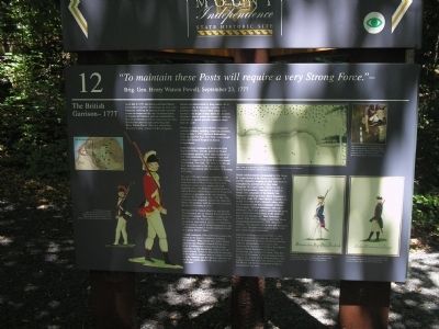
The British Garrison – 1777
“To maintain these Posts will require a very Strong Force.” -
Brig. Gen. Henry Watson Powell, September 23, 1777
As of July 6, 1777, the British controlled Mount Independence and Fort Ticonderoga. Lt. Gen. John Burgoyne, realizing the posts protected a possible avenue of escape and the line of communication to Canada, left behind a garrison commanded by Gen. James Hamilton until he returned to the main British army and was replaced by Brig. Gen. Henry Watson Powell. The force, drawn from Burgoyne’s army, consisted of British regulars, German auxiliaries hired by King George III to supplement the British army, Loyalists, and Canadian workers. Most of their camps were located on the height of land above this location, the perfect spot to protect the extensive southern fortifications against possible American attack from the south.
During the early part of the British occupation wounded soldiers, including American prisoners, from the July 7, 1777 battles at Hubbardton, Vermont and Fort Ann, New York, were brought to the new General Hospital on Mount Independence.
Eight battalion companies of the British 62nd Regiment of Foot, initially part of the Mount Independence garrison, were commanded by Lt. Col. John Anstruther. They remained here until ordered on August 12 to rejoin Burgoyne around Fort Edward, New York. The soldiers in this unit were taken prisoner by the Americans when Burgoyne surrendered after the Battled of Saratoga in October.
On August 18 eight battalion companies of the 53rd Regiment, commanded by Maj. Paul Irving, were sent back to Mount Independence from Burgoyne’s main army to replace the 62nd Regiment. The 53rd Regiment suffered severely during Brown’s raid on September 18, losing four companies as prisoners in the early morning attack on the Ticonderoga side of the lake. The remaining four companies manned the works on Mount Independence until the garrison evacuated the post on November 8, 1777.
Serving with the British 62nd Foot and later the 53rd Regiment was the German Brunswick Prinz Friedrich Regiment. They were a steadfast part of the force until the November evacuation. They guarded the most critical section of fortifications on the southeast side of Mount Independence, and a detachment located in Fort Ticonderoga defended it during Brown’s raid.
A small contingent of Royal Artillery manned the cannon in the numerous batteries on Mount Independence. When British Gen. Guy Carleton requested that Brigadier General Powell send a detail of artillerymen back to Canada in late September to help defend that territory, Powell firmly refused. “It will be impossible to send any of the Artillery stationed here to Canada, there are so many Batteries and Blockhouses, that they are not by any means equal to the duty expected from them.”
British reinforcements commanded by Col. Barry St. Ledger arrived at the Mount on September 27 and 28, originally stopping on their way south to strengthen the position of Lt. Gen. John Burgoyne. St. Ledger’s men ordered to stay at Mount Independence, consisted of a range of troops: four companies of the British 34th Regiment of Foot, the King’s Royal regiment of New York under Col. John Johnson, a loyalist unit mainly from New York’s Mohawk valley with a few Vermonters, and four companies of Hesse Hanau Jagers, German woodsmen, and expert marksmen. These last soldiers served on the guard posts outside the fortifications to the south and also west of Ticonderoga. Their lieutenant colonel, Carl von Creuzbourg, wrote from Mount Independence on October 5, 1777, about their clothing. “The uniforms are in rags, and darning is of no avail; the colors have faded to brown with not a shade of green noticeable.”
When the shocking news arrived that Lt. Gen. John Burgoyne had surrendered on October 17 after the Battles of Saratoga, the British garrison at Mount Independence was at grave risk. Assessing the situation, Powell gave the order to abandon Mount Independence and Fort Ticonderoga and evacuate to Canada. They did just that on November 8, first packing up everything of use, setting fire to all the buildings, and making useless the rest of the defensive works. The British and German occupation of Mount Independence was over.
Erected by Mount Independence State Historic Site.
Topics. This historical marker is listed in this topic list: War, US Revolutionary. A significant historical month for this entry is February 1777.
Location. 43° 49.353′ N, 73° 22.8′ W. Marker is in Orwell, Vermont, in Addison County. Marker can be reached from Mount Independence Road, on the right when traveling south. Marker is along the walking trail in Mount Independence State Historic Site. Touch for map. Marker is in this post office area: Orwell VT 05760, United States of America. Touch for directions.
Other nearby markers. At least 8 other markers are within walking distance of this marker. British Blockhouse - 1777 (within shouting distance of this marker); German Hut – 1777 (within shouting distance of this marker); Southern Battery – 1777 (within shouting distance of this marker); Foundation -1776 or 1777 (about 300 feet away, measured in a direct line); Lake Champlain and the American Revolution (about 400 feet away); Storehouse - 1776 (about 500 feet away); Third Brigade Encampment – 1776 (about 600 feet away); Heritage Travelers over the Years (about 700 feet away). Touch for a list and map of all markers in Orwell.
More about this marker. A map of Mount Independence appears at the top of the first marker. Next to that is a picture of various tools used in building fortifications. A modern photograph of the Southern Defenses and a picture of Thaddeus Kosciuszko also appear on the marker.
A map of Fort Carillon/Ticonderoga and Mount Independence appears on the right side of the second marker. Below this is a photo of a button found in the vicinity by archaeologists. The left side of the marker contains pictures of cannon balls.
The top of the third marker contains a map of the “Plan of the Situation on Mount Independence near Carillon Before the Retreat.” Next to this is a photograph of an archaeologist with the caption, “This canteen base was discovered in a 1992 archaeological investigation inside what was likely a British hut site near the southern battery. Collection of the Mount Independence State Historic Site.” Also on the marker are pictures of various soldiers, including a British artilleryman, a British 62nd Regiment soldier, soldier of the Prinz Friedrich Regiment and a Hessian Jager.
Related markers. Click here for a list of markers that are related to this marker. This series of markers are found on the walking trails in Mount Independence State Historic Site.
Credits. This page was last revised on November 3, 2020. It was originally submitted on June 1, 2009, by Bill Coughlin of Woodland Park, New Jersey. This page has been viewed 2,552 times since then and 30 times this year. Photos: 1, 2, 3, 4. submitted on June 1, 2009, by Bill Coughlin of Woodland Park, New Jersey.


