Hopewell, Virginia — The American South (Mid-Atlantic)
The Waterfront
Petersburg National Battlefield
— National Park Service, U.S. Department of the Interior —
“Everything is as perfectly arranged as in Boston.” - Pvt. R.G. Carter 22nd Massachusetts Infantry
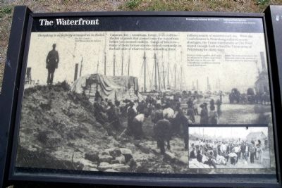
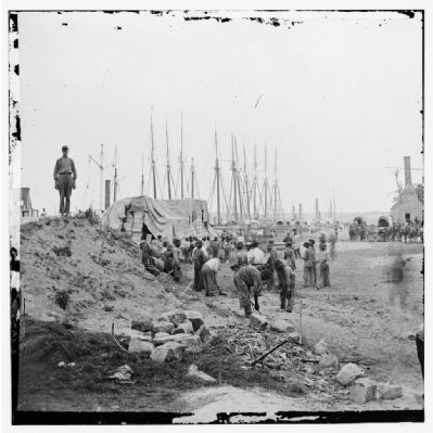
Cannons, food, munitions, forage, even coffins-the list of goods that passed onto the waterfront before you seemed endless. Gangs of laborers-many of them former slaves-toiled constantly on the half mile of wharves here, unloading three million pounds of materiel each day. While the Confederates in Petersburg suffered severe shortages, the Union warehouses at City Point stored enough food to feed the Union army at Petersburg for thirty days.
Erected by National Park Service, U.S. Department of the Interior.
Topics. This historical marker is listed in this topic list: War, US Civil.
Location. This marker has been replaced by another marker nearby. It was located near 37° 18.957′ N, 77° 16.387′ W. Marker was in Hopewell, Virginia. Marker could be reached from Water Street near Pecan Avenue. This marker is located in the Old City Point Waterfront Park. Touch for map. Marker was in this post office area: Hopewell VA 23860, United States of America. Touch for directions.
Other nearby markers. At least 8 other markers are within walking distance of this location. Clearing the Way (here, next to this marker); Quartermaster Repair Shops (within shouting distance of this marker); Virginia Indians near City Point (within shouting distance of this marker); City Point (within shouting distance of this marker); a different marker also named City Point (within shouting distance of this marker); Taverns (about 500 feet away, measured in a direct line); Housing Several Thousand Federal Troops (about 500 feet away); One Soldier, One Family, One War (about 600 feet away). Touch for a list and map of all markers in Hopewell.
More about this marker. Across the panel is a photo of the City Point waterfront with the caption, "Workers ready supplies of all types for shipment to Union siege lines. By this time in the war, the Confederates would have gawked at such abundance. Inset: The work of stevedores like these was vital to the success of Federal soldiers in the front lines."
Related marker. Click here for another marker that is related to this marker. New Marker At This Location titled "Clearing the Way".
Also see . . .
1. Petersburg National Battlefield. City Point. (Submitted on June 5, 2009.)
2. US Army Quartermaster Foundation - Quartermaster Professional Bulletin - Spring 1991. “City Point: The Tool That Gave General Grant Victory” by Captain Robert O. Zinnen, Jr. (Submitted on June 5, 2009.)
Credits. This page was last revised on November 7, 2021. It was originally submitted on June 4, 2009, by Bernard Fisher of Richmond, Virginia. This page has been viewed 2,267 times since then and 31 times this year. Photos: 1, 2. submitted on June 4, 2009, by Bernard Fisher of Richmond, Virginia. 3. submitted on June 5, 2009, by Bernard Fisher of Richmond, Virginia. 4. submitted on June 8, 2009, by Bernard Fisher of Richmond, Virginia.


