Historic District - North in Savannah in Chatham County, Georgia — The American South (South Atlantic)
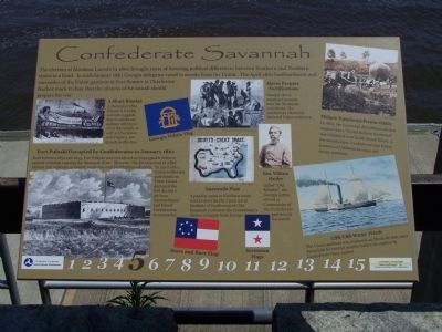
Confederate Savannah
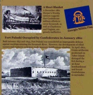
A Short Blanket
( Picture included )
A December 1861 Harper's Weekly cartoon suggests that Confederate military efforts to cover Savannah, as well as Charleston and Virginia, are grossly ineffective. ( Georgia Military Flag included )
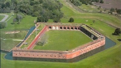
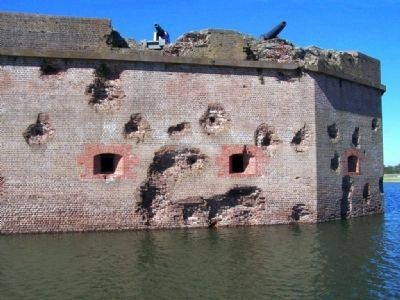
Fort Pulaski Occupied by Confederates in January 1861
( Picture included )
Built between 1831 and 1845, Fort Pulaski was concidered an impregnable defense against warships entering the Savannah River. However , the development of rifled cannon and explosive ordnance made masonry fortifications obsolete. In April 1862, Union artillerists positioned on Tybee Island damaged the fort during a 30-hour bombardment and forced Confederates to surrender.
Slaves Prepare Fortifications
( Picture Included )
Georgia slaves construct mounds near the Savannah waterfront. The earthworks effectively deterred Union ordnance.
Anaconda Plan
( Picture of Scott's Great Snake. )
A popular name in Northern states used to describe the Union Naval blockade of Southern Ports like Savannah to destroy the Confederacy's lifeline of supply from Europe.
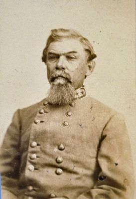
Gen. William Hardee
( Picture Included )
Called " Old Reliable ", the Georgia native, served as Commander of the Confederate garrison in Savannah.
( Stars and Bars Flag & Secession Flags included )
Military Transforms Prewar Oddity
( Picture Included )
In 1860, the Savannah Republican advised readers that a " Grand Ballon Ascension" was scheduled near South Broad Street. A few months later, Confederate and Union armies used balloons to scope out enemy positions.
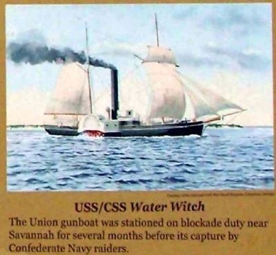
USS/CSS Water Witch
( Picture Included )
The Union gunboat was stationed on blockade duty near Savannah for several months before its capture by Confederate Navy raiders.
Erected 2009 by U.S. Dept. Of Transportation Federal Highway Administration, Georgia Dept. of Transportation. (Marker Number 5.)
Topics. This historical marker is listed in this topic list: War, US Civil. A significant historical month for this entry is January 1861.
Location. 32° 4.875′ N, 81° 5.328′ W. Marker is in Savannah, Georgia, in Chatham County. It is in the
Historic District - North. Marker is on East River Street, on the left when traveling east. Located between Drayton St. Ramp and Lincoln St. Ramp, Riverside. Touch for map. Marker is in this post office area: Savannah GA 31401, United States of America. Touch for directions.
Other nearby markers. At least 8 other markers are within walking distance of this marker. Savannah's Cobblestones (within shouting distance of this marker); River Street Inn (within shouting distance of this marker); Christmas in Savannah 1864 (about 300 feet away, measured in a direct line); Solomon's Lodge No. 1 F.& A.M. (about 300 feet away); Arts & Crafts Emporium (about 300 feet away); Salzburger Monument of Reconciliation (about 300 feet away); The Invention of the Cotton Gin (about 400 feet away); Solomon's Lodge No. 1 F. & A.M Savannah, Georgia (about 400 feet away). Touch for a list and map of all markers in Savannah.
Related markers. Click here for a list of markers that are related to this marker. Related Markers
Also see . . . William Joseph Hardee ,From Wikipedia. His initial assignment as a general was to organize a brigade of Arkansas regiments and he impressed his men and fellow officers by solving difficult supply problems and for the thorough training he gave his brigade. He received his nickname, "Old Reliable", while with this command. (Submitted on June 5, 2009, by Mike Stroud of Bluffton, South Carolina.)
Credits. This page was last revised on February 8, 2023. It was originally submitted on June 5, 2009, by Mike Stroud of Bluffton, South Carolina. This page has been viewed 1,624 times since then and 62 times this year. Photos: 1, 2, 3, 4, 5, 6, 7. submitted on June 5, 2009, by Mike Stroud of Bluffton, South Carolina. • Craig Swain was the editor who published this page.
