Tybee Island in Chatham County, Georgia — The American South (South Atlantic)
Cockspur Island Lighthouse
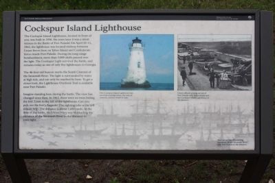
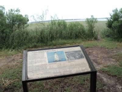
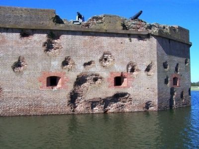
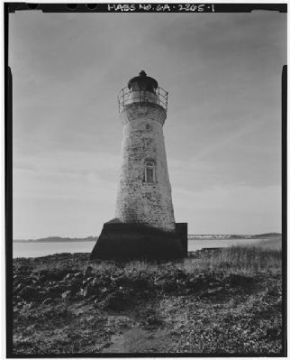
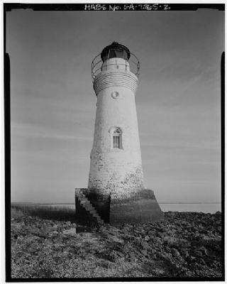
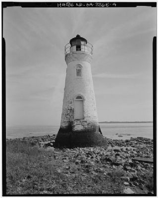
The Cockspur Island Lighthouse, located in front of you was built in 1856. Six years later it was a silent witness to the Battle of Fort Pulaski. On April 10-11, 1862, the lighthouse was located midway between Union forces here on Tybee Island and Confederate forces inside Fort Pulaski. During the long-range bombardment, more than 5,000 shells passed over the light. The Cockspur Light survived the battle, and remains today as only one of five lighthouses in Georgia.
The 46-foot-tall beacon marks the South Channel of the Savannah River. The light is surrounded by water at high tide, and can only be reached by boat. To get a closer look, the Light Overlook Trail is available near Fort Pulaski.
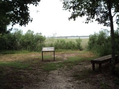
Imagine standing here during the battle. The view has changed since then. In 1862, there were no trees hiding the fort. Look to the left of the lighthouse. Can you pick out the fort's flagpole? The sighting tube at left should help. The distance is about 1,600 yards. At the time of the battle, the Union Navy was blockading the entrance to the Savannah River in the distance to your right.
Erected 2009 by National Park Service, Fort Pulaski National Monument.
Topics and series. This historical marker is listed in these topic lists: Landmarks • War, US Civil • Waterways & Vessels. In addition, it is included in the Lighthouses series list. A significant historical month for this entry is April 1853.
Location. 32° 1.001′ N, 80° 52.251′ W. Marker is on Tybee Island, Georgia, in Chatham County. Marker can be reached from Islands Expressway (U.S. 80) near Catalina Drive, on the right when traveling west. Touch for map. Marker is in this post office area: Tybee Island GA 31328, United States of America. Touch for directions.
Other nearby markers. At least 8 other markers are within 2 miles of this marker, measured as the crow flies. Long Range Artillery Duel (a few steps from this marker); A Turning Point In History (within shouting distance of this marker); Federal Batteries on Tybee Island (about 600 feet away, measured in a direct line); Lazaretto (approx. half a mile away); The Breached Wall (approx. 1.3 miles away); 5,275 Shots & Shells in 30 Hours (approx. 1.3 miles away); Shifting Shoreline (approx. 1.3 miles away); A Devastating Bombardment (approx. 1.3 miles away). Touch for a list and map of all markers in Tybee Island.
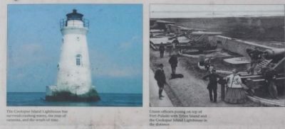
More about this marker. The center photo is captioned, The Cockspur Island Lighthouse has survived crashing waves, the roar of cannons and the wrath of tme. On the right is a photo of Union officers posing on top of Fort Pulaski with Tybee Island and the Cockspur Island Lighthouse in the distance. The background of the marker depicts The Union Navy Blockading Squadron off the Savannah River with Fort Pulaski in the distance.
Regarding Cockspur Island Lighthouse. The sighting tube mentioned on the marker is not currently in place.
Also see . . .
1. Nat. Park Service , Cockspur Lighthouse. stands twelve miles east of the port of Savannah. The islet, often covered by high tide, is comprised of oyster shells, and marsh grass. (Submitted on June 4, 2009, by Mike Stroud of Bluffton, South Carolina.)
2. Cockspur Island, GA. additional pictures (Submitted on June 4, 2009, by Mike Stroud of Bluffton, South Carolina.)
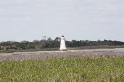
Photographed By Mike Stroud, April 7, 2009
5. Cockspur Island Lighthouse seen from Tybee Island
On April 10, 1862, Union forces in eleven batteries stretching along the beach at Tybee Island started a long-range bombardment of Fort Pulaski. Thirty-six guns participated in a thirty-hour siege of the fort with the Cockspur Lighthouse in direct line of fire.
Credits. This page was last revised on May 3, 2020. It was originally submitted on June 4, 2009, by Mike Stroud of Bluffton, South Carolina. This page has been viewed 1,692 times since then and 29 times this year. Last updated on June 5, 2009, by Mike Stroud of Bluffton, South Carolina. Photos: 1. submitted on June 4, 2009, by Mike Stroud of Bluffton, South Carolina. 2, 3. submitted on December 12, 2013, by Bill Coughlin of Woodland Park, New Jersey. 4, 5, 6. submitted on June 4, 2009, by Mike Stroud of Bluffton, South Carolina. 7, 8, 9. submitted on May 20, 2010, by Mike Stroud of Bluffton, South Carolina. • Craig Swain was the editor who published this page.
