Marker Logo HMdb.org THE HISTORICAL
MARKER DATABASE
“Bite-Size Bits of Local, National, and Global History”
Near Rock Springs in Sauk County, Wisconsin — The American Midwest (Great Lakes)
 

Van Hise Rock


Van Hise Rock Marker image. Click for full size.
Photographed By Keith L, June 7, 2009
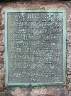
1. Van Hise Rock Marker
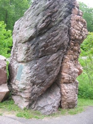
Inscription. The material of this rock was once sand on the sea bottom, and has since hardened into quartzite. It was tilted to the present position by a slow earth movement, and then separated from the adjacent cliff by erosion. The vertical light and dark bands represent the original layers. The inclined cracks in the dark layer were caused by the readjustment in the layers during the tilting.

This rock is pictured in geologic books as a type illustrating important principles of structural geology, and has been a point of special interest to many investigators in geology visiting this region. President Charles R. Van Hise of the University of Wisconsin was one of the first and foremost of these.

Please do not deface.

Tablet presented by friends of Van Hise at the University of Wisconsin.
1923

 
Erected 1923 by friends of Van Hise at the University of Wisconsin.
 
Topics. This historical marker is listed in these topic lists: EducationNatural Features. A significant historical year for this entry is 1923.
 
Location. 43° 29.348′ N, 89° 54.94′ W. Marker is near Rock Springs, Wisconsin, in Sauk County. Marker is on North River Street (State Highway 136) 0.8 miles north of Broadway (State Highway 154), on
Paid Advertisement
Click on the ad for more information.
Please report objectionable advertising to the Editor.
Click or scan to see
this page online
the right when traveling north. Marker is located just north of a highway pull-off. Touch for map. Marker is in this post office area: Rock Springs WI 53961, United States of America. Touch for directions.
 
Other nearby markers. At least 8 other markers are within 6 miles of this marker, measured as the crow flies. A different marker also named Van Hise Rock (within shouting distance of this marker); Mid–Continent Railway Historical Society (approx. 2.9 miles away); Clare A. Briggs – Cartoonist (approx. 3.1 miles away); Vodak Memorial Park (approx. 3.1 miles away); Attempted Native American Deportation and Relocation (approx. 5.4 miles away); Babb's Ford (approx. 5.6 miles away); Reedsburg WWII Prisoner of War Camp (approx. 5.8 miles away); Veterans Memorial (approx. 5.8 miles away).
 
Also see . . .  Wikipedia article on the Van Hise Rock. (Submitted on June 11, 2009.)
 
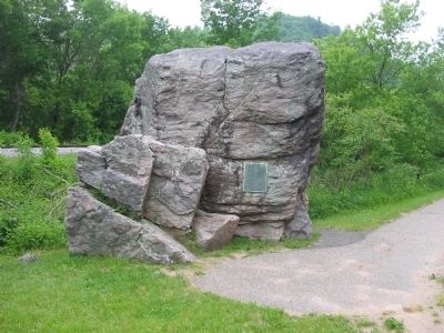
Van Hise Rock and Marker image. Click for full size.
Photographed By Keith L, June 7, 2009
2. Van Hise Rock and Marker
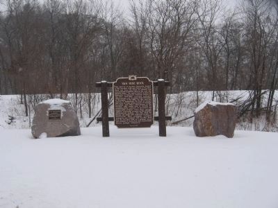
Van Hise Rock and Markers image. Click for full size.
Photographed By Robert L Weber, January 12, 2009
3. Van Hise Rock and Markers
Van Hise Rock image. Click for full size.
Photographed By Keith L, June 7, 2009
4. Van Hise Rock
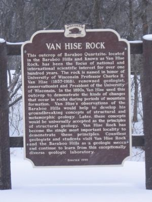
Another Van Hise Rock Marker image. Click for full size.
Photographed By Robert L Weber, January 12, 2009
5. Another Van Hise Rock Marker
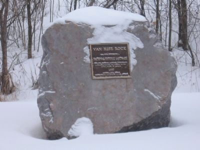
Van Hise Rock and Marker image. Click for full size.
Photographed By Robert L Weber, January 12, 2009
6. Van Hise Rock and Marker
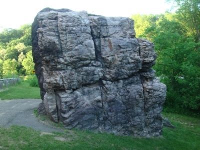
The other side of Van Hise Rock image. Click for full size.
Photographed By William J. Toman, June 5, 2011
7. The other side of Van Hise Rock
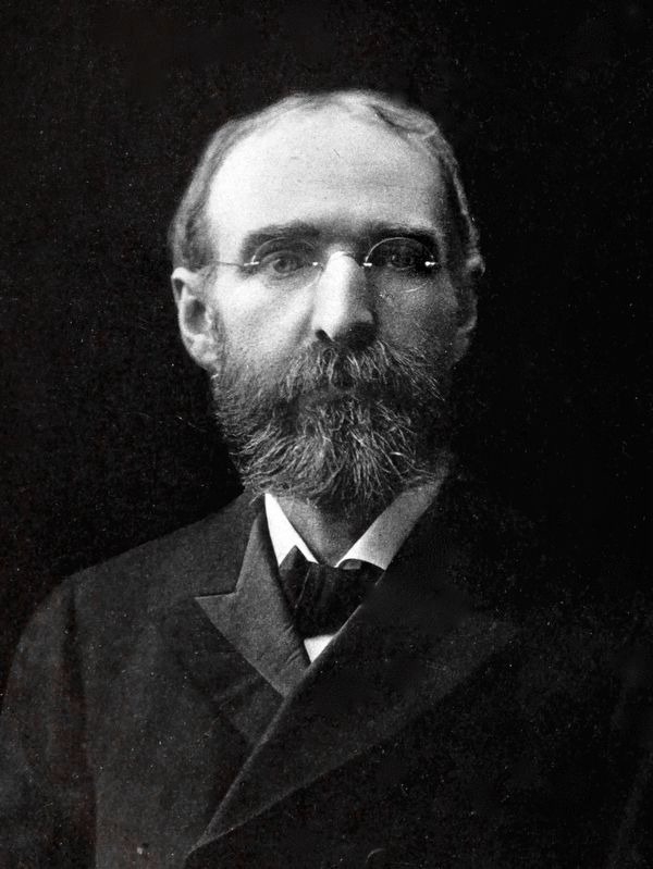
Dr. Charles R. Van Hise<br>The New President of The University of Wisconsin image. Click for full size.
Internet Archive
8. Dr. Charles R. Van Hise
The New President of The University of Wisconsin
From The Worlds Work, Vol. 6, No. 2, June 1903.
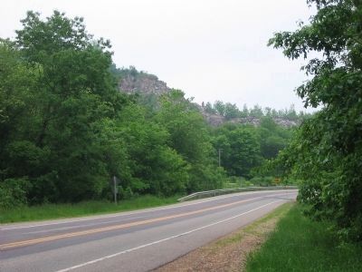
Highway and Cliff by Rock image. Click for full size.
Photographed By Keith L, June 7, 2009
9. Highway and Cliff by Rock
Looking Northbound

National Register of Historic Places #97001267
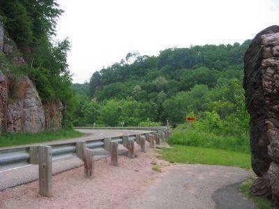
Southbound towards Van Hise Rock image. Click for full size.
Photographed By Keith L, June 7, 2009
10. Southbound towards Van Hise Rock
Marker is just past the curve on the left side of the highway.
Nearby Sign image. Click for full size.
Photographed By Keith L, June 7, 2009
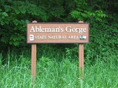
11. Nearby Sign
Ableman's Gorge
State Natural Area
 
 
Credits. This page was last revised on September 23, 2020. It was originally submitted on June 11, 2009, by Keith L of Wisconsin Rapids, Wisconsin. This page has been viewed 990 times since then and 18 times this year. Photos:   1, 2. submitted on June 11, 2009, by Keith L of Wisconsin Rapids, Wisconsin.   3. submitted on June 6, 2011, by Bob (peach) Weber of Dewey, Arizona.   4. submitted on June 11, 2009, by Keith L of Wisconsin Rapids, Wisconsin.   5, 6. submitted on June 6, 2011, by Bob (peach) Weber of Dewey, Arizona.   7. submitted on June 11, 2011, by William J. Toman of Green Lake, Wisconsin.   8. submitted on September 23, 2020, by Allen C. Browne of Silver Spring, Maryland.   9, 10, 11. submitted on June 11, 2009, by Keith L of Wisconsin Rapids, Wisconsin. • Craig Swain was the editor who published this page.
Share this page.  
Share on Tumblr
m=19848

CeraNet Cloud Computing sponsors the Historical Marker Database.
This website earns income from purchases you make after using our links to Amazon.com. We appreciate your support.
Paid Advertisements
Mar. 19, 2024