Tunnel Hill in Whitfield County, Georgia — The American South (South Atlantic)
The Excavation
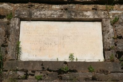
[Left Side of Marker]
of the west end was
begun early July 15, 1848.
& the first opening
effected Oct. 31, 1849
The first train
of cars passed through
May 9, 1850
Length of excavation
in this end 575 feet
& of the tunnel
1477 feet.
[Right Side of Marker]
George W. Towns
Governor
Wm. L. Mitchell Esq.
Chief Engineer
Mr. Benj. C. Norse
Principal Assistant Engineer
Mr. B. E. Wells
Assistant Engineer
Jno D. Gray & Co.
Contractors
Topics. This historical marker is listed in these topic lists: Anthropology & Archaeology • Railroads & Streetcars. A significant historical month for this entry is May 1863.
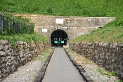
Location. 34° 50.345′ N, 85° 2.13′ W. Marker is in Tunnel Hill, Georgia, in Whitfield County. Marker is on Clisby Austin Drive, 0.4 miles east of Oak Street. This historical marker is located above the west end of the Railroad tunnel excavated through Chetoogeta Mountain. To get to this marker travel approximately 0.4 miles east on Clisby Austin Drive from it's intersection with Oak Street and where the road veers right at the base of the mountain there is a parking lot for those wishing to view this historic railroad tunnel. Touch for map. Marker is in this post office area: Tunnel Hill GA 30755, United States of America. Touch for directions.
Other nearby markers. At least 8 other markers are within walking distance of this marker. Building a Tunnel (about 700 feet away, measured in a direct line); The Leg of Hood (about 700 feet away); Remembering the General Stores (approx. 0.2 miles away); Captain Key & Key's Battery (approx. 0.2 miles away); The Clisby Austin House (approx. 0.2 miles away); The Reverend Clisby Austin Sr. (approx. 0.2 miles away); Tunnel Hill (approx. 0.4 miles away); What are Sherman Neckties? (approx. 0.4 miles away). Touch for a list and map of all markers in Tunnel Hill.
Credits. This page was last revised on August 23, 2020. It was originally submitted on June 16, 2009, by Dale K. Benington of Toledo, Ohio. This page has been viewed 1,077 times since then and 12 times this year. Photos: 1, 2. submitted on June 16, 2009, by Dale K. Benington of Toledo, Ohio. • Craig Swain was the editor who published this page.

