Oldwick in Hunterdon County, New Jersey — The American Northeast (Mid-Atlantic)
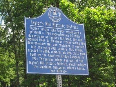
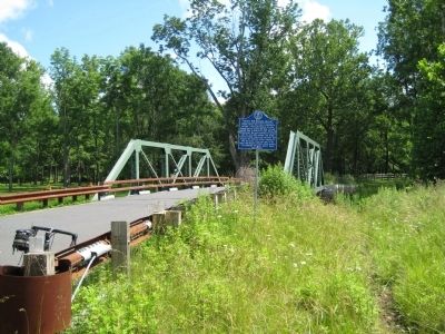
Taylor's Mill Historic District
Erected by Hunterdon County Cultural And Heritage Commission.
Topics and series. This historical marker is listed in these topic lists: Bridges & Viaducts • Colonial Era • Industry & Commerce • Settlements & Settlers • War, US Revolutionary. In addition, it is included in the New Jersey, Hunterdon County Cultural and Heritage Commission series list. A significant historical year for this entry is 1760.
Location. 40° 40.038′ N, 74° 46.609′ W. Marker is in Oldwick, New Jersey, in Hunterdon County. Marker is on Potterstown Road, on the right when traveling north. Touch for map. Marker is in this post office area: Oldwick NJ 08858, United States of America. Touch for directions.
Other nearby markers. At least 8 other markers are within 3 miles of this marker, measured as the crow flies. Col. John Taylor's Grist Mill (approx. 0.7 miles away); Village of Bissell (approx. 0.8 miles away); New Germantown (approx. 1˝ miles away); Zion Evangelical Lutheran Church (approx. 1˝ miles away); a different marker also named Zion Evangelical Lutheran Church (approx. 1˝ miles away); Potterstown (approx. 2.1 miles away); Site of Colonel John Mehelm House (approx. 2.3 miles away); Mountainville Post (approx. 2.4 miles away). Touch for a list and map of all markers in Oldwick.
Related marker. Click here for another marker that is related to this marker. To better understand the relationship, study each marker in the order shown.
Credits. This page was last revised on June 16, 2016. It was originally submitted on June 28, 2009, by Alan Edelson of Union Twsp., New Jersey. This page has been viewed 1,624 times since then and 144 times this year. Photos: 1, 2. submitted on June 28, 2009, by Alan Edelson of Union Twsp., New Jersey. • Kevin W. was the editor who published this page.

