Olde Towne in Portsmouth, Virginia — The American South (Mid-Atlantic)
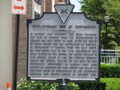
Revolutionary War at Portsmouth
Topics. This historical marker is listed in this topic list: War, US Revolutionary. A significant historical month for this entry is October 1775.
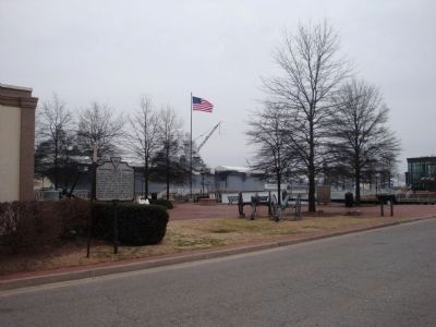
Location. 36° 50.151′ N, 76° 17.812′ W. Marker is in Portsmouth, Virginia. It is in Olde Towne. Marker is at the intersection of Water Street and High Street, on the right when traveling north on Water Street. Beside the Portsmouth Naval Shipyard Museum. Touch for map. Marker is at or near this postal address: 2 High Street, Portsmouth VA 23704, United States of America. Touch for directions.
Other nearby markers. At least 8 other markers are within walking distance of this marker. Naval Shipyard Museum (a few steps from this marker); Cornwallis' Embarkation (a few steps from this marker); John Luke Porter (within shouting distance of this marker); Home Site of William Crawford (d. 1762) Founder of Portsmouth (within shouting distance of this marker); Seaboard Air Line Railroad (within shouting distance of this marker); The Elizabeth River (about 400 feet away, measured in a direct line); Col. William Craford (about 400 feet away); Crawford House (about 400 feet away). Touch for a list and map of all markers in Portsmouth.
Credits. This page was last revised on February 1, 2023. It was originally submitted on July 2, 2009, by Kristin Rollins of Portsmouth, Virginia. This page has been viewed 1,349 times since then and 76 times this year. Photos: 1. submitted on July 2, 2009, by Kristin Rollins of Portsmouth, Virginia. 2. submitted on February 14, 2014, by Mike Wintermantel of Pittsburgh, Pennsylvania. • Bill Pfingsten was the editor who published this page.

