Parkers Crossroads in Henderson County, Tennessee — The American South (East South Central)
Battlefield Overview
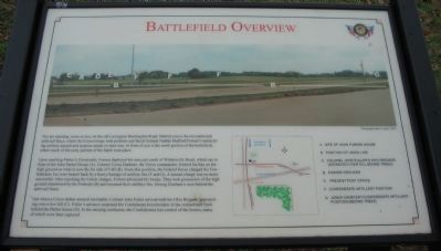
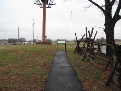
You are standing, more or less, on the old Lexington-Huntingdon Road. Behind you is the reconstructed split-rail fence, where the Union troops took position and faced General Nathan Bedford Forrest's unrelenting artillery assault and surprise attack on their rear. In front of you is the north portion of the battlefield, where much of the early portion of the battle took place.
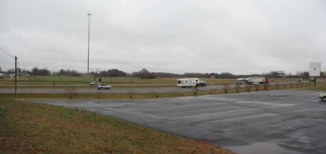
Upon reaching Parker's Crossroads, Forrest deployed his men just south of Wilderness Road, which ran in front of the John Parker House (A). Colonel Cyrus Dunham, the Union commander, formed his line on the high ground on what is now the far side of I-40 (B). From this position, the Federal forces charged the Confederates, but were beaten back by a heavy barrage of artillery fire (F and G). A second charge was no more successful. After repulsing the Union charges, Forrest advanced his troops. They took possession of the high ground abandoned by the Federals (B) and resumed their artillery fire, forcing Dunham's men behind the split-rail fence.
Just when a Union defeat seemed inevitable; Colonel John Fuller arrived with his Ohio Brigade, approaching over a low hill (C). Fuller's advance surprised the Confederate horseholders in the orchard and field behind the Parker house (D). In the ensuing confusion, the Confederates lost control of the horses, many of which were later captured.
(Key to photograph)
A. Site of John Parker House
B. Position of Union Line
C. Colonel John Fuller's Ohio Brigade (Advanced over hill behind trees)
D. Parker Orchard
E. Present Post Office
F. Confederate artillery psoition
G. Jones Cemetery/Confederate artillery position (behind trees)
Erected by Parkers Crossroads Battlefield Association.
Topics. This historical marker is listed in this topic list: War, US Civil.
Location. 35° 47.331′ N, 88° 23.386′ W. Marker is in Parkers Crossroads, Tennessee, in Henderson County. Marker is on Federal Lane, on the right when traveling east. Located on the South Loop Walking Trail at stop seven, of the driving tour of Parker's Crossroads Battlefield. Touch for map. Marker is in this post office area: Wildersville TN 38388, United States of America. Touch for directions.
Other nearby markers. At least 8 other markers are within walking distance of this marker. Nathan Bedford Forrest (within shouting distance of this marker); Battle of Parker's Crossroads (within shouting distance of this marker); Lt. Col. Alonzo Napier (within shouting distance of this marker); McPeake Cabin (within shouting distance of this marker); 39th Iowa Infantry Regiment (within shouting distance of this marker); A Very Successful Campaign (about 300 feet away, measured in a direct line); Withdrawal to the Split-Rail Fence (about 300 feet away); The Lexington-Huntingdon Road (about 400 feet away). Touch for a list and map of all markers in Parkers Crossroads.
Also see . . .
1. Parkers Crossroads. Civil War Preservation Trust page detailing the battle and preservation efforts. (Submitted on July 4, 2009, by Craig Swain of Leesburg, Virginia.)
2. Parkers Crossroads Battlefield Association. More details about the battle and preservation efforts. (Submitted on July 4, 2009, by Craig Swain of Leesburg, Virginia.)
Credits. This page was last revised on February 21, 2022. It was originally submitted on July 4, 2009, by Craig Swain of Leesburg, Virginia. This page has been viewed 1,155 times since then and 7 times this year. Photos: 1, 2, 3. submitted on July 4, 2009, by Craig Swain of Leesburg, Virginia.


