Tenleytown in Northwest Washington in Washington, District of Columbia — The American Northeast (Mid-Atlantic)
Fort Reno
Tenleytown, D.C.
— Country Village to City Neighborhood —
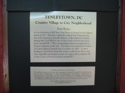
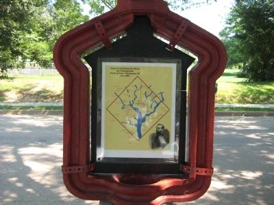
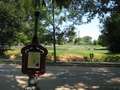
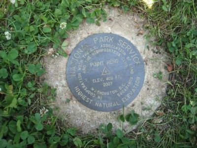
At an elevation of 410 feet, Fort Reno is located at the highest point in DC. The fort, originally named Fort Pennsylvania, was well situated to provide defense of the Nation's Capital during the Civil War as one of the Circle of Forts (pictured here) around DC. The commanding view is recognized as a historic element of the fort. Fort Reno was renamed in honor of Union Major General Jesse Lee Reno in 1865. A street leading to Fort Reno from the south is called Fort Drive and was originally envisioned as part of a ring road to connect all of the Circle of Forts locations around DC.
Erected by Cultural Tourism DC, DC Commission on Arts and Humanities, District Department of Transportation, and Office of the Deputy Mayor for Planning and Economic Development.
Topics and series. This historical marker is listed in these topic lists: Forts and Castles • War, US Civil. In addition, it is included in the DC, Art on Call, and the Defenses of Washington series lists. A significant historical year for this entry is 1865.
Location. 38° 57.04′ N, 77° 4.626′ W. Marker is in Northwest Washington in Washington, District of Columbia. It is in Tenleytown. Marker is on Chesapeake Street Northwest west of Nebraska Avenue Northwest, on the left when traveling west. Touch for map. Marker is in this post office area: Washington DC 20016, United States of America. Touch for directions.
Other nearby markers. At least 8 other markers are within walking distance of this marker. A different marker also named Fort Reno (within shouting distance of this marker); Reservoir / Reno City (within shouting distance of this marker); The Civil War Defenses of Washington (within shouting distance of this marker); a different marker also named Fort Reno (about 400 feet away, measured in a direct line); Reno City (about 500 feet away); a different marker also named Fort Reno (about 500 feet away); a different marker also named Fort Reno (about 600 feet away); Schools (about 600 feet away). Touch for a list and map of all markers in Northwest Washington.
Also see . . . Fort Reno. Tenleytown Historical Society website entry (Submitted on July 2, 2023, by Larry Gertner of New York, New York.)
Credits. This page was last revised on July 2, 2023. It was originally submitted on July 7, 2009, by F. Robby of Baltimore, Maryland. This page has been viewed 1,676 times since then and 19 times this year. Photos: 1, 2, 3, 4. submitted on July 7, 2009, by F. Robby of Baltimore, Maryland.


