Near Kingman in Mohave County, Arizona — The American Mountains (Southwest)
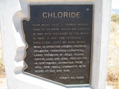
Chloride
Topics. This historical marker is listed in these topic lists: Industry & Commerce • Natural Resources • Settlements & Settlers. A significant historical year for this entry is 1864.
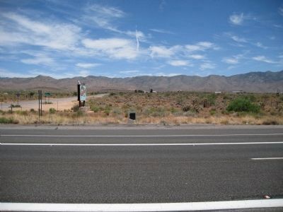
Location. 35° 23.817′ N, 114° 15.536′ W. Marker is near Kingman, Arizona, in Mohave County. Marker is at the intersection of U.S. 93 and County Road 125, on the right when traveling north on U.S. 93. Marker is 18.3 miles north of Interstate 40. Touch for map. Marker is in this post office area: Chloride AZ 86431, United States of America. Touch for directions.
Other nearby markers. At least 7 other markers are within 17 miles of this marker, measured as the crow flies. Metcalf Baker - Andrew Judson (approx. 3.1 miles away); a different marker also named Chloride (approx. 3½ miles away); Arizona and Utah / Western Arizona Railway (approx. 3.6 miles away); Mineral Park (approx. 6 miles away); Cerbat (approx. 9.3 miles away); Camp Beale Springs Arizona (approx. 16.7 miles away); Ha' Qa' Muwe: (approx. 16.7 miles away).
Regarding Chloride. A firm name given here is Tennessee–Schuykill, which should be Tennessee–Schuylkill. Here, the 1st "l" in "Schuylkill" is missing.
Also see . . . The Ghost Town - Chloride, Arizona. (Submitted on July 11, 2009, by Syd Whittle of Mesa, Arizona.)
Credits. This page was last revised on August 19, 2023. It was originally submitted on July 11, 2009, by Richard Wisehart of Sonora, California. This page has been viewed 3,343 times since then and 91 times this year. Last updated on August 17, 2023, by Carl Gordon Moore Jr. of North East, Maryland. Photos: 1, 2. submitted on July 11, 2009, by Richard Wisehart of Sonora, California. 3, 4, 5, 6. submitted on June 13, 2010, by Bill Kirchner of Tucson, Arizona. • Bill Pfingsten was the editor who published this page.
