Capitol District in Richmond, Virginia — The American South (Mid-Atlantic)
The Triangle
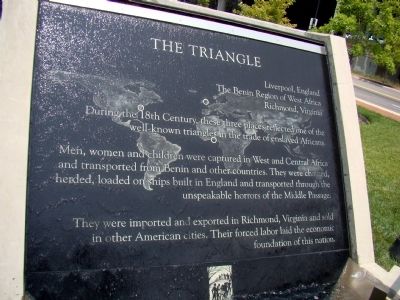
During the 18th Century, these three places reflected one of the well-known triangles in the trade of enslaved Africans.
Men, women and children were captured in West and Central Africa and transported from Benin to other countries. They were chained, herded, loaded on ships built in England and transported through the unspeakable horrors of the Middle Passage.
They were imported and exported in Richmond, Virginia, and sold in other American cities. Their forced labor laid the economic foundation of this nation.
Erected 2007 by The Virginia Slave Trail Commission.
Topics. This historical marker is listed in these topic lists: African Americans • Colonial Era.
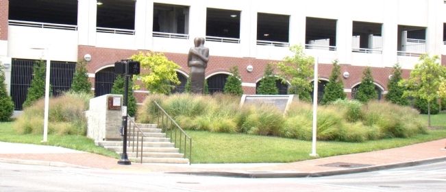
Location. 37° 32.094′ N, 77° 25.824′ W. Marker is in Richmond, Virginia. It is in the Capitol District. Marker is at the intersection of East Main Street (U.S. 60) and 15th Street, on the left when traveling east on East Main Street. Touch for map. Marker is in this post office area: Richmond VA 23219, United States of America. Touch for directions.
Other nearby markers. At least 8 other markers are within walking distance of this marker. Reconciliation Statue (a few steps from this marker); Odd Fellows Hall (within shouting distance of this marker); Slave Auction Site (within shouting distance of this marker); Bell Tavern (within shouting distance of this marker); Kahal Kadosh Beth Shalome (about 500 feet away, measured in a direct line); Davenport Trading Company (about 500 feet away); Auction Houses (about 500 feet away); The Old State Capitol (about 600 feet away). Touch for a list and map of all markers in Richmond.
More about this marker. A clear sheet of water gently calls you from the street as it constantly flows over the face of the text on this monument, which is inscribed over a map of the world marked with the three points of this triangle.
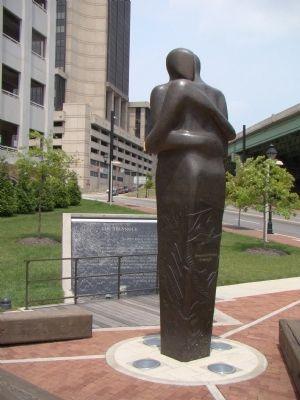
A 16 foot bronze statue of two figures in close embrace stands in front, one figure looking down at the text. It is the last of three identical statues by Liverpool artist Stephen Broadbent to be placed as the three points of the triangle.
Regarding The Triangle. This monument marks the site of the Richmond slave market. English ships from Benin docked at the James River a few blocks away.
Also see . . .

Photographed By J. J. Prats, July 11, 2009
2. Slave Trade Reconciliation Triangle Monument
Bronze entitled “Reconciliation Triangle” by Stephen Broadbent in about 16 feet tall. It is inscribed on the back in French and English, “Reconnaissons el pardonnons le passé. Célébrons le présent. Construisons l’avenir dans la réconciliation et la justice. • Acknowledge and forgive the past. Embrace the present. Shape a future of reconciliation and justice.”
Credits. This page was last revised on February 1, 2023. It was originally submitted on July 12, 2009, by J. J. Prats of Powell, Ohio. This page has been viewed 1,373 times since then and 46 times this year. Photos: 1, 2, 3. submitted on July 12, 2009, by J. J. Prats of Powell, Ohio.

