Gallipolis in Gallia County, Ohio — The American Midwest (Great Lakes)
The Dunmore War 1774
Inscription.
[Front Side]
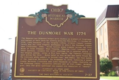
The Shawnee and Delaware Indians grew restless as numbers of Virginians encroached on their lands by settling along the Ohio River. On October 10, 1774, Lord Dunmore, of the Virginia Colony, ordered Colonel Andrew Lewis and his 1100 Virginia militiamen to attack the Shawnee Indians near Chillicothe, Ohio. While Lewis's army camped across the Ohio River at Point Pleasant, West Virginia, Shawnee Chief Cornstalk, with 1000 warriors, crossed the river upstream for a surprise attack on the Virginia militia. After a five hour battle, the Shawnee retreated west across the Ohio. Some refer to this as the last battle fought by the Colonists while subject to British rule, and really, the first battle of the American Revolution. On November 5, 1774, Lord Dunmore at Camp Charlotte on the Pickaway Plains, Dunmore's officers met at Fort Gower, Hockingport, Ohio (48 miles upstream) and passed this resolution of "liberty":
[Reverse Side]
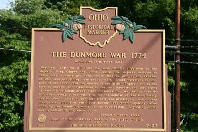
"Resolved, that we will bear the most faithful allegiance to His Majesty, King George the Third, whilst His Majesty delights to reign over a brave and free people; that we will, at the expense of life, and everything dear and valuable, exert ourselves in support of his crown, and the dignity of the British Empire. But as the love of liberty, and attachment to the real interests and just rights of America outweigh every other consideration, we resolve that we will exert every power within us for the defense of American liberty, and for the support of her just rights and privileges; not on any precipitate, riotous or tumultuous voice of our countrymen. Signed by order and in behalf of the whole corps. Benjamin Ashby, Clerk"
Erected 1992 by Society of Colonial Wars in the State of Ohio and The Ohio Historical Society. (Marker Number 7-27.)
Topics and series. This historical marker is listed in these topic lists: Colonial Era • Wars, US Indian. In addition, it is included in the Indian Wars Battlefield Trails, and the Ohio Historical Society / The Ohio History Connection series lists. A significant historical month for this entry is October 1861.
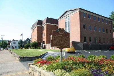
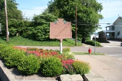
Location. 38° 48.515′ N, 82° 12.14′ W. Marker is in Gallipolis, Ohio, in Gallia County. Marker is at the intersection of Locust Street and 1st Avenue, on the right when traveling north on Locust Street. Touch for map. Marker is at or near this postal address: 18 Locust Street, Gallipolis OH 45631, United States of America. Touch for directions.
Other nearby markers. At least 8 other markers are within walking distance of this marker. High Water Mark (within shouting distance of this marker); Our House (about 400 feet away, measured in a direct line); Charles E. Holzer, Sr., M.D. (about 500 feet
away); Elks Pledge (about 800 feet away); J.P.R. Bureau House (about 800 feet away); Gallia County Veterans Memorial (approx. 0.2 miles away); World War I Memorial (approx. 0.2 miles away); 1790 - Gallipolis - 1940 (approx. 0.2 miles away). Touch for a list and map of all markers in Gallipolis.
Related markers. Click here for a list of markers that are related to this marker. To better understand the relationship, study each marker in the order shown.
Also see . . . Lord Dunmore's War. This link is published and made available by, "Ohio History Central," an online encyclopedia of Ohio History (Submitted on July 14, 2009, by Dale K. Benington of Toledo, Ohio.)
Credits. This page was last revised on June 16, 2016. It was originally submitted on July 14, 2009, by Dale K. Benington of Toledo, Ohio. This page has been viewed 1,520 times since then and 56 times this year. Photos: 1, 2, 3, 4. submitted on July 14, 2009, by Dale K. Benington of Toledo, Ohio. • Craig Swain was the editor who published this page.


