Mechanicsville in Hanover County, Virginia — The American South (Mid-Atlantic)
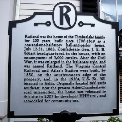
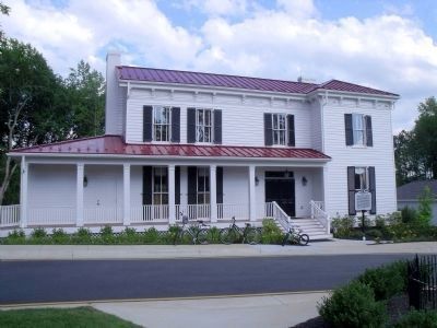
Rutland
Topics. This historical marker is listed in these topic lists: African Americans • War, US Civil. A significant historical date for this entry is July 12, 1721.
Location. 37° 39.602′ N, 77° 23.974′ W. Marker is in Mechanicsville, Virginia, in Hanover County. Marker can be reached from Chamberlayne Road (U.S. 301) near Atlee Road. This marker is located in the Rutland residential housing development. Touch for map. Marker is in this post office area: Mechanicsville VA 23116, United States of America. Touch for directions.
Other nearby markers. At least 8 other markers are within 3 miles of this marker, measured as the crow flies. Patrick Henry's Birthplace (approx. half a mile away); Lee’s Headquarters (approx. 0.8 miles away); WWII Memorial Wall (approx. 2.3 miles away); Totopotomoy Line (approx. 2˝ miles away); Liberty Golden Eagle (approx. 2˝ miles away); a different marker also named Totopotomoy Line (approx. 2.8 miles away); Digging In Under Fire (approx. 2.8 miles away); Lives on the Line (approx. 2.9 miles away). Touch for a list and map of all markers in Mechanicsville.

Photographed By Bernard Fisher, July 18, 2009
4. Rutland African American Cemetery
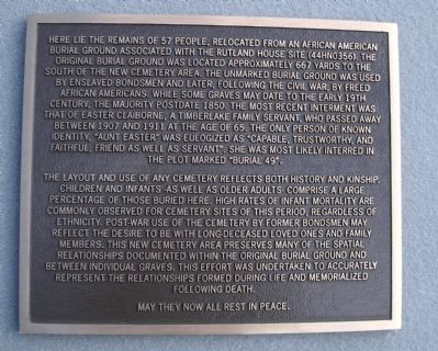
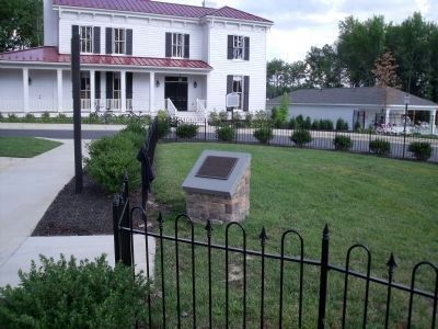
Here lie the remains of 57 people, relocated from an African American burial ground associated with the Rutland house site (44HN0356). The original burial ground was located approximately 667 yards to the south of the new cemetery area. The unmarked burial ground was used by enslaved bondsmen and later, following the Civil War, by freed African Americans. While some graves may date to the early 19th century, the majority postdate 1850. The most recent interment was that of Easter Claiborne, a Timberlake family servant, who passed away between 1907 and 1911 at the age of 65. The only person of known identity, “Aunt Easter” was eulogized as “capable, trustworthy, and faithful, friend as well as servant”. She was most likely interred in the plot marked “Burial 49”.
The layout and use of any cemetery reflects both history and kinship. Children and infants -as well as older adults- comprise a large percentage of those buried here. High rates of infant mortality are commonly observed for cemetery sites of this period, regardless of ethnicity. Post-war use of the cemetery by former bondsmen may reflect the desire to be with long-deceased loved ones and family members. This new cemetery area preserves many of the spatial relationships documented within the original burial ground and between individual graves. This effort was undertaken to accurately represent the relationship formed during life and memorialized following death.
May they now all rest in peace.
The layout and use of any cemetery reflects both history and kinship. Children and infants -as well as older adults- comprise a large percentage of those buried here. High rates of infant mortality are commonly observed for cemetery sites of this period, regardless of ethnicity. Post-war use of the cemetery by former bondsmen may reflect the desire to be with long-deceased loved ones and family members. This new cemetery area preserves many of the spatial relationships documented within the original burial ground and between individual graves. This effort was undertaken to accurately represent the relationship formed during life and memorialized following death.
Credits. This page was last revised on June 16, 2016. It was originally submitted on July 20, 2009, by Bernard Fisher of Richmond, Virginia. This page has been viewed 2,494 times since then and 206 times this year. Photos: 1, 2, 3, 4. submitted on July 20, 2009, by Bernard Fisher of Richmond, Virginia.


