East Central in Fort Wayne in Allen County, Indiana — The American Midwest (Great Lakes)
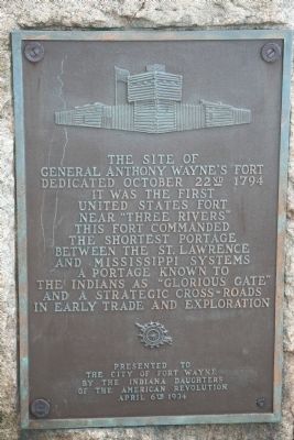
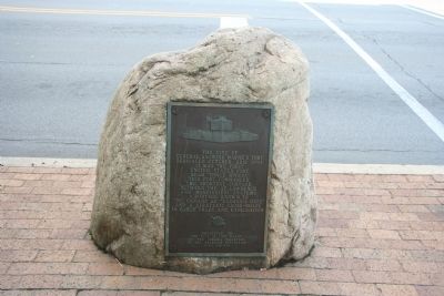
The Site of General Wayne's Fort
Dedicated October 22nd 1794
It was the first United States fort near "Three Rivers". This fort commanded the shortest portage between the St. Lawrence and Mississippi systems a portage known to the Indians as "Glorious Gate" and a strategic cross-roads in early trade and exploration.
Erected 1934 by The Indiana Daughters of the American Revolution.
Topics and series. This historical marker is listed in these topic lists: Forts and Castles • Native Americans • Wars, US Indian. In addition, it is included in the Daughters of the American Revolution series list. A significant historical date for this entry is October 22, 1965.
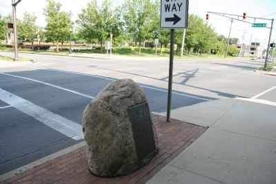
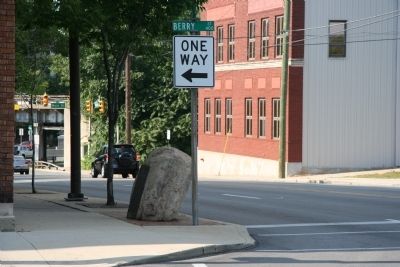
Location. 41° 4.825′ N, 85° 7.994′ W. Marker is in Fort Wayne, Indiana, in Allen County. It is in East Central. Marker is at the intersection of Clay Street and East Berry Street, on the left when traveling north on Clay Street. This historical marker is located in downtown Fort Wayne, Indiana. It is two blocks south of the three rivers area where the two rivers (the St. Marys River and the St. Joseph River) come together to create the Maumee River. Touch for map. Marker is in this post office area: Fort Wayne IN 46802, United States of America. Touch for directions.
Other nearby markers. At least 8 other markers are within walking distance of this marker. The Last Two American Forts / The Siege of 1812 (about 400 feet away, measured in a direct line); Old Fort Wayne Well (about 400 feet away); First Central Fire House (about 500 feet away); The History of the Bell (about 500 feet away); Mother George (about 700 feet away); First Wayne Street United Methodist Church (approx. 0.2 miles away); Kekionga (approx. 0.2 miles away); Takaoka and Fort Wayne Time Capsule (approx. 0.2 miles away). Touch for a list and map of all markers in Fort Wayne.
Also see . . .
1. Anthony Wayne. Ohio History Central website entry (Submitted on July 23, 2009, by Dale K. Benington of Toledo, Ohio.)
2. Wayne's Indian Campaign of 1794. Ohio History Central website entry (Submitted on July 23, 2009, by Dale K. Benington of Toledo, Ohio.)
3. Fort Wayne, Indiana. Wikipedia entry (Submitted on June 22, 2022, by Larry Gertner of New York, New York.)
Additional commentary.
1. An Unmarked Historical Site in 1934
According to the website of the Mary Penrose Wayne Chapter of the Daughters of the American Revolution, the marker, which indicates the site of General Wayne's 1794 fort, was placed here after a state-wide contest to locate the most significant "unmarked" historical site in the State of Indiana.
— Submitted April 27, 2014, by Duane Hall of Abilene, Texas.
Credits. This page was last revised on February 4, 2023. It was originally submitted on July 22, 2009, by Dale K. Benington of Toledo, Ohio. This page has been viewed 3,588 times since then and 62 times this year. Photos: 1, 2, 3. submitted on July 22, 2009, by Dale K. Benington of Toledo, Ohio. 4. submitted on July 23, 2009, by Dale K. Benington of Toledo, Ohio. • Craig Swain was the editor who published this page.


