Whitesville in Harris County, Georgia — The American South (South Atlantic)
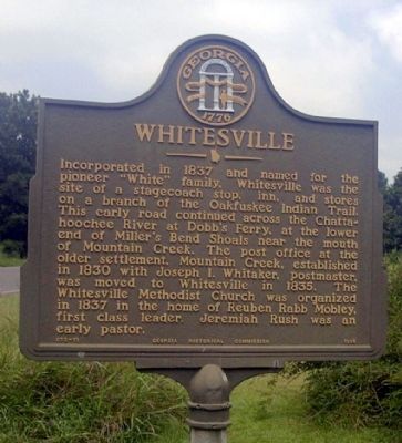
Whitesville
Erected 1958 by Georgia Historical Commission. (Marker Number 072-11.)
Topics and series. This historical marker is listed in these topic lists: Churches & Religion • Industry & Commerce • Roads & Vehicles • Settlements & Settlers • Waterways & Vessels. In addition, it is included in the Georgia Historical Society series list. A significant historical year for this entry is 1837.
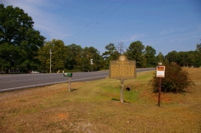
Location. 32° 49.075′ N, 85° 1.914′ W. Marker is in Whitesville, Georgia, in Harris County. Marker is at the intersection of Whitesville Road (Georgia Route 219) and Pine Lake Road, on the left when traveling south on Whitesville Road. Touch for map. Marker is in this post office area: Pine Mountain GA 31822, United States of America. Touch for directions.
Other nearby markers. At least 8 other markers are within 9 miles of this marker, measured as the crow flies. Whitesville Methodist Episcopal Church, South (approx. ¼ mile away); Sunnyside School, Midway Baptist Church and Midway Cemetery Historic District (approx. 2.8 miles away); Jones Crossroads (approx. 3.6 miles away); Civil Rights Marker Honoring Henry "Peg" Gilbert (approx. 3.6 miles away); Salem Road Bridge (approx. 7.7 miles away); Langdale Veterans Memorial (approx. 8.1 miles away in Alabama); West Point Manufacturing Company (approx. 8.1 miles away in Alabama); Mountain Hill District Consolidated School (approx. 8.4 miles away). Touch for a list and map of all markers in Whitesville.
Credits. This page was last revised on January 30, 2020. It was originally submitted on July 23, 2009, by David Seibert of Sandy Springs, Georgia. This page has been viewed 1,035 times since then and 48 times this year. Photos: 1. submitted on July 23, 2009, by David Seibert of Sandy Springs, Georgia. 2. submitted on September 20, 2010, by David Seibert of Sandy Springs, Georgia. • Craig Swain was the editor who published this page.

