Olde Towne in Portsmouth, Virginia — The American South (Mid-Atlantic)
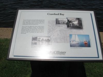
Crawford Bay
One of the few eighteenth-century manor houses remaining in Hampton Roads, the Dale-Reed House, is located in Swimming Point. The family of Revolutionary War hero Richard Dale once lived in this home. Although modernized, the home still has sections of what is probably the oldest house in Portsmouth.
Topics. This historical marker is listed in these topic lists: War, US Revolutionary • Waterways & Vessels.
Location. 36° 50.427′ N, 76° 18.042′ W. Marker is in Portsmouth, Virginia. It is in Olde Towne. Marker is on Crawford Parkway east of Court Street, on the right when traveling west. Touch for map. Marker is in this post office area: Portsmouth VA 23704, United States of America. Touch for directions.
Other nearby markers. At least 8 other markers are within walking distance of this marker. Craney Island (within shouting distance of this marker); Cornwallis at Portsmouth (within shouting distance of this marker); Arnold's British Defenses, 1781 (within shouting distance of this marker); Olde Towne Portsmouth (about 300 feet away, measured in a direct line); Fort Nelson (about 300 feet away); Elks Lodge (approx. 0.2 miles away); Watts House (approx. 0.2 miles away); The Yellow Fever of 1855 (approx. 0.2 miles away). Touch for a list and map of all markers in Portsmouth.
More about this marker. Marker is part of the Path of History of Portsmouth.
Credits. This page was last revised on February 1, 2023. It was originally submitted on July 25, 2009, by Kristin Rollins of Portsmouth, Virginia. This page has been viewed 1,018 times since then and 23 times this year. Photos: 1. submitted on July 25, 2009, by Kristin Rollins of Portsmouth, Virginia. 2, 3. submitted on October 13, 2010, by James Thomson of Chesapeake, United States. • Kevin W. was the editor who published this page.


