Poolesville in Montgomery County, Maryland — The American Northeast (Mid-Atlantic)
Historic Poolesville
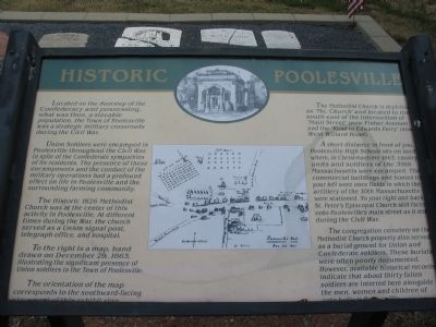
Located on the doorstep of the Confederacy and possessing, what was then, a sizable population, the Town of Poolesville was a strategic military crossroads during the Civil War.
Union Soldiers were encamped in Poolesville throughout the Civil War, in spite of the Confederate sympathies of its residents. The presence of these encampments and the conduct of the military operations had a profound effect on life in Poolesville and the surrounding farming community.
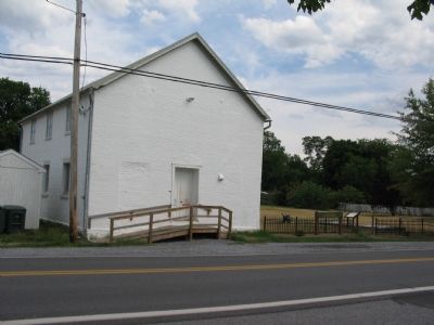
The historic 1826 Methodist Church was at the center of this activity in Poolesville. At different times during the War, the church served as a Union signal post, telegraph office, and hospital.
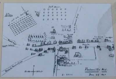
To the right is a map, hand drawn on December 29, 1863, illustrating the significant presence of Union soldiers in the Town of Poolesville.
The orientation of the map corresponds to the southward-facing placement of this exhibit sign.
The Methodist Church is depicted as ‘Me. Church’ and located to the south-east of the instersection of ‘Main Street’ (now Fisher Avenue) and the ‘Road to Edwards Ferry’ (now West Willard Road).
A short distance in front of you, Poolesville High School sits on land where, in Christmastime 1863, cavalry units and soldiers of the 39th Massachusetts were encamped. The commercial buildings and homes to your left were once fields in which the artillery of the 10th Massachusetts were stationed. To your right and back, St. Peter’s Episcopal Church still faces onto Poolesville’s main street as it did during the Civil War.
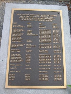
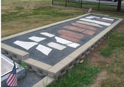
The congregation cemetery on the Methodist Church property also served as a burial ground for Union and Confederate soldiers. These burials were often poorly documented. However, available historical records indicate that about thirty fallen soldiers are interred here alongside the men, women and children of ante-bellum Poolesvile.
Topics. This historical marker is listed in this topic list: War, US Civil. A significant historical month for this entry is December 1861.
Location. 39° 8.721′ N, 77° 25.098′ W. Marker is in Poolesville, Maryland, in Montgomery County. Marker is on West Willard Road, on the left when traveling south. On the grounds of the Historic 1826 Methodist Church Building and Cemetery. Touch for map. Marker is at or near this postal address: 17605 West Willard Road, Poolesville MD 20837, United States of America. Touch for directions.
Other nearby markers. At least 8 other markers are within walking distance of this marker. The Civil War at Poolesville (about 400 feet away, measured in a direct line); Welcome to Poolesville (about 400 feet away); St. Peter's Church (about 500 feet away); 20101 Fisher Avenue (about 500 feet away); Poolesville (about 600 feet away); The Old Bank Building (about 700 feet away); Lynching of George W. Peck / Lynching in Maryland (about 700 feet away); a different marker also named Poolesville (about 800 feet away). Touch for a list and map of all markers in Poolesville.
More about this marker. A copy of a map, referenced in the text, is the centerpiece of the marker. A drawing at the top of the marker is of the Poolesville City Hall (old Bank Building).
Also see . . . Poolesville Methodist Church History. Church website entry (Submitted on August 18, 2007, by Craig Swain of Leesburg, Virginia.)
Credits. This page was last revised on February 25, 2024. It was originally submitted on August 18, 2007, by Craig Swain of Leesburg, Virginia. This page has been viewed 2,245 times since then and 48 times this year. Photos: 1, 2, 3, 4, 5. submitted on August 18, 2007, by Craig Swain of Leesburg, Virginia. • J. J. Prats was the editor who published this page.
