Near Fredericksburg in Spotsylvania County, Virginia — The American South (Mid-Atlantic)
Slaughter Pen Farm
Gibbon's Advance
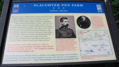
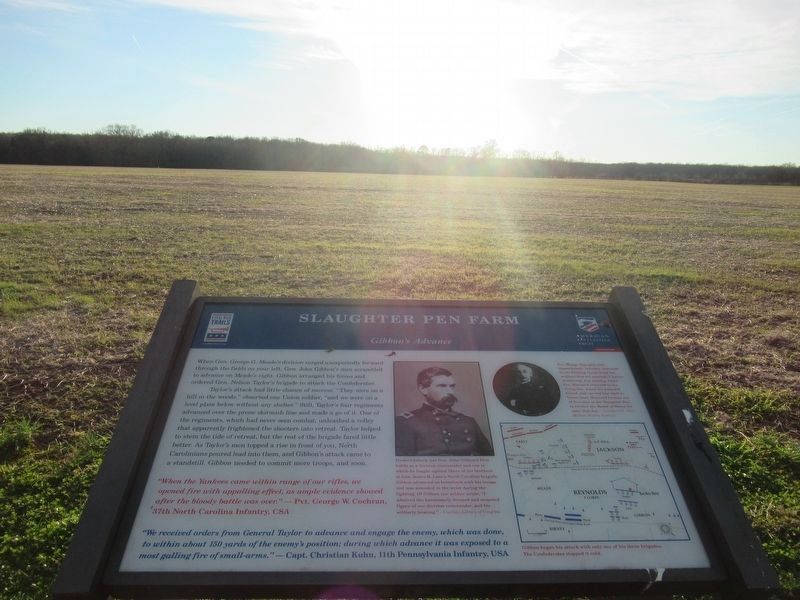
When Gen. George G. Meade's division surged unexpectedly forward through the fields on your left, Gen. John Gibbon's men scrambled to advance on Meade's right. Gibbon arranged his forces and ordered Gen. Nelson Taylor's brigade to attack the Confederates.
Taylor's attack had little chance of success. "They were on a hill in the woods," observed one Union soldier, "and we were on a level plain below without any shelter." Still, Taylor's four regiments advanced over the prone skirmish line and made a go of it. One of the regiments, which had never seen combat, unleashed a volley that apparently frightened the shooters into retreat. Taylor helped to stem the tide of retreat, but the rest of the brigade fared little better. As Taylor's men topped a rise in front of you, North Carolinians poured lead into them, and Gibbon's attack came to a standstill. Gibbon needed to commit more troops, and soon.
"When the Yankees came within range of our rifles, we opened fire with appalling effect, as ample evidence showed after the bloody battle was over."
- Pvt. George W. Cochran, 37th North Carolina Infantry, CSA
"We received orders from General Taylor to advance and engage the enemy, which was done, to within about 150 yards of the enemy's position; during which advance it was exposed to a most galling fire of small-arms."
- Capt. Christian Kuhn, 11th Pennsylvania Infantry, USA
Erected 2009 by Civil War Preservation Trust and Virginia Civil War Trails.
Topics and series. This historical marker is listed in this topic list: War, US Civil. In addition, it is included in the Virginia Civil War Trails series list.
Location. 38° 15.846′ N, 77° 26.84′ W. Marker is near Fredericksburg, Virginia, in Spotsylvania County. Marker can be reached from Tidewater Trail (U.S. 17), on the right when traveling south. Located on the Civil War Preservation Trust's Slaughter Pen Farm trail. Please obtain permission before entering the property. Call CWPT at (800) 298-7878. Touch for map. Marker is at or near this postal address: 11232 Tidewater Trail, Fredericksburg VA 22408, United States of America. Touch for directions.
Other nearby markers. At least 8 other markers are within walking distance of this marker. A different marker also named Slaughter Pen Farm (about 700 feet away, measured in a direct line); a different marker also named Slaughter Pen Farm (about 700 feet away); a different marker also named Slaughter Pen Farm (approx. 0.2 miles away); a different marker also named Slaughter Pen Farm (approx. ¼ mile away); a different marker also named Slaughter Pen Farm (approx. ¼
mile away); a different marker also named Slaughter Pen Farm (approx. ¼ mile away); a different marker also named Slaughter Pen Farm (approx. 0.3 miles away); Battle of Fredericksburg (approx. 0.3 miles away). Touch for a list and map of all markers in Fredericksburg.
More about this marker. In the upper center the marker displays a portrait of Gen. John Gibbon. Fredericksburg was Gen. John Gibbon's first battle as a division commander and one in which he fought against three of his brothers in Gen. James H. Lane's North Carolina Brigade. Gibbon advanced on horseback with his troops and was wounded in the wrist during the fighting. Of Gibbon one soldier wrote, "I admired the handsomely dressed and mounted figure of our division commander, and his soldierly bearing."
On the upper right is a portrait of Pvt. George Maynard, 13th Massachusetts Infantry, who retreated to the Bowling Green Road but realized that his comrade, Charles Armstrong, was missing. Under fire, Maynard returned to the firing line, found his wounded friend, and carried him back to Union lines. Maynard became one of five men at the Slaughter Pen to receive the Medal of Honor for

3. Civil War Preservation Trust
Help preservation like the Slaughter Pen Farm.
Click for more information.
Click for more information.
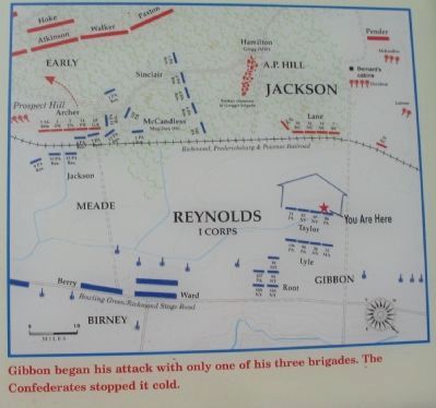
On the lower right is a map of this sector of the battlefield. Gibbon began his attack with only one of his three brigades. The Confederates stopped it cold.
Also see . . . The Slaughter Pen Farm. Civil War Preservation Trust virtual tour of the Slaughter Pen Farm. (Submitted on July 27, 2009, by Craig Swain of Leesburg, Virginia.)
Photographed By Craig Swain, July 25, 2009
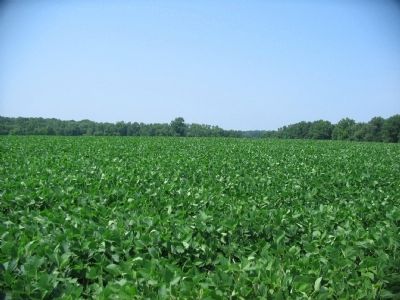
6. The Rise in front of Taylor's Advance
Looking directly toward the railroad, to the south of the marker location. Taylor's men advanced across this ground, away from the camera, toward the railroad. The railroad, and markers along the trail at that point, are blocked from view by a rise in the middle of the field.
Photographed By Craig Swain, July 25, 2009
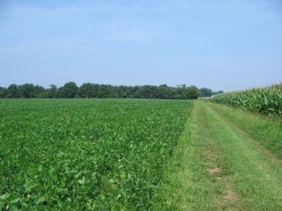
7. Taylor's Brigade Enters the Battle
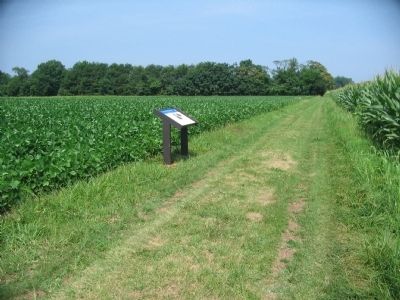
Looking along the walking trail, which runs generally east to west across the field of battle at this point, toward the marker location. Taylor's Brigade of Gibbon's Division advanced from a position on the right, where in this photo a crop of corn stands. The Brigade advanced toward the railroad, crossing this view to the left.
Credits. This page was last revised on February 2, 2023. It was originally submitted on July 27, 2009, by Craig Swain of Leesburg, Virginia. This page has been viewed 1,713 times since then and 24 times this year. Last updated on October 29, 2022, by Carl Gordon Moore Jr. of North East, Maryland. Photos: 1. submitted on July 27, 2009, by Craig Swain of Leesburg, Virginia. 2. submitted on February 23, 2022, by Benjamin Harrison Allen of Amissville, Virginia. 3. submitted on July 26, 2009, by Craig Swain of Leesburg, Virginia. 4, 5, 6, 7. submitted on July 27, 2009, by Craig Swain of Leesburg, Virginia. • Bernard Fisher was the editor who published this page.
