Olde Towne in Portsmouth, Virginia — The American South (Mid-Atlantic)
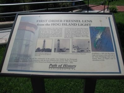
First Order Fresnel Lens from the Hog Island Light
The Fresnel Lens was named after Augustin Fresnel — the French physicist who devised the optical system around 1822. At about 10 feet high and 2,500 pounds, this lens is among the largest and brightest of its kind, with more than 250 prisms of optical glass. Only the lens at Makapu’u Point Light, Hawaii is larger.
Established in 1852, the Hog Island Light was located on the north side of the Great Machipongo Inlet on the Eastern Shore of Virginia until its demolition in 1948.
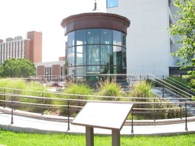
The restoration of the lens and the construction of the pavilion were funded by the Portsmouth Museums Foundation, Inc. in cooperation with the City of Portsmouth and the Fifth Coast Guard District. The dedication ceremony of the Fresnel Lens Pavilion took place on November 5, 2003.
Topics. This historical marker is listed in this topic list: Waterways & Vessels. A significant historical month for this entry is November 1934.
Location. 36° 50.088′ N, 76° 17.769′ W. Marker is in Portsmouth, Virginia. It is in Olde Towne. Marker can be reached from the intersection of High Street and Water Street. Marker is along the seawall, just south of the High Street ferry landing, southeast of the intersection of High Street and Water Street. Touch for map. Marker is in this post office area: Portsmouth VA 23704, United States of America. Touch for directions.
Other nearby markers. At least 8 other markers are within walking distance of this marker. The Elizabeth River (within shouting distance of this marker); In Commemoration of the Last Public Appearance of William F. “Buffalo Bill” Cody (within shouting distance of this marker); Seaboard Air Line Railroad (within shouting distance of this marker); John Luke Porter (about 400 feet away, measured in a direct line); Naval Shipyard Museum (about 400 feet away); Cornwallis' Embarkation (about 400 feet away); Revolutionary War at Portsmouth (about 400 feet away); Home Site of William Crawford (d. 1762) Founder of Portsmouth (about 400 feet away). Touch for a list and map of all markers in Portsmouth.
Credits. This page was last revised on February 1, 2023. It was originally submitted on July 28, 2009, by Kristin Rollins of Portsmouth, Virginia. This page has been viewed 1,617 times since then and 25 times this year. Photos: 1, 2. submitted on July 28, 2009, by Kristin Rollins of Portsmouth, Virginia. • Craig Swain was the editor who published this page.

