Watsonville in Santa Cruz County, California — The American West (Pacific Coastal)
Watsonville
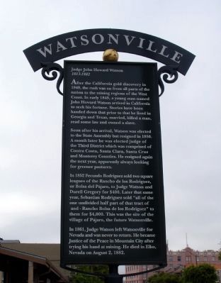
Judge John Howard Watson
— 1813-1882 —
Soon after his arrival, Watson was elected to the State Assembly but resigned in 1850. A month later he was elected judge of the Third District which was comprised of Contra Costa, Santa Clara, Santa Cruz and Monterey Counties. He resigned again the next year, apparently always looking for greener pastures.
In 1852 Fecundo Rodriguez sold two square leagues of the Rancho de los Rodriguez, or Bolsa del Pájaro, to Judge Watson and Durell Gregory for $400. Later that same year, Sebastian Rodriguez sold “all of the one undivided half part of that tract of – Rancho Bolsa de los Rodriguez” to them for $4,000. This was the site of the village of Pájaro, the future Watsonville.
In 1861, Judge Watson left Watsonville for Nevada and was never to return. He became Justice of the Peace in Mountain City after trying his hand at mining. He died in Elko, Nevada on August 2, 1882.
Topics. This historical marker is listed in these topic lists: Government & Politics • Industry & Commerce • Settlements & Settlers. A significant historical year for this entry is 1848.
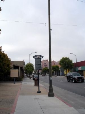
Location. 36° 54.769′ N, 121° 45.561′ W. Marker is in Watsonville, California, in Santa Cruz County. Marker is on Main Street (California Route 152), on the right when traveling west. Touch for map. Marker is in this post office area: Watsonville CA 95076, United States of America. Touch for directions.
Other nearby markers. At least 8 other markers are within walking distance of this marker. St. Patricks Church (about 400 feet away, measured in a direct line); The Apple Annual (about 400 feet away); Where Strawberries are Sweeter (approx. 0.2 miles away); Kalich Building (approx. 0.2 miles away); The Mansion House (approx. 0.2 miles away); Lest We Forget (approx. 0.2 miles away); The Lettunich Building (approx. Ľ mile away); The City Plaza (approx. Ľ mile away). Touch for a list and map of all markers in Watsonville.
Also see . . . City of Watsonville Website. (Submitted on July 28, 2009.)
Additional keywords. California Gold Rush
Credits. This page was last revised on November 8, 2019. It was originally submitted on July 28, 2009. This page has been viewed 1,077 times since then and 11 times this year. Photos: 1, 2. submitted on July 28, 2009. • Syd Whittle was the editor who published this page.

