Newtown in Fairfield County, Connecticut — The American Northeast (New England)
Newtown
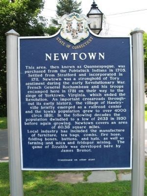
This area, then known as Quanneapague, was purchased from the Pohtatuck Indians in 1705. Settled from Stratford and incorporated in 1711, Newtown was a stronghold of Tory settlement during the early Revolutionary War. French General Rochambeau and his troops encamped here in 1781 on their way to the siege of Yorktown, Virginia, which ended the Revolution. An important crossroads throughout its history, the village of Hawleyville briefly emerged as a railroad center and the town’s population grew to over 4000 circa 1881. In the following decades the population dwindled to a low of 2635 in 1930 before again growing. Newtown covers an area of 60.38 square miles. Local industry has included the manufacture of furniture, tea bags, combs, fire hose, folding boxes, buttons and hats, as well as farming and mica and feldspar mining. The game of Scrabble was developed here by James Brunot.
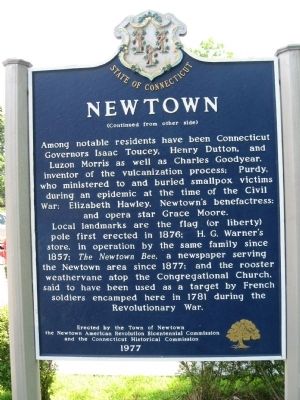
Among notable residents have been Connecticut Governors Isaac Toucey, Henry Dutton and Luzon Morris as well as Charles Goodyear, inventor of the vulcanization process; Purdy, who ministered to and buried smallpox victims during an epidemic at the time of the Civil War; Elizabeth Hawley, Newtown’s benefactress; and opera star Grace Moore. Local landmarks are the flag (or liberty) pole first erected in 1876; H.G. Werner’s store, in operation by the same family since 1857; The Newtown Bee, a newspaper serving the Newtown area since 1877; and the rooster weathervane atop the Congregational Church, said to have been used as a target by French soldiers encamped here in 1781 during the Revolutionary War.
Erected by the Town of Newtown the Newtown American Revolution Bicentennial Commission and the Connecticut Historical Commission
1977
Erected 1977 by Town of Newtown, Newtown American Revolution Bicentennial Commission, Connecticut Historical Commission.
Topics. This historical marker is listed in these topic lists: Colonial Era • Settlements & Settlers. A significant historical year for this entry is 1705.
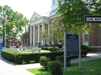
Location. 41° 24.914′ N, 73° 18.613′ W. Marker is in Newtown, Connecticut, in Fairfield County. Marker is at the intersection of Main Street (Connecticut Route 25) and East Street, on the right when traveling south on Main Street. Located in front of the Edmond Town Hall. Touch for map. Marker is at or near this postal address: 45 Main Street, Newtown CT 06470, United States of America. Touch for directions.
Other nearby markers. At least 8 other markers are within 4 miles of this marker, measured as the crow flies. Newtown Veterans Memorial (about 700 feet away, measured in a direct line); Newtown Meeting House (about 800 feet away); Cyrenius H. Booth Library (approx. ¼ mile away); Rochambeau (approx. ¼ mile away); In Commemoration (approx. 0.4 miles away); Washington – Rochambeau Revolutionary Route (approx. 0.4 miles away); Rev. John Beach, A.M. (approx. half a mile away); Where Rochambeau Crossed the Housatonic River (approx. 3.7 miles away). Touch for a list and map of all markers in Newtown.
Also see . . . Roster of Connecticut Governors. (Submitted on August 2, 2009, by Bill Pfingsten of Bel Air, Maryland.)
Credits. This page was last revised on February 10, 2023. It was originally submitted on July 29, 2009, by Michael Herrick of Southbury, Connecticut. This page has been viewed 2,249 times since then and 74 times this year. Last updated on January 11, 2022, by Carl Gordon Moore Jr. of North East, Maryland. Photos: 1, 2, 3, 4, 5. submitted on July 29, 2009, by Michael Herrick of Southbury, Connecticut.
