Northside in Fort Wayne in Allen County, Indiana — The American Midwest (Great Lakes)
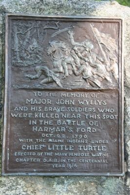
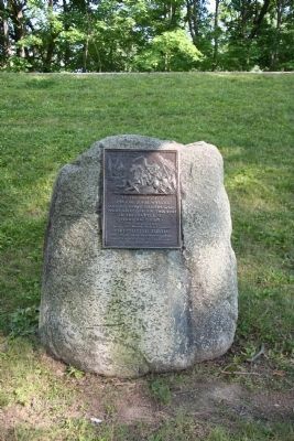
The Battle of Harmar's Ford
Major John Wyllys
And His Brave Soldiers Who
Were Killed Near this Spot
In The Battle of
Harmar's Ford
Oct. 22, 1790
With the Indians Under
Chief Little Turtle
Erected 1916 by The Fort Wayne Chapter D.A.R.
Topics and series. This historical marker is listed in these topic lists: Native Americans • Wars, US Indian. In addition, it is included in the Daughters of the American Revolution, and the Indian Wars Battlefield Trails series lists. A significant historical year for this entry is 1790.
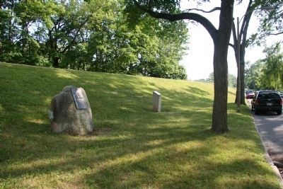
Location. 41° 5.016′ N, 85° 7.539′ W. Marker is in Fort Wayne, Indiana, in Allen County. It is in Northside. Marker is at the intersection of Edgewater Avenue and Dearborn Street, on the left when traveling west on Edgewater Avenue. Touch for map. Marker is in this post office area: Fort Wayne IN 46802, United States of America. Touch for directions.
Other nearby markers. At least 8 other markers are within walking distance of this marker. The Battle of Kekionga (here, next to this marker); Kekionga (approx. 0.3 miles away); The Headwaters of the Maumee River (approx. 0.3 miles away); Three Rivers Water Filtration Plant (approx. 0.4 miles away); The Site of General Wayne's Fort (approx. half a mile away); Old Fort Wayne Well (approx. half a mile away); The Last Two American Forts / The Siege of 1812 (approx. half a mile away); William Wells (approx. half a mile away). Touch for a list and map of all markers in Fort Wayne.
Related markers. Click here for a list of markers that are related to this marker. To better understand the relationship, study each marker in the order shown.
Also see . . .
1. Harmar's Defeat. This link is published and made available by, "Ohio History Central," an online encyclopedia of Ohio History. (Submitted on August 3, 2009, by Dale K. Benington of Toledo, Ohio.)
2. Josiah Harmar. This web link was both published and made available by, "Absolute Astronomy.com," in it's quest to enable "exploring the universe of knowledge." (Submitted on August 3, 2009, by Dale K. Benington of Toledo, Ohio.)
Credits. This page was last revised on February 4, 2023. It was originally submitted on July 23, 2009, by Dale K. Benington of Toledo, Ohio. This page has been viewed 3,233 times since then and 66 times this year. Last updated on August 3, 2009, by Dale K. Benington of Toledo, Ohio. Photos: 1, 2, 3. submitted on August 3, 2009, by Dale K. Benington of Toledo, Ohio. • Craig Swain was the editor who published this page.


