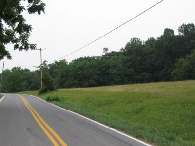
Near Burkittsville in Frederick County, Maryland — The American Northeast (Mid-Atlantic)
Bartlett Leads the Way
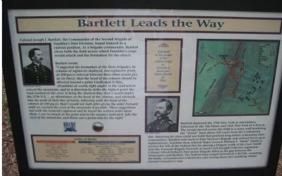
Colonel Joseph J. Bartlett, the Commander of the Second Brigade of Franklin’s First Division, found himself in a curious position. As a brigade commander, Bartlett chose both the field across which Franklin’s Corps would attack and the formation for the attack.
Bartlett wrote:
“I suggested the formation of the three brigades, in column of regiments, deployed, two regiments front, at 100 paces interval between lines (that would give us six lines); that the head of the column should be directed toward a point I indicated to him, (Franklin) at nearly right angles to the road which crossed the mountain, and in a direction to strike the highest point the road reached at the crest, it being the shortest line; that I would deploy the 27th N.Y. ... as skirmishers at the head of the column, and skirmish into the teeth of their line of battle, following with the head of the column at 100 paces; that I would not halt after giving the order forward until we reached the crest of the mountain if possible. These suggestions met with the General’s approval and he based his written order upon them. I was to attack at the point and the manner indicated, take the crest of the mountain, and throw out a picket-line for the night.”
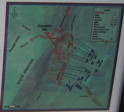
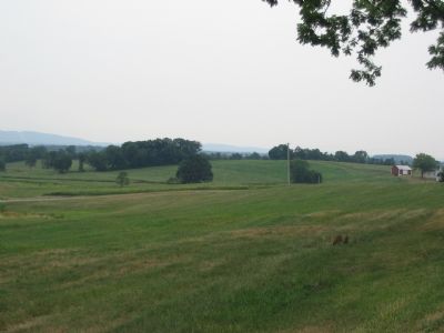
Bartlett deployed the 27th New York as skirmishers, followed by the 5th Maine and 16th New York at 4:30 p.m. The troops moved across the field to a stone wall bordering the “Forest” farm about 250 yards from the Confederate line. Knowing his men could not hold that position long before exhausting their ammunition, Bartlett road back to find Newton’s Brigade and ordered them up as replacements. Franklin then ordered Major General William F. “Baldy” Smith to anchor the left of the Federal line by placing a brigade south of the road. Smith sent the Vermont Brigade forward, at nearly full strength with five regiments. Colonel Alfred Torbert’s NeW Jersey Brigade filled in the gap between the Vermonters and Bartlett. The Federal lines surged forward at 5:30 P.M., smashing the badly outnumbered Confederates and forcing them into headlong retreat towards Crampton’s Gap.
Order of Battle
Confederate States of America
Col. Thomas T. Munford
2nd Va. Cav., 12th Va. Cav., Chew’s Battery
Col. William A. Parham
6th Va., 12th Va., 16th Va., Portsmouth Light Arty
Brig. Gen. Paul J. Simmes
10th Ga.
United States of America
Maj. Gen. William B. Franklin, VI Corps
Maj. Gen. Henry W. Slocum
Col. Torbet
1st N.J., 2nd N.J., 3rd N.J., 4th N.J.
Col. Bartlett
27th N.Y., 5th Me, 16th N.Y., 96th Pa.
Brig. Gen. Newton
18th N.Y., 31st N.Y., 32nd N.Y., 95th Pa.
Maj. Gen. William F. (Baldy) SmithBrig. Gen. Brooks
2nd Vt., 3rd Vt (nc), 4th Vt., 5th Vt. (nc), 6th Vt.(nc)
(nc) noncombatants
Donated to the people of the United States by Donald & Kathrine Stokes-Shafer of Ohio. Presented to the people of the United States by the Board of Directors of the Blue and Gray Education Society, Colonel William C. Lowe, President.
Erected by Blue & Gray Educational Society / State of Maryland Department of Natural Resources.
Topics. This historical marker is listed in this topic list: War, US Civil.
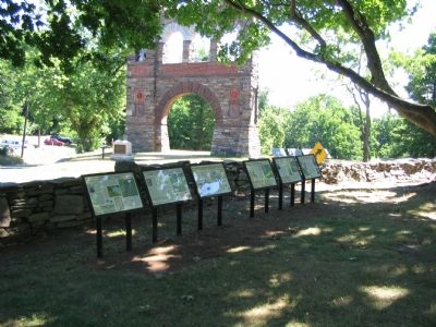
Location. 39° 24.312′ N, 77° 38.364′ W. Marker is near Burkittsville, Maryland, in Frederick County. Marker is at the intersection of Gapland Raod and Arnoldstown Road, on the left when traveling west on Gapland Raod. Across the road from the War Correspondent’s Memorial Arch, in Gathland State Park. Touch for map. Marker is in this post office area: Burkittsville MD 21718, United States of America. Touch for directions.
Other nearby markers. At least 8 other markers are within walking distance of this marker. Troup Light Artillery (here, next to this marker); Padgett’s Field: Confederate Last Stand (here, next to this marker); Burial: A Most Disagreeable Task (here, next to this marker); The Stage is Set (here, next to this marker); Medal of Honor Recipients
(here, next to this marker); Journalists Who Gave Their Lives (within shouting distance of this marker); GATH: The Man and His Mountain (within shouting distance of this marker); Gath's Empty Tomb (within shouting distance of this marker). Touch for a list and map of all markers in Burkittsville.
More about this marker. The marker displays portraits of Colonels Joseph J. Bartlett and Alfred Torbert. A map details the tactical maneuvers described in the text.
Also see . . .
1. Joseph Jackson Bartlett. History Central website entry:
Bartlett fought in all the major battles of the eastern theater, save Second Manassas. Promoted to Major General near the end of the war, he was chosen to receive the ceremonial surrender of the Army of Northern Virginia at Appomattox. (Submitted on August 23, 2007, by Craig Swain of Leesburg, Virginia.)
2. Col Joseph J Bartlett's Official 1862 Report on Crampton's Gap. Antietam on the Web website entry (Submitted on August 23, 2007, by Craig Swain of Leesburg, Virginia.)
3. Col A T A Torbert's Official Report of September 16, 1862 at Crampton's Gap. Antietam on the Web website entry (Submitted on August 23, 2007, by Craig Swain of Leesburg, Virginia.)
Credits. This page was last revised on February 26, 2022. It was originally submitted on August 23, 2007, by Craig Swain of Leesburg, Virginia. This page has been viewed 1,420 times since then and 28 times this year. Photos: 1, 2, 3, 4, 5. submitted on August 23, 2007, by Craig Swain of Leesburg, Virginia. • J. J. Prats was the editor who published this page.
