Findlay in Hancock County, Ohio — The American Midwest (Great Lakes)
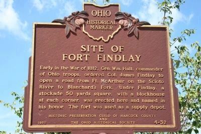
Site of Fort Findlay
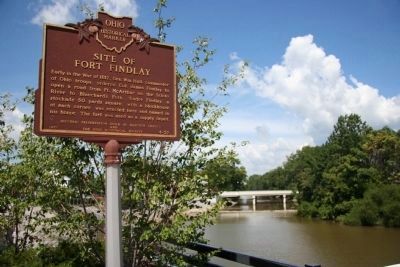
Early in the War of 1812, Gen. Wm. Hull, commander of Ohio troops, ordered Col.. James Findlay to open a road from Ft. McArthur on the Scioto River to Blanchardís Fork. Under Findlay, a stockade 50 yards square, with a blockhouse at each corner was erected here and named in his honor. The fort was used as a supply depot.
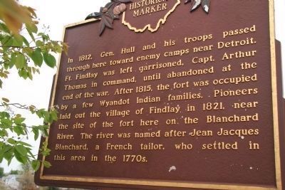
[Marker Reverse]:
In 1812, Gen. Hull and his troops passed through here toward enemy camps near Detroit. Ft. Findlay was left garrisoned, Capt. Arthur Thomas in command, until abandoned at the end of the war. After 1815, the fort was occupied by a few Wyandot Indian families. Pioneers laid out the village of Findlay in 1821, near the site of the fort here on the Blanchard River. The river was named after Jean Jacques Blanchard, a French tailor, who settled in this area in the 1770s.
Erected 1978 by Historic Preservation Guild of Hancock County and The Ohio Historical Society. (Marker Number 4-32.)
Topics and series. This historical marker is listed in these topic lists: Forts and Castles • Native Americans • Settlements & Settlers • War of 1812. In addition, it is included in the Ohio Historical Society / The Ohio History Connection series list. A significant historical year for this entry is 1812.
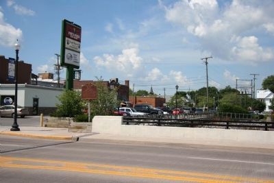
Location. 41° 2.463′ N, 83° 39.029′ W. Marker is in Findlay, Ohio, in Hancock County. Marker is on S. Main Street (Ohio Route 12), on the right when traveling south. Touch for map. Marker is in this post office area: Findlay OH 45840, United States of America. Touch for directions.
Other nearby markers. At least 8 other markers are within walking distance of this marker. Veterans Memorial Flagpole (about 300 feet away, measured in a direct line); Outstanding Renovated Building, 1980 - 1986 (about 600 feet away); Outstanding New Building, 1978 - 1979 (about 800 feet away); Hancock County Veterans Memorial (about 800 feet away); Congressional Medal of Honor Recipients (about 800 feet away); Hancock County Courthouse (about 800 feet away); War Savings Stamps (approx. 0.2 miles away); The Ohio Oil Co - Marathon Oil Co / Gas Boom Era (approx. 0.2 miles away). Touch for a list and map of all markers in Findlay.
Regarding Site of Fort Findlay. Shortly before the start of the War of 1812 the American General William Hull, the commander of the American fortification on Michigan's border with Canada (located in Detroit), believed that unless his position was reinforced with additional troops, that his command would be in serious trouble once the war finally got under way. So he took it upon himself to travel down to southern Ohio in order to raise those additional troops.
As soon as General Hull had raised
an army of soldiers, he began to march northward from Urbana, Ohio. Since much of the territory between Urbana and Detroit was a hostile wilderness through both territory controlled by pro-British Native Americans and an inhospitable region know as the Black Swamp, General Hull built a string of fortifications, along his route, in order to protect his lines of supply and communication. One of those fortifications, built to protect the crossing of the Scioto River, was Fort McArthur (near Kenton, Ohio). Another fortification built mid way between modern day Kenton, Ohio and Findlay, Ohio was Fort Necessity. And a final fortification, built to protect the crossing of the Blanchard River, was Fort Findlay (in present day Findlay, Ohio).
Related markers. Click here for a list of markers that are related to this marker. To better understand the relationship, study each marker in the order shown.
Also see . . . Hull's Road. This is a link to information provided by Ohio History Central, an online encyclopedia of Ohio History. (Submitted on August 13, 2010, by Dale K. Benington of Toledo, Ohio.)
Additional commentary.
1. Regarding Fort Findlay
In his book "Twentieth Century History of Findlay and Hancock County Ohio, and Representative Citizens" (published 1910, the author, J.A.
Kimmell states the following regarding Fort Findlay: "The Fort at Findlay was erected by Col. James Findlay, under orders from General Hull, and was named in honor of the Colonel. It was a stockade of about fifty yards square, with a blockhouse at each corner, and a ditch in front. It stood on the south side of the Blanchard River, just west of the present iron bridge and was used as a depot for military stores.
The Fort was garrisoned by a company under the command of Captain Arthur Thomas, who lived at King's Creek, three miles from Urbana. So far as known, there were no battles fought at Findlay, and the garrison duty was, no doubt monotonous and irksome.
After the close of the war, Capt. Thomas' company returned to Urbana. On their journey home, the Captain and his son lost their horses, and separated from the rest of the company in search of them. They encamped at the Big Spring, near Solomonstown, about five miles from Bellefontaine, and the next morning were found murdered and scalped. Their bodies were taken to Urbana by a deputation of citizens."
— Submitted May 27, 2009, by Dale K. Benington of Toledo, Ohio.
Photographed By Dale K. Benington, June 17, 2008
5. Related site to the Fort Findlay Marker
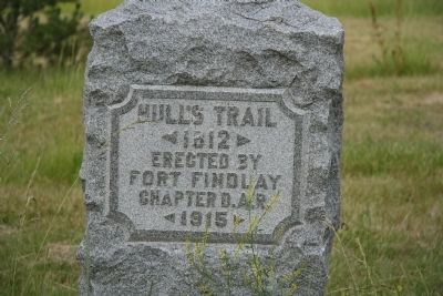
To the south of the Fort Findlay Marker, at the intersection of State Route 15 and U.S. 68 is a "Hull's Trail" marker, that helps to mark the path of Hull's Military Road from Urbana, Ohio to Detroit, Michigan. The map location is 40.59.450N by 083.39.080W
Credits. This page was last revised on June 16, 2016. It was originally submitted on April 30, 2009, by Dale K. Benington of Toledo, Ohio. This page has been viewed 5,335 times since then and 122 times this year. Last updated on August 12, 2009, by Dale K. Benington of Toledo, Ohio. Photos: 1. submitted on May 1, 2009, by Dale K. Benington of Toledo, Ohio. 2. submitted on May 25, 2009, by Dale K. Benington of Toledo, Ohio. 3. submitted on May 1, 2009, by Dale K. Benington of Toledo, Ohio. 4, 5. submitted on May 2, 2009, by Dale K. Benington of Toledo, Ohio. • Kevin W. was the editor who published this page.
